Download
1 / 36
360 likes | 438 Views
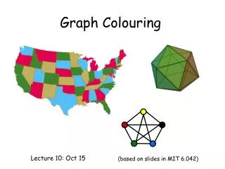
A web service enabling personalized map colouring based on user preferences and individual needs. Overcoming conflicts in data portrayal and addressing issues like color vision impairment for enhanced visual perception.

E N D
A Web Service to personalise Map Colouring Joerg Steinruecken Department of Geoinformation Institute of Geodesy and Geoinformation University of Bonn A Web Service to personalise Map Colouring
Motivation • World Wide Web offers geospatial data from many different sources • „Mapping on Demand“: Creating maps • in real time • by combining data from different sources • for individual purposes • independent of time and place • Problems: • Portrayal of data from different sources conflict A Web Service to personalise Map Colouring
Personalisierung Befragung Legend Tour 1 Tour 2 Tour 3 Tour 4 Tour 5 Tour 6 Tour 7 A Web Service to personalise Map Colouring
Motivation • World Wide Web offers geospatial data from many different sources • „Mapping on Demand“: Creating maps • in real time • by combining data from different sources • for individual purposes • independent of time and place • Problems: • Portrayal of data from different sources conflict • Perceptibility is influenced by • Users‘ visual system (colour vision impairment) • Outer effects • Device specific colour reproduction • Environment (e.g. dark room or sunlight) A Web Service to personalise Map Colouring
Stating the problem • Given • Background: Topographical Map which has a fixed graphical representation • Overlay: Objects O1 … On which can be portrayed by users • Searching portrayal options of objects O1 … On • Postulations • Conciseness: Visual distinguishability • of objects O1 … On among each other • of objects O1 … On from the topographic map • for all users and on all devices • Solution „on demand“ • Access without technical barriers A Web Service to personalise Map Colouring
Outer Frame • Service-oriented architecture • Geospatial data provided by standardised services • Open Geospatial Consortium (OGC) Web Map Service (WMS) Specification • OGC Symbology Encoding (SE) / Styled Layer Descriptor (SLD) Specification A Web Service to personalise Map Colouring
Statement • Portrayal • Options: Visual variables • Most important variable: Colour • Problem of distinguishability is reduced to the identification of well distinguishable colours • Colours are adjusted to a specific user and his device • Colours provided by a Web Service A Web Service to personalise Map Colouring
Stating the problem with colours • Given • Background: Topographical Map which contains m colours • Overlay: Objects O1 … On which can be portrayed by users • Searching n colours for objects O1 … On • Postulations • Conciseness: Visual distinguishability • of colours of objects O1 … On among each other • of colours of objects O1 … On from the colours of the topographic map • for all users and on all devices • Solution „on demand“ • Access without technical barriers A Web Service to personalise Map Colouring
Architecture Domain Client Server Browser Webserver Proxy Web Map Client Server Server (SLD-)WMS Webserver (Service) Colouring Personali-sation Geodata User Data A Web Service to personalise Map Colouring
Architecture - Personalisation Domain Client Server Browser Webserver Proxy Web Map Client Server Server (SLD-)WMS Webserver (Service) Colouring Personali-sation Geodata User Data A Web Service to personalise Map Colouring
Personalisation • Creation of user profiles (user name, password,…) • Getting personal data • Colour vision impairment • specified by users • Users have to evaluate test images • Display‘s colour reproduction and ambient light • Display calibrated? • Visual calibration by gamma adjustment • Users have to evaluate test images A Web Service to personalise Map Colouring
Architecture – Map request Domain Client Server Browser Webserver Proxy Web Map Client Server Server (SLD-)WMS Webserver (Service) Colouring Personali-sation Geodata User Data A Web Service to personalise Map Colouring
Architecture – Map request Domain Client Server Browser Webserver Proxy Web Map Client Web Map Client Server Server (SLD-)WMS Webserver (Service) Colouring Personali-sation Geodata User Data A Web Service to personalise Map Colouring
Architecture – Map request Domain Client Server Browser Webserver Proxy Web Map Client Web Map Client WMS-URL WMS-URL Server Server (SLD-)WMS Webserver (Service) Colouring Personali-sation Geodata User Data A Web Service to personalise Map Colouring
Architecture – Map request Domain Client Server Browser Webserver Proxy Web Map Client Web Map Client Server Server GetCapabilties (SLD-)WMS Webserver (Service) Colouring Personali-sation Geodata User Data A Web Service to personalise Map Colouring
Architecture – Map request Domain Client Server Browser Webserver Proxy Web Map Client Web Map Client Server Server (SLD-)WMS Webserver (Service) Colouring SE Personali-sation Geodata User Data A Web Service to personalise Map Colouring
Architecture – Map request Domain Client Server Browser Webserver Proxy Web Map Client Web Map Client SE-URL SE-URL Server Server (SLD-)WMS Webserver (Service) Colouring SE Personali-sation Geodata User Data A Web Service to personalise Map Colouring
Architecture – Map request Domain Client Server Browser Webserver Proxy Web Map Client Web Map Client GetMap Server Server (SLD-)WMS Webserver (Service) Colouring SE Personali-sation Geodata User Data A Web Service to personalise Map Colouring
Architecture – Map request Domain Client Server Browser Webserver Proxy Web Map Client Web Map Client GetMap Server Server SLD=SE-URL (SLD-)WMS Webserver (Service) Colouring SE Personali-sation Geodata User Data A Web Service to personalise Map Colouring
Architecture – Map request Domain Client Server Browser Webserver Proxy Web Map Client Web Map Client Server Server (SLD-)WMS Webserver (Service) Colouring Personali-sation Geodata User Data A Web Service to personalise Map Colouring
Approach of colouring Visual Distinguishability Colour space, providing an appropriate metric(visual equidistance) Modelling the colour space: 3D-Polyhedron Formulation of an optimisation problem:Maximise the minimal distance between colours Solution on demand A Web Service to personalise Map Colouring
Process of colouring sRGB Standard-RGB A Web Service to personalise Map Colouring
Process of colouring XYZ sRGB CIE-XYZ colour space A Web Service to personalise Map Colouring
Process of colouring XYZ CIELUV sRGB CIE L* u* v* colour space A Web Service to personalise Map Colouring
Process of colouring XYZ CIELUV MAXMIN sRGB A Web Service to personalise Map Colouring
Process of colouring XYZ CIELUV MAXMIN sRGB A Web Service to personalise Map Colouring
Optimisation problem maximise objective subject to constraints Set of m given colours Set of n colours which have to be determined Euclidean Distance Parameters of hyperplanes which formthe polyhedron A Web Service to personalise Map Colouring
Problem characteristics • Nonlinear problem • Large number of local optimal solutions • Efficient algorithms find a locally optimal solution, but usually not the globally optimal solution Global Optimum Local Optima Rastrigins function (source: Matlab) A Web Service to personalise Map Colouring
Behaviour of efficient algorithms Local Optimum Global Optimum Fundamental importance of starting points‘ location A Web Service to personalise Map Colouring
Algorithm Finding appropriate starting points S1 Method of local optimisation S2 Detect suboptimal solutions S3 Nearly global optimal solution A Web Service to personalise Map Colouring
S1: Appropriate starting points • Observation: To use the colour space in the best possible way, the majority of points have to lie on the polyhedron‘s boundary. • Conclusion: Points which are placed on the boundary are well suited as starting points A Web Service to personalise Map Colouring
S3: Detect suboptimal solutions Given points Voronoi vertices intersection ofVoronoi edgesand polygon Vertices ofthe polygon • Find an improvement • Candidats are given by the Voronoi-Diagram • Example in 2D: A Web Service to personalise Map Colouring
Personal information • Incorporation of users‘ personal information as constraints • Color vision impairment: Finding colours in a plane • Colour reproduction & ambient light: Clipping the colour space A Web Service to personalise Map Colouring
Personalisierung Befragung Legend Tour 1 Tour 2 Tour 3 Tour 4 Tour 5 Tour 6 Tour 7 A Web Service to personalise Map Colouring
Conclusions • Concise maps by selection of well distinguishable colours • Formulation of an optimisation problem • distinguishability = Euclidean distance • Efficient identification of a nearly optimal solution • Algorithm: Find appropriate starting points, local optimisation method, geometric evaluation • Adaptation to users‘ individual requirements • Usable as Web Service • Prototype will shortly be available on http://colour.ikg.uni-bonn.de A Web Service to personalise Map Colouring
Thank you for your attention A Web Service to personalise Map Colouring