Download
1 / 6
60 likes | 256 Views
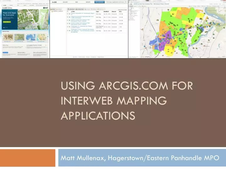
Using ArcGIS.com for Interweb Mapping Applications. Matt Mullenax, Hagerstown/Eastern Panhandle MPO. What is ArcGIS.com?. ESRI’s ArcGIS Online is a cloud-based, collaborative content management system for maps, apps, data and other geographic information .

E N D
Using ArcGIS.com for Interweb Mapping Applications Matt Mullenax, Hagerstown/Eastern Panhandle MPO
What is ArcGIS.com? • ESRI’s ArcGIS Online is a cloud-based, collaborative content management system for maps, apps, data and other geographic information. • Allows non-programmers to deploy and share webernet maps containing their own GIS data for free through the ArcGIS.com map viewer.
ArcGIS.com Specifics • Create a free ESRI global account. • Number of mapping applications and amount of data limited to 2GB. • These mapping applications can be shared with a group or the public through web browser, smart phone apps, social media and emails. • Can also be embedded into websites. • Use Mozilla Firefox or Google Chrome for best performance.
ArcGIS.com Specifics cont’d… • Can import .shp (zipped), .csv/.txt, .gpx files, as well as content from ArcGIS Online (including base layers accessible on Desktop). • Imported files cannot have >1,000 features (or 250 addresses) and are projected on the fly. • Layers editable for multiple authors, and edits are tracked. • ArcGIS Desktop and ArcGIS Explorer (Desktop and Online) can access web maps.
Questions? Matt Mullenax, GISP Hagerstown/Eastern Panhandle MPO (304) 267-5118 mmullenax@hepmpo.net