Download
1 / 7
120 likes | 481 Views
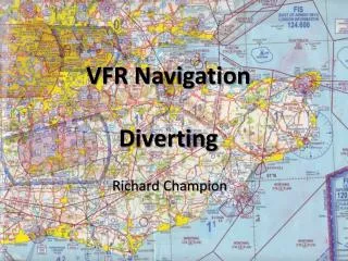
VFR Navigation Diverting. Richard Champion. Diverting. Aim To learn how to to divert to an alternate destination. Objective

E N D
VFR NavigationDiverting Richard Champion
Diverting • Aim • To learn how to to divert to an alternate destination. • Objective • By the end of this briefing, you should be able to use your diversion rule and wind star to plan a diversion to an alternate destination in flight, with the minimum of mental effort. • Airmanship • Good navigation, avoiding airspace busts • Agenda • Equipment needed • How to use it • Examples • Summary
Equipment Required • Wind Star • Pre-calculated adjustments for forecast wind. • Allows diversion headings and ground speed to be estimated with the minimum mental effort. • Diversion Rule • Makes it easy to measure distances and estimate arrival times.
How to divert • Mark current position on chart. Loiter if necessary. • Mark diversion destination on chart. • Draw free hand line from present position to diversion destination. • Estimate the no wind magnetic heading by comparison to a nearby VOR rose. With practice you will be able to judge this by eye with surprising accuracy. • Turn onto heading and note time (or start watch). • Interpolate wind correction angle and ground speed from Wind Star. Note on chart. • Adjust heading to wind corrected value. • Use diversion rule to estimate distance and ETA using ground speed. • Fly heading until ETA is up. Do regular FREDA checks. • On long diversions, use Standard Closing Angle to correct back to planned track if required.
Example 1 TAS 90Kts, heading 051°, ETA +32 mins WCA -12 GS 95 32nm, 20 mins After 14 minutes – actual position Uckfield Divert - new destination Lydd Use wind star to estimate wind correction angle and ground speed Calculate ETA allowing for time already on stop watch. 20 – 4 = 16 minutes Fly heading, FREDA check, use Standard Closing Angle if off track Mark Uckfield and Lydd and draw line by hand Estimate heading - 100° Use diversion rule to measure distance and read off time required. Turn on to100°, start watch Adjust heading 100° -12° = 088° 350/20
Example 2 TAS 90Kts, heading 051°, ETA +32 mins Divert - new destination Rochester Calculate ETA allowing for time already on stop watch. 22 – 4 = 18 minutes Use diversion rule to measure distance and read off time required. Fly heading, FREDA check, use Standard Closing Angle if off track After 14 minutes – actual position Uckfield Use wind star to estimate wind correction angle and ground speed Turn on to 030°, start watch Estimate heading - 030° Adjust heading 030° -8° = 022° Mark Uckfield and Rochester. Draw line by hand WCA -8 GS 75 27nm, 22 mins 350/20
Summary • We have learned : • How to plot current position, diversion destination and track required. • How to estimate the no wind heading. • How to use the wind star to adjust the no wind heading to allow for the forecast wind. • How to use the wind star to estimate ground speed. • How to use the diversion rule to measure distance and estimate time of arrival at diversion destination. • Always prepare a wind star and take your diversion rule with you on cross countries.