Download
1 / 22
220 likes | 242 Views
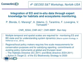
Integration of EO and in-situ data through expert knowledge for habitats and ecosystems monitoring. P. Blonda, C. Marangi*, A. Adamo, C. Tarantino, F. Lovergine, V. Tomaselli ° CNR_ISSIA; CNR-IAC*; CNR-IBBR°. Bari-Italy. 4 th GEOSS S&T Workshop, Norfolk-USA.

E N D
Integration of EO and in-situ data through expert knowledge for habitats and ecosystems monitoring.P. Blonda, C. Marangi*, A. Adamo, C. Tarantino, F. Lovergine, V. Tomaselli °CNR_ISSIA; CNR-IAC*; CNR-IBBR°. Bari-Italy 4th GEOSS S&T Workshop, Norfolk-USA • Multiple temporal and spatial scales are required for monitoring ES and BD state and for understanding system dynamics (Macro-system Ecology, in Heffernan et al., 2014). • Regional/local policy makers requires fine scale measurements for conservation purposes and for satisfying reporting commitments of existing policy instruments at global and Europen level: • The Habitats Directive (EC 2011) and Birds directive (EEA 2011) • Action 5 (Target 2) of the EU Biodiversity Strategy to 2020
Temporal requirements “The evolution of ecosystems properties over time can be described using simple math. response functions and the better these functions can be described, the grater insight ecologists can draw about ES dynamics” ( Kennedy at al., 2014; Front Ecol. Env. 12 (6)) Actually only abrupt changes of state can be detected at VHR(<3m) as step functions file:///media/alma/E29A-8C3C/DISSEMINATION/2015/NORFOLK_VIRGINIA_22MARCH/PRESENTATION_NORFOLK/Blonda_ConnectinGEO_Norfolk_Knowledge.ppt Credits: Kennedy et al. 2014, 3
Possible solutions within GEO • Horizon 2020 • SC5-16-2014 • Ecopotential • ConnectinGEO www.biosos.eu www.ms-monina.eu
The FP7-BIO_SOS approach • Knowledge as input for data interpretation and integration output of the analysis. • Knowledge-driven models are able: • to fill the gaps between different domains: • spectral, temporal, spatial relations, geom. attributes • to facilitate data management and multi-source integration; • to monitor limited accessibility or huge extension areas • to facilitate users engagement • Assumptions: habitats with similar morpho-structural characteristics can be differentiated by different vegetative cycles and/or flooding periods, with different spectral signatures in EO images In-situ component EO component
Natura 2000 sites in Southern Italy Lago Salso. WorldView2 imagery: Biomass Peak Image (BPI): June 2010 Pre BPI (PreBPI): Feb. 2011 Le Cesine: BPI: June 2013 Post BPI: Nov. 2013
FP7-SPACE-2010 BIO_SOS (GA.263435) (Tomaselli et al. 2013. Landscape Ecology) 7
Visual representation of phenology and water coverage for Le Cesine site (Italy) Habitat 1310 ( Salicornia) Figure. Visual representation of ccorresponding to a common LC classes in two Natura 2000 sites: a) IT1 site and b) IT2 site.
Similar classes can be discriminated by spatial (topological) relationships • 1310 (in S) and 3170 (in L) belong to A24/A2.A5.E7 category, but: • 1310 is adjacent to the lagoon (i.e., 1150 in D) • 1210 (in A) and E1.6 (in N) belong to A24/A2.A5.E7 category, but: • 1210 is adjacentto the sea LCCS A24/A2.A5.E7 = aquatic vegetation, herbaceous forbs, annual LCCS A12/A2.A5.E7 = terrestrial vegetation, herbaceus forbs, annual SEA
Features for LC/LU to habitat translation and discrimination
Phenology: Green Ratio Index (GRR) from the Post Biomass Peak Image (PoBPI), Oct. WorldView2; Geometric attribute: instantiated as elongatedness. (I) ELONGATEDNESS is defined as the object Length/Width Ratio (LWR) The GREEN RATIO INDEX (GRR) as Decision tree including the pattern zonation rule.
Geometric attribute: instantiated as elongatedness Pattern zonation rules: adjacent rules (I) • A24 aquatic vegetation/ A2 herbaceous. • A6 graminoid. E6 perennial • 1410/A2.522; • X/C2; • 7210/D5.24; • X/A2.53C
Combined in-situ environmental data and spatial topological rule (adjacency) (II)
Changes B15A12 B28B16 B15B28 • PEAK image 2009 • POST image 2010 • PEAK image 2013 • POST image 2013
Conclusions: Habitat maps and LC/LU as EBV. Habitats as proxies LC/LU maps and LIDAR Bio-physical indices Kick off meeting. February 18th, 2015. Barcelona 17
Conclusions • There is a need to operationalize VHR habitat mapping techniques for the extraction of trends and quantification of pressures: • Expert knowledge (prior spectral, ecological modeling at habitat and landscape levels), with this elicited through ontologies, can be used for new services (knowledge) in large or limited accessibility areas. • VHR EO dense time series for regional policy making as well as LIDAR data for vegetation (ecosystems structure) are not regularly collected on protected sites (e.g., Natura 2000). • In-situ: lack of centralized environmental data bases (e.g., water salinity, lithology, slope) and data for generalization of input expert rules (e.g., pattern zonation changes due to human pressures) and outputs (according to different taxonomies). • New research in Horizon2020 Ecopotential project • Citizen observatories can help
Habitat monitoring from VHR EO data in previous FP7-SPACE-2010 project: BIO_SOS www.biosos.eu 19
Annex I 1410 Annex I 7210 CLC3 4.2.1 - Salt marshes A24 A2.A6.A12.B4.C2.E5/B11.E6 Perennial closed tall grasslands on temporarily flooded land +environmental attributes EUNIS D5.2 A24 A2.XX.A13.B4.C2.E5/B13.E7 Open annual short herbaceous vegetation on temporarily flooded land Annex I 1310 Annex I 1420 A24 A1.A4.A12.B3.C2.D3./B10 Aphyllous closed dwarf shrubs on temporarily flooded land
Spatial and temporal reasoning • Spatial and temporal reasoning for habitat mapping from LC/LU and multi-source (satellite, aerial LIDAR and in-situ) data integration • Spatial relations concerning vegetation pattern (zonation): • Topological (e.g., adjacency to the seashore, the costal lagoon). • Non-topological (e.g., close to, distance to) • Multi-temporal information: plant growth stages (phenology) and water regime (i.e., flooding and dray periods) • Plant height information from LIDAR or texture measurements • Assumption: habitats with similar morpho-structural characteristics can be differentiated by different vegetative cycles and/or flooding periods, with different spectral signatures in EO images 21
Knowledge based model of the world model (in a specific domain ) consisting of concepts (objects) and spatial/temporal relations between objects can be represented trough ontologies in a community agreed vocabulary as tools for knowledge description and dissemination of complex categories: • Domain ontologies • Processing ontologies