Download
1 / 49
490 likes | 536 Views
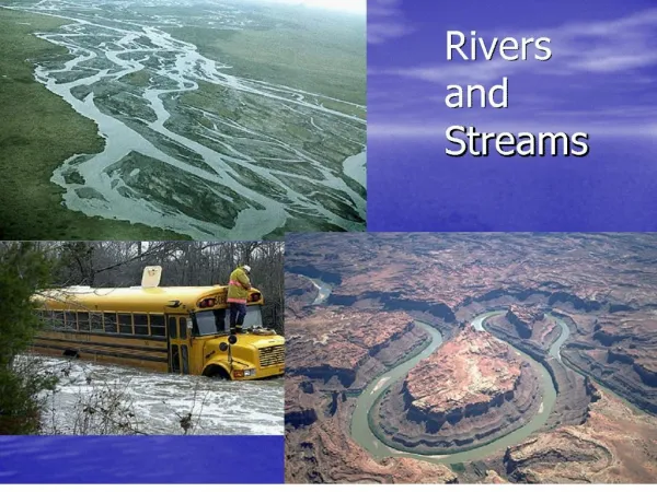
Explore the dynamic world of river systems in this chapter, covering water cycle stages, factors influencing water budgets, approaches to water conservation, river formation, erosion factors, stream deposition types, floodplain dwelling, flood control methods, lake life cycles, and more.

E N D
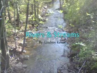
Chp 15 River Systems • Objectives • Stages of the water cycle • Factors that affect a water budget • List approaches to water conservation • Summarize how a river develops • Describe the parts of a river system • Explain factors that affect the erosive ability of a river • Describe how erosive factors affect the evolution of a river channel • Explain the types of stream deposition • Describe advantage and disadvantage of living in floodplain • Identify the methods of flood control • Describe the life cycle of a lake
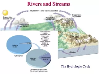
Movement of Water on Earth • Water vapor-water that occurs as invisible gas in atmosphere • Water cycle-continuous movement of water between the atmosphere, land, oceans • Evapotranspiration-total loss of water from an area • Evaporation-liquid water changes into water vapor. Where does the most evaporation take place at? _________ ( 90%) • Transpiration-plants release water vapor ( 10%) • Condensation-gas to liquid • Tiny liquid water droplets and forms clouds • Precipitation-water falls from clouds • 75% falls on oceans rest falls on land and becomes runoff or groundwater. • Eventually ,all water returns to atmosphere through evapotranspiration, condenses, and falls back to Earth’ surface. • Examples: rain,snow,sleet,and hail
Water Budget/Use • Water budget established by water cycle • Factors that affect it include; temperature, vegetation, wind, and amount and duration of rainfall. How are these factors related? • Average person uses 95,000 L each yr. What is it used for? • 90% of water used in cities, returned to rivers and oceans as wastewater • Some may contain harmful materials
Water Conservation • What is water conservation? • The wise use of water resources • How can people conserve water? • How can governments conserve? • Enforcing conservation laws and antipollution laws that prohibit dumping of waste into bodies of water • Finding alternative ways to obtaining fresh water • Desalination-process of removing salt from ocean water • Expensive and impractical
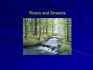
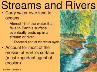
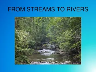
Stream Erosion • How does a river develop? • Soil collects water, runoff begins from excess water, erodes rock and soil, forms narrow ditch. Precipitation and erosion form valley w/ permanent stream • Parts of River System • Tributaries-feeders streams into main stream • Watershed-land that is drained by river system • Divides-ridges or elevated regions, separate water sheds • Channel-narrow depression stream follows downhill • Banks-edges of stream above water level • Bed-the part of stream channel below water level
What is a watershed? • Land from which water runs off into these streams • Ridges that separate watersheds are called divides. • 14 major in GA • Divided into 52
Channel Erosion(caused by ) • Stream Load-materials other than water carried by stream • Suspended load, bed load, dissolved load • Stream Discharge-volume of water that flows w/in given time • Stream Gradient-change in elevation over given distance. Velocity depends on gradient
Evolution of River Channels • As the stream’s load, discharge, and gradient decrease, the erosive power of the stream decreases • Channels erode, become wider,deeper, and longer =rivers • Two types of River Channels: • Meander- one of the bends, twists, or curves in low-gradient stream or river. • More energy directed to banks than beds. • Faster on outside of curve, sediment deposited to form sand bars • Oxbow Lake-the meander becomes isolated from river • Braided Streams-multiple channels, divide or rejoin around sediment bars • Large sediment load, coarse sand and gravel • Build up on channel floor
Braided Streams Depending on erosion sometimes a single river can change into a braided or meandering stream as the gradient and discharge change. Most Rivers are single channels.
River Valley Development A river has a life cycle from source to mouth. The processes at work cause changes to the river valley and river features in the landscape that it passes over. Traditionally this cycle has been described in 3 stages, the Upper (Torrent) section, the Middle (Valley) section and the Lower (Flood Plain) section. The terminology's Youthful, Mature and Old have also been used to describe the sections. The stages are not clearly defined but merge from one to the other and rivers show individual characteristics. There are river features that can be defined within a broad pattern. upper middle lower
Waterfalls and Rapids : Features of an upper course of river • River flows over alternating bands of hard and soft rocks • Soft rocks erode faster • Hard rocks jut out • A series of small and short falls develop these falls are known as rapids • A waterfall is a vertical flow of fast-moving water from a great height • A waterfall usually forms when a river flows over hard and soft rocks • The soft rock is eroded more quickly • A ledge is formed over which water falls • The force of the water is so great that it cuts a depression or plunge pool at the bottom Angel Fall of Venezuela 3231 ft
WATERFALL RETREATS . . OVERHANG PLUNGE POOL UNDERCUTTING OF SOFT ROCK UPSTREAM . .
River Systems Stream gradient the change in elevation over a given distance • Near the headwaters, or the beginning of a stream, the gradient generally is steep. • As the stream nears its mouth, its gradient often becomes flatter. • The characteristics of streams with different gradients are very different
Evolution of Mature Streams meander • When a river rounds a bend, the velocity of the water on the outside of the curve increases. • Increase erosion • On the inside of the curve, the velocity of the water decreases. • Increased deposition • Causes curves to widen • http://www.wwnorton.com/college/geo/egeo2/content/animations/14_1.htm
Point bar/ Cut Bank • Where is water the fastest? slowest?
Meandering to Oxbow Lake Meanders can become so curved that they almost form a loop, separated by a narrow strip of land. When the river cuts across the neck, the meander can become isolated from the river resulting in an oxbow lake.
Stream Deposition • Types of stream deposition • Deltas-fan shaped mass of rock material deposited at mouth of stream • Size and shape is determined by waves, tides, offshore depths, sediment load of the stream. • Alluvial fan-fan shaped mass of rock material deposited by stream when slope of land decreases sharply • Form when streams flow from mts to flat land
Deltas/Alluvial Fans Death Valley, California
Floodplains • What is a floodplain? • Area along river that forms from sediments deposited when river overflows its banks • Natural levees: raised banks from sediment deposits • Advantage • Convenient access to river for shipping, fishing, transportation • Rich soils, good for farming • Disadvantage • Swampy areas • Flooding homes
Flood Control • Name some things that could prevent flooding • Forest and soil conservation measures • Artificial structures • Dams * Most common method of flood control • Artificial levees, artificial lakes • Permanent overflow channels or floodways
Life Cycle of Lake • Most lakes located in high latitudes and mountainous areas • Water that collects in a depression in land. • What are some sources of lakes? • Springs, rivers, runoff • Most comes from precipitation and melting of ice and snow • Short in geologic terms. Why?
Groundwater • Groundwater-water beneath the Earth’s surface, fills fractures and cavities in rock
Earth’s water • Earth’s water is: • -97% is saltwater. -3% is freshwater (2.1% = glaciers, 0.6% = groundwater, and 0.3% = lakes and rivers). • Ground water- Water that lies beneath the earth’s surface, filling pore spaces between the grains of sediment or within the voids of sedimentary rock. Groundwater may also fill fractures in rock. • Water becomes groundwater when precipitation infiltrates the geosphere. • Ground water is a source of drinking water…it is usually purer than freshwater in lakes and rivers. • Hydrologist- A geologist that studies the behavior of ground water.
Properties of Aquifers • What is an aquifer? • Body of rock or sediment in which large amounts of water can flow and be stored • Factors that affect flow of water-porosity and permeability • Porosity • Percentage of total volume of a rock or sediment that consists of open spaces • 3 factors that affect porosity: • Sorting • Particle packing (loosely packed particles leave many open spaces that can store water • Grain shape : the more irregular the grain shape the more porous the rock or sediment is .
Properties of Aquifers cont. • Permeability • Ability of rock or sediment to let fluids pass through its open spaces or pores • Factors that affect permeability: • For a rock to be permeable the open spaces must be connected. • Size and sorting: The larger and better sorted the particles are the more permeable the rock or sediment tends to be. - The most permeable rocks , such as sandstone are composed of coarse particles; whereas rocks that contain clay are considered impermeable because they are composed of flat, very fine-grained particles.
Zones of Aquifers • Zone of saturation-layer of aquifer in which the pore space is completely filled w/ water • Zone of aeration-lies between the water table and Earth’s surface • Top layer holds soil moisture • Bottom region above water table is capillary fringe • Dry area in between fills w//water when it rains • Water table-upper surface of underground water • Recharge zone- anywhere that water from the surface can travel through permeable rock to reach an aquifer
Topography and the Water Table The depth of the w.table depends on four things: • Surface topography • Permeability of the aquifer • Amount of rainfall • Rate at which humans use the water
Water tables • In most areas only one water table exist. • Some areas have a layer of impermeable rock that lies above the main water table, this zone of rock prevents water from reaching the main zone of saturation. Water collects on the top and creates a second water table , called a perched water table.
Conserving Groundwater • In many communities, groundwater is the only source of fresh water. • Although it is renewable, its long renewal time limits the supply. • Groundwater collects and moves slowly, and the water taken from aquifers may not be replenished for 100’s or 1000’s of years.
Recharge zone • Surface water enters an aquifer through an area called a recharge zone. • They are environmental sensitive areas because pollution in the recharge zone can enter an aquifer.
Wells and Springs • Well-hole that is dug to below level of water table and through which groundwater is brought to Earth’s surface • Cone of depression- water table lowers below the well, it goes dry • Spring-Natural flow of groundwater to Earth’s surface in places where ground surface dips below water table
Artesian Wells and Springs • Artesian formation-sloping layer of permeable rock sandwiched between 2 layers of impermeable rock and exposed at surface • Artesian well-well through which water flows freely w/out being pumped • Artesian formations are also the source of water for some springs. When cracks occur naturally in the caprock, water from the aquifer flows though the crack forming artesian springs
Hot Springs and Geysers • Hot springs-groundwater is heated when it passes through rock that has been heated by magma • At least 37 deg C and rises to surface before cooling
Geysers • Geysers-hot springs that periodically erupt from surface pools or through small vents • Narrow vent that connects 1 or more underground chambers w/ surface
Results of Weathering by Groundwater • Caverns-large cave that may consist of many smaller connecting chambers • Carbonic acid slowly dissolves the limestone and enlarges cracks in the rock
Stalactites/Stalagmites • Stalactites-suspended cone-shaped deposit of calcite on ceiling of cavern • Stalagmites-upward pointing cone of calcite on floor of cavern • Column –place where a stalactite and stalagmite join
Sinkholes/Natural Bridges • Sinkholes-circular depression that forms at the surface when rock dissolves, when sediment is removed, or when caves or mines collapse • Natural bridges-uncollapsed rock between each pair of sinkholes forms an arch of rock
Karst Topography • Irregular topography caused by the chemical weathering of limestone or other soluble rock by groundwater. • Closely spaced sinkholes and caverns • Climate humid and limestone formations exist can also form in dry regions in these areas sinkholes may form very close together and leave dramatic arches and spires.