Download
1 / 46
480 likes | 716 Views
Rivers and streams are vital agents that constantly adjust to natural and human changes, impacting erosion and flooding management. Learn about factors influencing overland flow, drainage basins, and stream patterns affecting erosion and deposition rates. Understand the significance of stream gradients, velocities, transportation, and erosion power. Explore the processes of stream erosion, transportation, and deposition, and how different stream characteristics affect their behavior from headwaters to mouth. Discover the role of particle size and velocity in stream processes.

E N D
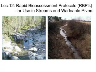
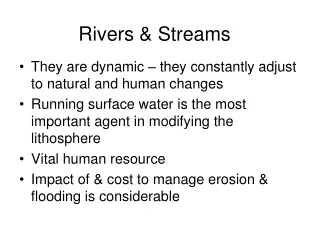
Rivers & Streams • They are dynamic – they constantly adjust to natural and human changes • Running surface water is the most important agent in modifying the lithosphere • Vital human resource • Impact of & cost to manage erosion & flooding is considerable
What are some Factors that influence the rate of overland flow?
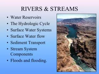
”Surface” Runoff (Stream Network)
Drainage Basin All the land drained by one river system
Watershed: Drainage divide High elevation points that separate 2 or more drainage basins.
Continental Divide and Mississippi Drainage A PPALACHIANS R OCK I ES watershed/drainage basin
Dendritic Uniform hardness of strata
Rectangular Pattern (Follows Joints/fractures/faults)
Trellis Pattern (Follows folded landscape)
Factors Affecting Rate of Stream Erosion & Deposition
The amount of potential energy is proportional to stream gradient.
Gradient - the vertical drop of a channel over a horizontal distance.
Streams: Headwaters The headwaters are the upper part of the stream near its source in the mountains. Upstream regions. • Steep Gradient. Lower reaches of a stream are referred to as downstream regions. • Shallow Gradient.
Streams: Mouth & Base Level The mouth is the place where a stream channel terminates and enters the sea, a lake, etc. Base level is the theoretical limit to which the stream can erode. It is, in effect, the elevation of the streams mouth.
The Un-Graded Stream Irregularities in path of river – falls, lakes, falls Rate of Deposition is not equal to Rate of Erosion
A Graded Stream: No irregularities in cross-section of river channel from its mouth to source Rate of Deposition = Rate of Erosion Streams constantly adjust channel & gradient to reach this equilibrium source mouth Base Level Lowest level to which a stream can erode Sea level
. The ability of a stream to erode also relates to stream velocity Velocity -- the speed of the water, generally measured in meters per second.
Streams: Transportation and Erosive Power • Competency: the size of particles that a stream can carry • Capacity or Load: Maximum amountof particles of a given size that a stream can carry Greater Gradient = Greater Velocity = increased competency & capacity
Velocity: straight channel The velocity of flow is greatest in the (a) middle and at the (b) top of the stream. Why? Least of amount of friction
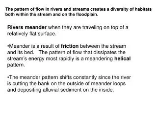
Velocity: Curved Channel • A river erodes sediment from its banks on the outside curve and deposits sediment on the inside curve. - The Force of Moving Water
Maximum Velocity: Curve Inside of curve: Slip off Slope/point bar Outside curve: Undercutting of bank
Channel Roughness Smooth, semi-circular channel yields highest velocity Wide, shallow channel increases friction Rough channel also slows river at base
Discharge Volume of water that flows past a given point per unit time Discharge (cfs) = average stream width (ft) x average depth (ft) x average velocity (ft/sec) Example: stream dimensions are 100 ft wide and 15 ft deep ---flowing at 6 ft/sec (4 mph) has a discharge of 9000 cfs Discharge typically increases downstream: • water flows into stream from groundwater • tributaries are added downstream
Types of Stream Erosion Abrasion (aka “corrasion”) – Physical Attrition - Physical Corrosion - Chemical Hydraulic Pressure - Physical
Methods of Stream Transportation Suspension Solution Saltation Traction Load: Includes the dissolved and suspended material
PARTICLE SIZE vs. VELOCITY • Different sized materials require different water velocities to be carried via suspension, saltation, or traction. This is illustrated by the size/velocity curve…
The Upstream Headwaterregion • The collecting system • Steep gradient - high velocity, therefore high erosion. Less water = less transport • Consist of a network of narrow v-shaped tributary channels that collect water and sediment to the main stream.
The Downstream Region • The transporting system • Shallow gradient: low velocity; major process is to transport water and sediment from upstream to the streams mouth. • Consists of a wide, deep U-shaped valley with a main channel.
The Dispersing System • Consists of a network of distributariesat the streams mouth, where water and sediment are dispersed. • Upon exiting the mouth, the velocity of the stream will decrease to zero, and the sediment is deposited to form a delta(in water) or an alluvial fan(on land) • Alluvium: stream deposited sediments (sand, silt, clay)