Download
1 / 20
200 likes | 310 Views
NASA WATER SCIENCE & APPLICATIONS. USE OF GEO DATA IN HELP BASINS Ted Engman Science Applications International Corp., NASA/GSFC. Extending the societal and economic benefits of Earth science research, information, and technology … LACB, Lima, 2009.

E N D
NASA WATER SCIENCE & APPLICATIONS USE OF GEO DATA IN HELP BASINS Ted Engman Science Applications International Corp., NASA/GSFC Extending the societal and economic benefits of Earth science research, information, and technology … LACB, Lima, 2009
Hydrology for the Environment, Life and Policy To deliver social, economic and environmental benefit to stakeholders through sustainable and appropriate use of water by directing hydrological science towards improved integrated catchment management basins http://www.unesco.org/water/ihp/help Real people Real catchments Real answers
“Paradigm Lock” Biophysical Scientists and Process hydrology
The HELP Process Two major steps: • A comprehensive assessment of what we know now (physical, socio-economic, legal, cultural baseline information). • Iteration between stakeholders and scientists to determine research plan. • Implementation of research in collaboration between scientists, managers and stakeholders
What makes HELP unique? • Only international programme that is a catchment based activity which is interfacing scientific research with stakeholders needs. • Includes scientists, stakeholders, policy-makers, lawyers, environmentalists, etc. • Provides options as against imposing solutions. • Providing/testing/implementing and improving solutions. • IHP cross cutting program • Sharing experiences across a global network of basins.
Who are we? • Teams of scientists (natural, social, economic, political) stakeholders, managers, policy and decision makers. • Focusing on “needs driven” water related issues and research. • International platform for basin experiences (comparing/sharing). • Contribution towards IWRM.
HELP GLOBAL NETWORK Demonstration Evolving Proposed Operational
The HELP Integrated Catchment Management Challenge HELP is a program designed to deliver social, economic and environmental benefits to stakeholders through appropriate use of water by directing hydrologic science towards improved Integrated Catchment Management (ICM). Implicit in this goal is that one has a knowledge of the scientific hydrology of the catchment. Unfortunately, for much of the world the basic water cycle data for planning and management are sparse, unreliable or nonexistant.
The HELP Integrated Catchment Management Challenge The first step in ICM is an assessment to quantify the amount and condition of the water resource in space and time. Traditionally this has been done through in situ measurements of the major fluxes and storages (rain, stream flow, GW, snow, reservoir capacity, etc) and an assessment of the condition (quality). In many regions of the world these data do not exist or are unreliable. Traditional data collection activities are very expensive.
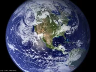
A NEW SOURCE OF WATER RESOURCES DATA- SATELLITES! The major space agencies and met services maintain a vast array of Earth observing satellites capable of providing basic water cycle data. These data have the potential for providing critical inputs to sustainable water resources development and ICM.
NASA MISSIONS FOR WATER MANAGEMENT Global Precipitation Measurement
Data: Land Surface Observations Precipitation:Remote-Sensing: SSM/I, TRMM, AMSR, GOES, AVHRR, GPM In-Situ: Surface Gages and Doppler Radar Radiation:Remote-Sensing: MODIS, GOES, AVHRR In-Situ: DOE-ARM, Mesonets, USDA-ARS Surface Temperature:Remote-Sensing: AVHRR, MODIS, SSM/I, GOES In-Situ: DOE-ARM, Mesonets, NWS-ASOS, USDA-NRCS Soil Moisture:Remote-Sensing: TRMM, SSM/I, AMSR, HYDROS, ESTAR, NOHRSC, SMOS In-Situ: DOE-ARM, Mesonets, Global Soil Moisture Data Bank, USDA-NRCS Groundwater:Remote-Sensing: GRACE In-Situ: Well Observations, Piezometers, pumping tests Snow Cover, Depth & Water:Remote-Sensing: AVHRR, MODIS, SSM/I, AMSR, GOES, NWCC, NOHRSC In-Situ: SNOTEL Streamflow:Remote-Sensing:Laser/Radar Altimeter In-Situ: Real-Time USGS, USDA-ARS Vegetation:Remote-Sensing: AVHRR, TM, VCL, MODIS, GOES In-Situ: Field Experiments Others: Soils, DEM, Latent & Sensible heat fluxes, etc.
What We Cannot Measure Directly, We Can Model Land Surface Prediction: Accurate hydrologic model prediction is essential to estimate all fluxes and storages in time and space. Based on water and energy balance. Input - Output = Storage Change P + Gin –(Q +ET+ Gout) = ΔS Rn - G =Le+ H
0% 20% LandData Assimilation Data Assimilation merges observations & model predictions to provide a superior state estimate. Remotely-sensed hydrologic state or storage observations (temperature, snow, soil moisture) are integrated into a hydrologic model to improve prediction, produce research-quality data sets, and to enhance understanding of complex hydrologic phenomenon.
But There Are Still Discontinuities in Space and Time Among Measured Variables and Model Produced Variables, Solution: 4 - D Land Data Assimilation Systems: • Quantification and prediction of hydrologic variability (time and space) • Critical for initialization and improvement of hydrologic DSTs • For applications such as flood forecasting, water supply, ground water management, etc. • Maturing of hydrologic observation and prediction tools: • Observation: Forcing, storages (states), fluxes, and parameters. • Simulation: Land process models (Hydrology). • Assimilation: Short-term state constraints (satellite & in situ data) • “LDAS” concept: • Bring state-of-the-art tools together tooperationallyobtain high quality land surface storages and fluxes. • Optimal integration of land surface observations, satellite data and model predictions. • Continuous in time&space; multiple scales, realtime, and forecast
Data Assimilation Data Assimilationmerges observations & model predictions to provide a improved state estimates +
High Resolution Global Modeling Christa Peters-Lidard and the GSFC LIS team Objective:A high performance, high resolution (1km), near-real-time (<1day/day execution time) global land modeling and assimilation system capable of demonstrating the impact of NASA observations on global water and energy cycles. Applications:Weather and climate modeling, Flood and water resources forecasting, Precision agriculture, Mobility assessment, etc. Example: 1km MODIS Leaf Area Index (LAI) data GLDAS LIS
STEPS NEEDED TO REALIZE THE POTENTIAL OF SATELLITE HYDROLOGY FOR WATER RESOURCES MANAGEMENT • Identify available data – evaluate • Select an actual problem (gw management, flood warning, new town) • Identify DST’s needed for problem • Identify data needed from #2 • Obtain those data from space agencies (go back in time) • Initiate training and capacity building w/ DSTs and R.S. data • Implement assessment with DSTs • Define baseline and improvements made with satellite data • Set up infrastructure for sustainability of data and use of DSTs
RELATIVE COSTS FOR EACH STEP • Select an actual problem (gw management, flood warning, new town) • Identify available data – evaluate • Identify DST’s needed for problem • Identify data needed from #2 • Obtain those data from space agencies (go back in time) • Initiate training and capacity building w/ DSTs and R.S. data • Implement assessment with DSTs • Define baseline and improvements made with satellite data • Set up infrastructure for sustainability of data and use of DSTs
SUMMARYSATELLITE DATA AND DATA PRODUCTS SHOULD BE ABLE TO SUBSTITUTE FOR TRADITIONAL WATER CYCLE DATA TO USE FOR SOLVING WATER RESOURCES MANAGEMENT PROBLEMS WHEN TRADITIONAL DATA ARE NOT AVAILABLE OR UNRELIABLETHANK YOU