Download
1 / 33
330 likes | 477 Views
Pacific Asian Regional Campaign (PARC-2008) .

E N D
Pacific Asian Regional Campaign(PARC-2008) • PARC-Asia: Advance understanding and predictability of high-impact weather over Asian and the western Pacific with emphasis on tropical cyclones from genesis to decay/extratropical transition (Japan, Korea, and China plus collaboration with the DOTSTAR program) • PARC-North American Predictability: Advance understanding and predictability of high-impact weather over North America whose forecast errors and dynamical roots lie in process over Asia and the western Pacific. (US and Canada) • PARC • THORPEX’s 1st scale interaction experiment with the planning led by the THORPEX International Executive Board • Perhaps the community’s first field campaign focused on weather phenomena and prediction at the medium range • Field phase is planned for July-Dec 2008 with facilities phased in and out for different foci NOAA THORPEX PI MEETING-- 19 Jan ‘06 -- NCEP
PARC International Aspects • The concept of PARC has already been endorsed outside of THORPEX by: • The WMO/CAS Working Group on Tropical Meteorological Research • The participants of the WMO/CAS Workshop on Tropical-Extratropical Interactions • The Joint ICSU/WMO Committee on the International Polar Year • PARC represents a unique sharing of resources between the North American and Asian nations for direct benefits to science and society in both regions. NOAA THORPEX PI MEETING-- 19 Jan ‘06 -- NCEP
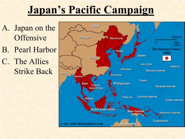
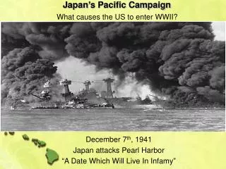
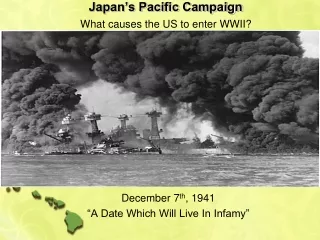
Asian Societal Motivation for PARC • Typhoons are the most important natural disaster for the Asian Pacific rim • Large numbers of named storms commonly occur (~26 each year, ten typhoons hit Japan in 2004) • Large economic toll (Super typhoon and ET storm Tokage resulted in $10 B in damage to public infrastructure alone) • Orography can make track forecasting more difficult • Mudslides can add to fatalities (Typhoon Rananim leaves 170 dead in China) • High death tolls in developing countries (~450 fatalities from Typhoon Muifa) HAITANG 2005 NOAA THORPEX PI MEETING-- 19 Jan ‘06 -- NCEP
North American Motivation • Statistical averages have long revealed that the western Pacific region is a strong “sensitive region” for North American and Arctic weather (among the strongest on the planet) • Past (and even some planned) operational and research field efforts over the Pacific lie outside of these known statistically-strong sensitive regions • High-impact forecast failures over N. American (for both warm and cool seasons) are often linked to cyclogenesis, typhoons, tropical convection, and ET storms over the western Pacific through the downstream dispersion of Rossby wave trains • The extratropical transition of Asian typhoons degrade forecast skill even in the global mean with a downstream propagation of uncertainty • Forecast skill in west coast cyclones is still lacking • Implications also exist for medium range predictions of severe weather NOAA THORPEX PI MEETING-- 19 Jan ‘06 -- NCEP
Prediction of global sensitive regions for November 2001 Error growth “hot” zones
NAVDAS Observation Count – 12 May 2005 All observation types - 00, 06, 12, 18 UTC Includes AMSU-A, scatterometer, MODIS, geosat winds, SSMI, raobs, land, ship, aircraft data Does not includes HIRS, AIRS, GPS, or ozone MAX SENSITIVITY Number of obs within 5o x 5o lat-lon boxes
General Decrease in Forecast Skill for ET Storms Forecast Skill Bifurcation ET Tracks From Jones et al., 2003: Wea. And Forecasting NOAA THORPEX PI MEETING-- 19 Jan ‘06 -- NCEP
19 Oct 27 Oct Tokage- Downstream Increase in Uncertainty ECMWF EPS 500 hPa Standard Deviation Forecast from 16 October Forecast from 18 October 17 Oct 25 Oct 0 0 0 180 0 180 NOAA THORPEX PI MEETING-- 19 Jan ‘06 -- NCEP
A Series of Three Poorly Predicted Major Downstream Events Initiated by Tropical Convection Western WA flood (Seattle 1-day record) BC’s flood of the Century (18.5”) CA Wild Fires (downslope winds)
00hr GFS 24hr GFS 48hr GFS 00hr + 48hr GFS
GFS 48-h Forecasts of 12-hr Precipitation 36h Forecast 24h Forecast 48h Forecast 12h Forecast
What is happening in this region? BC’s flood of the Century (18.5”) Western WA Flood (Seattle 1-day record) CA Wild Fires (downslope winds) NOAA THORPEX PI MEETING-- 19 Jan ‘06 -- NCEP
The US Weather Disasters Had Their Roots in Tropical Convection Days Earlier Twin typhoons and tropical convection NOAA THORPEX PI MEETING-- 19 Jan ‘06 -- NCEP
How well do we predict these west coast lows, what are the central pressure and cyclone position errors? Ave SLP error = 3.4 mb SD = 8.7 mb Absolute error = 7.5 mb Ave position error = 453.8 km SD = 260 km
Connection to IPY NOAA THORPEX PI MEETING-- 19 Jan ‘06 -- NCEP
Typhoon Tokage, After Killing Almost 100 People, is Worst in Japan in 25 Years; Japan’s 10 Typhoons in 2004 are Record for Worst Ever (Oct. 2004) Total Damages in public infrastructure(agriculture, Road, etc) by Typhoon and Heavy Rainfall in Japan this year are US$10 billion. Typhoon Tokage insurance claims are estimated at 88.5 billion Yen ($839 million). Tokyo, Japan (HDW) October 23, 2004 -Typhoon Tokage ravaged Kyoto and Tokyo on Japan’s main islands, potentially killing almost 100 people. This typhoon is reported to be the worst since 1979, making it the worst in a generation. Japan has suffered through 10 typhoons this year, which makes this the worst typhoon season by far in Japan’s history. The 2004 season has also been the worst hurricane season on record for the State of Florida within the United States, and the worst typhoon season for the country of China within Asia. Researchers are still trying to setermine exactly what made this one of the worst seasons globally for cyclone activity. The picture above, taken by a NASA satellite, shows Typhoon Tokage devastating the Japanese main islands.Typhoon Tokage was originally expected to weaken, according to the Joint Typhoon Warning Center (JWTC), as it tracked into cooler sea surface temperatures and sucked drier air into itself, but the storm maintained much of its strength as it moved through the ancient Japanese capital of Kyoto, and the modern Japanese capital of Tokyo. This typhoon was originally expected to lose power and spare major Japanese cities from the calamities of other typhoons that have hit Japan in this worst of Japanese typhoon seasons. Typhoon Tokage, however, caused great flooding and heavy rains, and many people are still missing. (http://www.hdweather.com/typhoon/typhoon_361.htm) NOAA THORPEX PI MEETING-- 19 Jan ‘06 -- NCEP
Nome, AK – during the storm NOAA THORPEX PI MEETING-- 19 Jan ‘06 -- NCEP
A residence in Shishmaref – after the storm NOAA THORPEX PI MEETING-- 19 Jan ‘06 -- NCEP
PACIFIC: NoPac forecast error – Oper forecast error at T+24 NormDiff in RMS Averaged over 50 cases NOAA THORPEX PI MEETING-- 19 Jan ‘06 -- NCEP
PACIFIC: NoPac forecast error – Oper forecast error at T+48 NormDiff in RMSAveraged over 50 cases NOAA THORPEX PI MEETING-- 19 Jan ‘06 -- NCEP
PACIFIC: NoPac forecast error – Oper forecast error at T+72 NormDiff in RMSAveraged over 50 cases NOAA THORPEX PI MEETING-- 19 Jan ‘06 -- NCEP
PACIFIC: NoPac forecast error – Oper forecast error at T+96 NormDiff in RMSAveraged over 50 cases NOAA THORPEX PI MEETING-- 19 Jan ‘06 -- NCEP
PACIFIC: NoPac forecast error – Oper forecast error at T+120 NormDiff in RMSAveraged over 50 cases NOAA THORPEX PI MEETING-- 19 Jan ‘06 -- NCEP
PACIFIC: NoPac forecast error – Oper forecast error at T+144 NormDiff in RMSAveraged over 50 cases NOAA THORPEX PI MEETING-- 19 Jan ‘06 -- NCEP
US Science Investigators • University: J. Hansen (MIT), P. Harr (NPGS), R. Elsbery (NPGS), J. Evans (Penn State), S. Majumdar (U Miami), I. Szunyogh (U MD), G. Hakim (UW), C. Mass (UW), L. McMurdie (UW), D. Chen (U HI), Y. Wang (U HI), D. Keyser (SUNY), E. Chang (SUNY), B. Etherton (UNC), C. Velden (Wisc) • NRL: R. Langland, C. Reynolds, C. Bishop • NOAA: Z. Toth, S. Aberson, D. Reynolds, J. Partain • NASA: W. Tao, R. Gelaro, T. Miller, E. Browell • NCAR: J. Tribbia, D. Parsons, G. Holland, R. Morss, J. Lazo, B. Kuo, W.-C. Lee NOAA THORPEX PI MEETING-- 19 Jan ‘06 -- NCEP
One Science Hypothesis Can high-impact forecast failures over North American and the Arctic be reduced by strategies aimed at improving the 24 to 48 h forecasts of high-impact weather over east Asia and the western Pacific? Such strategies may include improved and adaptive use of satellite data, high resolution modeling, advanced ensemble techniques, in-situ targeting techniques, and techniques to reduce model error. NOAA THORPEX PI MEETING-- 19 Jan ‘06 -- NCEP
A SIMPLE EXAMPLE OF CO-OPERATION What processes limit the predictability of ET storms and their downstream effects? Will strategies that improve typhoon track forecast correspondingly reduce this downstream uncertainty? with D-sonde + Bogus without D-sonde without Bogus
General Scientific Goals • A focal point for international collaborative studies aimed at advancing knowledge and predictive skill associated with Asian and Pacific processes and their downstream effects • Advancing satellite data assimilation, especially for cloudy and precip regions • Advance use of ensembles (TIGGE and NAEFS) by research community • Upscaling -- Gain in short and medium range/downstream forecast skill from use of high resolution grids that resolve convection or other adaptive modeling approaches • Development of new data assimilation techniques and comparisons between methods • Determining dynamical and physical factors that limit predictability and strategies for improvement in skill • Assessing and reducing model error for typhoon evolution and for the ET process • Understanding medium range forecast failure and the role of Western Pacific and Eastern Asian processes • Predictability and dynamical process studies with a greatly improved analysis • Targeting – New approaches, tests of adaptive use of satellite data sets and low cost in-situ targeting approaches that are not local in nature over a longer period (see Langland 2006) • Downscaling – local and regional impacts of improved global simulations • What is the societal and economic impacts of improved forecasts NOAA THORPEX PI MEETING-- 19 Jan ‘06 -- NCEP
Genesis Measurements: Taiwan sponsored driftsonde measurements (pilot program 2007) NOAA THORPEX PI MEETING-- 19 Jan ‘06 -- NCEP
Targeting by Asian Aircraft for Typhoons NOAA THORPEX PI MEETING-- 19 Jan ‘06 -- NCEP
HIAPER (NSF deployment pool), NRL P-3 (proposed NRL co-sponsorship) (and NASA DC-8?) North American Measurements in Areas of Recurvature, Extratropical Transition Plus in Region of Intense Cyclogensis NOAA THORPEX PI MEETING-- 19 Jan ‘06 -- NCEP
NAVDAS Observation Count – 12 May 2005 All observation types - 00, 06, 12, 18 UTC Canadian downstream Measurements with the Convair Driftsonde Nov-Dec (Propose partial Canadian And NOAA Support) NOAA G-4 Dec AF training Flights Nov or Dec Number of obs within 5o x 5o lat-lon boxes NOAA THORPEX PI MEETING-- 19 Jan ‘06 -- NCEP