Download
1 / 17
170 likes | 289 Views
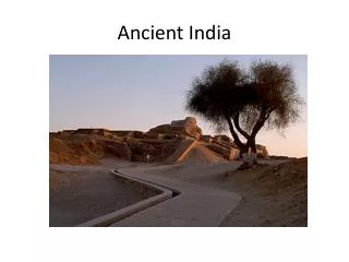
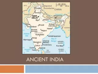
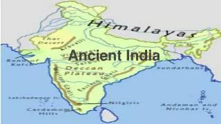
Ancient India. Geography. Geographers often refer to the landmass that includes India, Pakistan, and Bangladesh as the Indian subcontinent. A wall of the highest mountains in the world the Hindu Kush, Karakorum, and Himalayan ranges separates this region from the rest of the Asian continent.

E N D
Geography • Geographers often refer to the landmass that includes India, Pakistan, and Bangladesh as the Indian subcontinent. A wall of the highest mountains in the world the Hindu Kush, Karakorum, and Himalayan ranges separates this region from the rest of the Asian continent.
Geography • The world’s tallest mountains to the north and a large desert to the east helped protect the Indus Valley from invasion. • The mountains guard an enormous flat and fertile plain formed by two rivers the Indus and the Ganges (GAN•jeez).
Weather and Climate • Monsoons Seasonal winds called monsoons dominate India’s climate. From October to February, winter monsoons from the northeast blow dry air westward across the country. Then, from the middle of June through October, the winds shift. These monsoons blow eastward from the southwest, carrying moisture from the ocean in great rain clouds. The powerful storms bring so much moisture that flood-ing often happens. When the summer monsoons fail to develop, drought often causes crop disasters.
Monsoon • Monsoon
Weather and Climate • Yearly floods spread deposits of rich soil over a wide area. However, the floods along the Indus were unpredictable. • • The rivers sometimes changed course. • The cycle of wet and dry seasons brought by the monsoon winds was unpredictable. If there was too little rain, plants withered in the fields and people went hungry. If there was too much rain, floods swept away whole villages.
Civilization Emerges • Historians know less about the civilization in the Indus Valley than about those to the west. They have not yet deciphered the Indus system of writing. • Evidence comes largely from archaeological digs, although many sites remain unexplored, and floods probably washed away others long ago. At its height, however, the civilization of the Indus Valley influenced an area much larger than did either Mesopotamia or Egypt.
First Humans to the Region • Earliest Arrivals No one is sure how human settlement began in the Indian sub continent. Perhaps people who arrived by sea from Africa settled the south. Northern migrants may have made their way through the Khyber Pass in the Hindu Kush mountains. • Some artifacts date back as far as 7000 B.C.
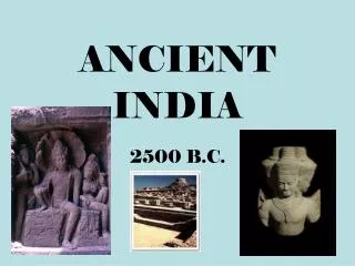
First Humans • Around 2500 b.c., while Egyptians were building pyramids, people in the Indus Valley were laying the bricks for India’s first cities. They built strong levees, or earthen walls, to keep water out of their cities. When these were not enough, they constructed human made islands to raise the cities above possible floodwaters. • Archaeologists have found the ruins of more than 100 settlements along the Indus and its tributaries mostly in modern day Pakistan. Indus Valley civilization is some times called Harappan civilization, because of the many archaeological discoveries made at that site.
The Harappan- Language • Like the other two river valley civilizations, the Harappan culture developed a written language. In contrast to cuneiform and hieroglyphics, the Harappan language has been impossible to decipher. • Why do you think this is? • The Harappan language is found on stamps and seals made of carved stone used for trading pottery and tools. About 400 symbols make up the language.
Harappan-Culture • The housing suggests that social divisions in the society were not great. Artifacts such as clay and wooden children’s toys suggest a relatively prosperous society that could afford to produce nonessential goods. • Few weapons of warfare have been found, suggesting that conflict was limited. • What does that suggest? • There were many artifacts depicting animals, what does this suggest?
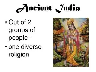
Harappan- Religion • Role of Religion As with other cultures, the rulers of the Harappan civilization are believed to have close ties to religion. Archaeologists think that the culture was a theocracy. • But no site of a temple has been found. Priests likely prayed for good harvests and safety from floods. Religious artifacts reveal links to modern Hindu culture. Figures show what may be early representations of Shiva, a major Hindu god.
Harappan-Trade • The Harappans conducted a thriving trade with peoples in the region. Gold and silver came from the north in Afghanistan. Semiprecious stones from Persia and the Deccan Plateau were crafted into jewelry. The Indus River provided an excellent means of transportation for trade goods.
Decline • It is believed the decline of these peoples was the result of harsh weather conditions and climate changes that made it impossible to continue to thrive
City • Design a City Map: • College______/2 • Granary______/2 • Citadel_______/2 • Assembly Hall______/2 • Tower/ Military Fortifications______/2 • Residential housing_______2/ • Must be done in blue or black pen____/2 • Fills the page________/2 • 6-8 Sentences explaining your arrangement___/4