Download
1 / 22
220 likes | 347 Views
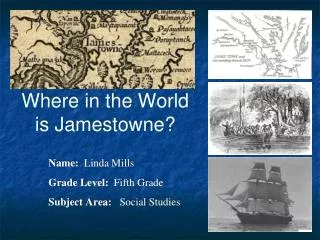
Where in the World is Jamestowne ?. Name: Linda Mills Grade Level: Fifth Grade Subject Area: Social Studies. Essential Questions. Big Idea – What big idea (or essential question) do you want students to explore through this activity?

E N D
Where in the World is Jamestowne? Name: Linda Mills Grade Level: Fifth Grade Subject Area: Social Studies
Essential Questions Big Idea –What big idea (or essential question) do you want students to explore through this activity? • How did historians/archaeologists know about Jamestowne or early settlements? • Why was Jamestown established? • Where was Jamestowne located?
Overall Idea of Unit • Explore map (1612) of early Jamestown by jigsaw (Example 1) • Share book on Jamestown (Captain John Smith’s Big and Beautiful Bay by Rebecca C. Jones. Illus. by Linda Shute. Schiffer, 2011.) • Compare later maps of Jamestown including present day maps • Use this site to show original fort http://ngm.nationalgeographic.com/2007/05/jamestown/jamestown-standalone
Indiana Standards • S.S. 5.1.4 Ways of life before and after the arrival of Europeans to 1610 • Locate and compare the origins, physical structure and social structure of early British settlements. • S.S. 5.1.19 Chronological Thinking, Historical Comprehension, Analysis and Interpretation. • Use primary and secondary sources to examine a historical account about an issue of the time • S.S. 5.3.4 Places and Regions: • Locate Native American Indian and colonial settlements on maps and suggest reasons for the locations of these places.
Background Knowledge • Students will have studied explorers (i.e.Cartier, Columbus, Magellan, etc) • Now comes…….the settlements in North America
Engagement • Explore 1612 map of early Jamestowne created by John Smith (jigsaw) (i.e.this map was used for 300 years) • Compare later maps of Jamestowne
Book Connection This book will be used to engage the students and to illustrate how the map they will be working with was used for 300 years. Overview of book: • account of John Smith’s exploration of the Chesapeake Bay in 1609 Discusses: • Exploration of Chesapeake Bay • Frustrations of men • Encounters with Powhatan Indians Publication: Schiffer, 2011
Critical Thinking • Observe details on maps • Reflect (infer) and question • Compare maps • New vocabulary: cartographer, archaeologist
Primary Source Analysis Tool • Students will use this form.
Questions and Prompts • How do maps/places change over time? • How do archaeologists discover information from clues? • Why did the Virginia Company settle at Jamestowne?
Resources • Colonial American overview to use on Jamestown http://www.loc.gov/teachers/classroommaterials/presentationsandactivities/presentations/timeline/colonial/indians/ • Use the National Geographic site to show how the discovery of Jamestowne is being done today. http://ngm.nationalgeographic.com/2007/05/jamestown/jamestown-standalone • National Park Service site http://www.nps.gov/jame/index.htm • Beyond a reasonable doubt http://apva.org/rediscovery/page.php?page_id=60 • Earliest map of Jamestown by Robert Tindall Eyewitness at Jamestowne fort http://apva.org/rediscovery/page.php?page_id=61 • Interactive map of the site today. What have we found? http://apva.org/rediscovery/page.php?page_id=4 (Try using this site some more with the interactivity of the map of the fort.) • West Bulwark http://apva.org/rediscovery/page.php?page_id=353 • Church tower at Jamestowne http://www.historicjamestowne.org/images/church_01.jpg • Picture from Library of Congress of old church at Jamestowne http://www.loc.gov/pictures/item/thc1995013020/PP/ Bigger picture http://www.loc.gov/pictures/resource/thc.5a47932/ • Original Jamestown Records of Virginia Company http://memory.loc.gov/ammem/collections/jefferson_papers/mtjessay2.html
Map Lesson Day 1 • Each child gets a piece of the map • Using the analyzing map tool, have students write their observations of the map. They need to write ONLY what they see at this time. Observation skills need to be explained and emphasized to students (this is a new skill). 5 minutes • Divide students into 7 groups, 4 students to a group • Put students together in their groups. Have students share what they have observed. Then have them write questions or inferences that they may have about the map after sharing time.
Assessment • Where is Jamestowne located? • Why was Jamestowne located in this particular place? • Use exit cards to have students tell the answers to these two questions • Assess map analyzing tool sheet that students completed **Suggest to teachers a guided reading lesson with information on Bill Kelso
What Did Jamestowne Look Like? Jamestowne in 1607 looked much different than it did today. These are artists renderings based on primary sources.
What Does Jamestowne Look Like Today? • Bill Kelso discovered in 1994 that Jamestown was still there and not in the river. This website will explain this further. http://www.apva.org/rediscovery/page.php?page_id=1 • It also includes videos of the archaeological dig. http://www.youtube.com/user/JamestownRediscovery
Bill Kelso My connection with him is that I met him at the Jamestowne dig. I need to share that with the students.
Interactive Site to Use • Use the National Geographic site to show how the discovery of Jamestowne is being done today. http://ngm.nationalgeographic.com/2007/05/jamestown/jamestown-standalone
Additional Book Connection • Discusses the settlers of Jamestown, Virginia, including John Smith, and the difficult early years in the colony. • Athenaeum, 2001
John Smith To extend this lesson more: • Compare pictures of John Smith • Read excerpts of John Smith’s diary • Look at the Disney portrait of John Smith
Excerpts from Smith’s Diary • The next day searching them for fresh water, we could find none, the defect whereof forced us to follow the next Easterne Channell, which brought us to the river of Wighcocomoco (Pocomoke). The people at first with great fury seemed to assault us, yet at last with songs and daunces and much mirth became very tractable, but searching their habitations for water, we could fill but three barricoes, & that such puddle, that never till then we ever knew the want of good water. We digged and searched in many places, but before two daies were expired, we would have refused two barricoes of gold for one of that puddle water of Wighcocomoco.
Additionally activities and thoughts Use a good map of present day Virginia to show the students although used the set of atlases that I own and used an atlas per each two students to examine a map of present day Virginia. This will also cover atlas skills. I had to decide to work with students in the library or in the classroom teaming with a classroom teacher. I liked it best when I teamed up with a classroom teacher.