Download
1 / 23
230 likes | 314 Views
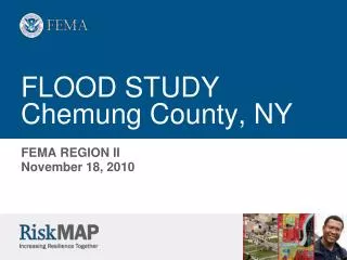
Flood Detection and Warning Chemung River Basin. Michael A. Sprague, Director Steuben County Office of Emergency Services & President, Environmental Emergency Services. Environmental Emergency Services, Inc. The Need For Real-Time Flood Information.

E N D
Flood Detection and Warning Chemung River Basin Michael A. Sprague, Director Steuben County Office of Emergency Services & President, Environmental Emergency Services Environmental Emergency Services, Inc.
The Chemung Basin Geographic features: The Chemung River is formed by the confluence of the Tioga River, flowing northward from Pennsylvania, and the Cohocton River, flowing southeast in New York. The Chemung joins the Susquehanna River at Sayre, Pennsylvania. Drainage area: 2,604 square miles Major tributaries: Chemung, Tioga, Cohocton, Cowanesque, Canisteo Population: 250,323 (6% of the total basin population) Major population centers: Elmira, Corning, Hornell (all in NY) Water Use: 59.8% Power Generation22.4% Municipal 9.7% Industrial 4.2% Agricultural 3.9% Domestic
Environmental Emergency Services • E.E.S. – A 3 county not-for-profit incorporation (501-c 3) Chemung Schuyler and Steuben Counties, Formerly the Chemung River Basin Flood Warning Support Corporation • To Advise and Inform the Populace of Chemung and Steuben Counties of Severe Flooding, Drought and Hazardous materials Incidents which Contribute to Environmental Emergencies
A Self-Help Group • Consensus for a self-help program – 1979 – “How Can We Help Ourselves !” • Steering committee formed • Memorandum of Understanding developed • Formed as Chemung River Basin Support Corporation ---- 1981 • Automated data collection equipment installed ----- 1984
Why a “LOCAL” System • Interest - Repeated Flooding • Demand to “FIX” • Need for Education • Ability to Foster Better Community Response • Take Advantage of Local Resources • Need - Repeated Flooding • Loss of Outside Info • Tailored Information • Greater Lead Time • Create A Focus Group • Coordinate, Coordinate, Coordinate!
Elements of A Successful Local Flood Warning System • Interest/need for a “LOCAL” system • Cooperation/community involvement • Local Funding and Support • Grants • Be Creative • We Know “IT” Will Happen Again !
Budget – How We Make It Work • Annual Budget: $31,750 • Counties $18,400 • Municipalities $13,350 • Cities-$2,000 • Towns-$2,000-$250 • Villages-$500-$250 Annual Report to All Municipalities
Evolution of the Current System • Emergency Operation Center - Staffed by Volunteers • Consolidated Information Center • Originally Based on “Long Term Flood Events” • Simplified Flood Forecasting Computer Model - NWS Assistance • ‘90’s Forced an Evolution to “Short Term-Flash Flood Events” • EOC became a “Clearing House” for Basin-wide information • Allows Emergency Management Offices, NWS and Corps • “Hands-Free” information exchange • Became a Pilot Site for “IP” based IFLOWS deployment • Challenge to evolve as NWS technology advances
Hydrologic Development and Verification • Many Events - Lots of Data • Local Involvement Provides Verification and Feedback • Able to Identify Basin Issues - Particularly Troublesome Tributaries • Changes to the Basin • Sitting of Additional Gauges - NWS Hydrologist Input • Development of “Standard Ratings” for new gauges • Cost Effective Approach Help the Weather Service Help Us