Download
1 / 44
440 likes | 594 Views
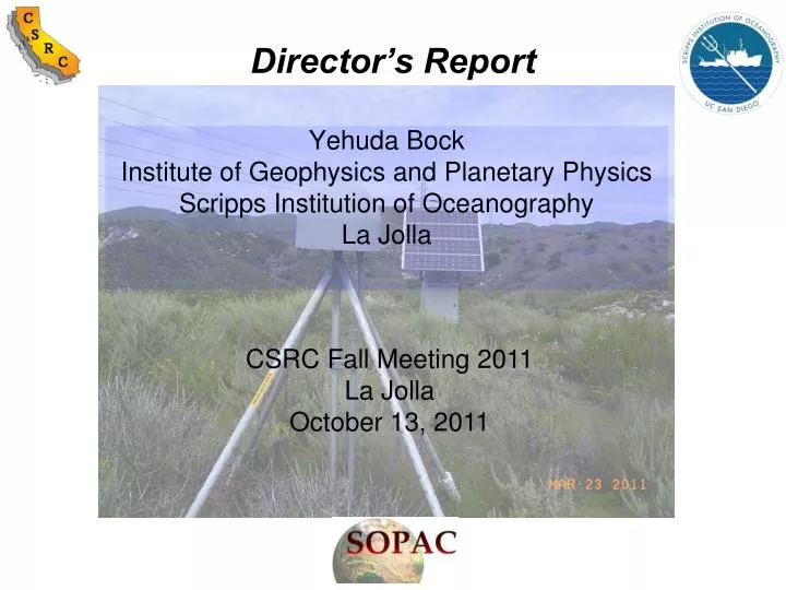
Director’s Report. CSRC Fall Meeting 2011 La Jolla October 13, 2011. Yehuda Bock Institute of Geophysics and Planetary Physics Scripps Institution of Oceanography La Jolla. SOPAC/CSRC Staff. Director: Yehuda Bock Coordinator: Maria Turingan Analysis: Peng Fang

E N D
Director’s Report CSRC Fall Meeting 2011 La Jolla October 13, 2011 Yehuda Bock Institute of Geophysics and Planetary Physics Scripps Institution of Oceanography La Jolla
SOPAC/CSRC Staff Director: Yehuda Bock Coordinator: Maria Turingan Analysis: Peng Fang Lead Programmer: Mindy Squibb Web Administrator: Hank Ratzesberger System Administrator: Anne Sullivan SCIGN and CRTN Engineer: Glen Offield Graduate Students: Brendan Crowell and Diego Melgar
Real-Time GPS Monitoring Infrastructure & Seismic Risk • Since early 1990’sover 1200 CGPS stations have been established for crustal deformation research in the Western U.S. Initial mode has been 15-s sampling and 24-hour position solutions. • Stations are being upgraded to real-time (RT) 1 Hz or greater sampling.Triangles on map show that more than 500 stations are now operating in RT (greater than number of seismic stations in the area) in the Western U.S. There are not many collocations of GPS and seismic stations. • The region is primed for several large earthquakes.
California Real Time GPS Network (CRTN) Started in 2003, there are now 1 Hz data available from ~200 stations from CRTN server at SIO with a latency of ~0.4 s. Data are collected from SCIGN/PBO stations via UCSD’s HPWREN, and from servers at UNAVCO, USGS Pasadena, UC Berkeley, Caltrans, Orange County, San Diego County and Metropolitan Water District. Displacements are computed on-the-fly with a total latency less than ~1 s.
CRTN as a Test Bed for Early Warning Systems • GPS seismology • Structural monitoring • Severe storm and flooding forecasts • Tsunami prediction • Volcano monitoring 2004 Stromboli eruption Displacement waveforms, 2004 Parkfield event LA freeway after 1994 Northridge earthquake
April 4, 2010 Mw 7.2 El Mayor-Cucapah Earthquake in Northern Baja California GNPS • 105 1 Hz CRTN stations recorded the earthquake in southern California • Using a Kalman smoother with a 2-3 s lag we estimated 100 Hz displacements using 1 Hz GPS and 100 Hz accelerometer data from 12 collocated GPS/seismic stations P494/WES P494/WES + 100 Hz 1 Hz
Real Time Estimation of Seismic Velocities: Detection of P-wave in Vertical Component at P494/WES + 2010 Mw 7.2 El Mayor-Cucapah Earthquake 100 Hz
Real Time Estimation of Displacements: Detection of P-wave in Vertical Component at P494/WES The magnitudes and precision are on the order of 1-2 mm. Not possible to do this with only GPS observations because of poorer determination of vertical component. + 2010 Mw 7.2 El Mayor-Cucapah Earthquake 100 Hz
Basic Elements of Earthquake Early Detection • Radio waves travel faster than seismic waves • P (primary) wave carries information • S (secondary) wave carries energy • Can we accurately predict the arrival and expected intensity of shaking based on P-wave detection, in time to issue an effective warning for large earthquakes ? Not with current seismic methods and instruments
March 11, 2011 Mw 9.0 Tohoku-oki Earthquake: Coseismic Displacements from 30 s GPS data The March 11, 2011 Mw=9.0 Tohoku-Oki earthquake severely stressed Japan’s early warning system. Shown in figure are coseismic displacements in the epicentral region computed from Japan’s 1200+ station CGPS Network (GEONET) by ARIA group at Caltech/JPL (courtesy of Susan Owen, JPL). Maximum surface displacement on land was 5.24 meters at station 0550 on coast. Maximum surface slip epicenter 5.4 m Fukushima Nuclear Plant Tokyo
Uses of Earthquake Early Warning • Some targets of early warning: • emergency service providers • transportation (public & private) • power plants – nuclear • gas supplies • factories • schools • hospitals • shopping malls • police • structures (dams, bridges) • public (see graphic to the left) This requires properly interfacing with first responders and development of automatic procedures and rapid response guidelines, and as the Tohoku-oki earthquake showed, the use of geodetic in addition to seismic data Public service guidelines for earthquake early warning in Japan
Surviving Sendai (the closest city to 2011 Mw 9.0 Tohoku-oki earthquake) - a first person account: "Our meeting was being held on the second floor of an office building near Sendai Station. Suddenly, during our discussions, our mobile phones began to ring with the distinctive earthquake alarm. ... This gave us a window of a few seconds to prepare before the shaking began. My business partner and I took shelter on the floor beneath a steel door frame and waited for the shaking to begin. Although the building we were in was fairly new, the shaking was strong enough that we were not able to stand. Dust and debris from the ceiling began to fall like snow and large cracks appeared in the walls." The account of Basil Tonks, Simcoe, March 15, 2011 Timeliness & Accuracy; Issue of False Alarms http://seismo.berkeley.edu/~rallen/research/WarningsInJapan/
EEW – 2011 Mw 9.0 Tohoku-oki Earthquake Amount of seconds until first warning was issued for 2011 Mw 9.0 Tohoku-oki earthquake. The contours show seconds until the S-wave arrival. The region within the 0 s contour is the blind zone where no warning is available. This illustration shows that the warning was issued before the S-wave reached the coastline. (Based on JMA report summarizing the earthquake and tsunami warnings) http://seismo.berkeley.edu/~rallen/research/WarningsInJapan/
March 11, 2011 Mw 9.0 Tohoku-oki Earthquake: Collocated GPS and Accelerometer Data Maximum surface slip Fukushima Nuclear Plant epicenter
March 11, 2011 Mw 9.0 Tohoku-oki Earthquake 100 Hz seismic waves at station 0550 (GPS/seismic) NEIC W phase M9.0 ~20 minutes JMA initial 6.8 15-16 seconds PGD-1 PGD-2 Detection (GPS/seismic) End of Shaking
March 11, 2011 Mw 9.0 Tohoku-oki Earthquake 100 Hz seismic waves at station 0550 (GPS/seismic) NEIC W phase M9.0: ~20 minutes Up Displacement (m) JMA initial 6.8 15-16 seconds PGD-1 PGD-2 Detection (GPS/seismic) End of Shaking
March 11, 2011 Mw 9.0 Tohoku-oki Earthquake: Detection: 2011 Mw 9.0 Tohoku-oki (100 Hz seismic waves at station 0550 (GPS/seismic) Up Displacement (mm)
March 11, 2011 Mw 9.0 Tohoku-oki Earthquake: Broadband Displacements using EEW Approach Maximum surface slip epicenter Station 0038 near Fukushima-Daiichi Nuclear Plant
Tsunami Travel Times for Tohoku-oki http://www.ngdc.noaa.gov
Rapid Estimation of Centroid & Magnitude 2003 Mw 8.3 Tokachi-oki Earthquake Our geodetic determination of centroid moment tensor solution for 2003 Mw 8.3 Tokachi-oki earthquake from observed 1 Hz GPS data processed in a simulated real-time mode, obtained in less than 2 minutes compared to 20-30 minutes using current seismic methods Play Grid search around epicenter, no a priori location
Rapid Estimation of Centroid & Magnitude 2003 Mw 8.3 Tokachi-oki Earthquake Magnitude converges within ~ 75 s, USGS and Global CMT solutions shown for comparison
March 11, 2011 Mw 9.0 Tohoku-oki Earthquake: Broadband Displacements using EEW Approach Maximum surface slip epicenter Station 3018 NE of Tokyo
Seismic Risk in the Western U.S.: Cascadia Megathrust • Cascadia great thrust earthquakes occur along the 1500 km length of the Cascadia margin from central British Columbia to northern California as the Juan de Fuca plate subducts beneath the North American plate. The most recent event in 1700 appears to have ruptured the entire subduction zone in a M9 earthquake, causing coastline subsidence and a massive tsunami (Adams, 1990; Atwater et al., 1996; Satake et al., 1997; Yamaguchi et al., 1997). The convergence rate between the Juan de Fuca plate and North America is 40 mm/yr and as much as 12 m of potential slip may have developed since 1700 that could drive a future recurrence of this event. While the average recurrence interval is 500-600 years, new evidence suggests intervals in southern Cascadia may be as low as 180 years, at least during Holocene times [Atwater and Hemphill-Haley, 1997; Goldfinger et al., 2005]. The seismic hazard posed by a future event the size of the 1700 rupture is extreme. Damage and death is likely to exceed that of the 2011 Mw 9.0 Tohoku-oki earthquake, in which 24m of displacement was measured directly and nearly 50m of slip inferred (Sato et al., 2011, Simons et al., 2011, Ide et al., 2011).
Seismic Risk in the Western U.S.: Southern San Andreas Fault • The San Andreas fault experiences great earthquakes every 150 years on average. The central portion last ruptured in 1857 during the magnitude 7.9 Fort Tejon earthquake with maximum slip of about 9 m along a 360 km segment, while the 1906 magnitude 7.9 San Francisco earthquake last ruptured the northern section with maximum slip of greater than 8 m along a nearly 300 km segment. The southern section has not experienced a large earthquake for at least 250-300 years. Geodesy and geology indicate that tectonic motion on this part of the fault is on the order of 22-30 mm/year, so that the earth has moved anywhere from 5.5-8.4 m since the last great earthquake. The slip deficit is approaching the maximum slip deficit accumulated in the historical record of large earthquakes along this part of the fault (Fialko, 2006). If one takes the upper value of the slip deficit it is possible that the earthquake will be as large as the 1857 or 1906 events.
Seismic Risk in the Western U.S.: San Francisco Bay Area • In the San Francisco Bay Area, two million people live in a geologically complex, tectonically active region that has experienced several large historic earthquakes, including the M6.8 1868 Hayward, the M7.9 1906 San Francisco, and M7.1 1989 Loma Prieta earthquakes. In the 19th century alone, 16 M>6 earthquakes shook the region and the Uniform California Earthquake Rupture Forecast (WGCEP, 2008) puts a 63% probability of a M6.7 or greater event before 2038 in the area. The Hayward fault along the eastern side of San Francisco Bay is arguably one of the most hazardous faults in the world in terms of risk when one combines the probability of an earthquake with proximity to urban centers. Though the southern Hayward fault last ruptured in 1868, historical accounts suggest that the northern Hayward fault has not ruptured for at least 160-220 years (Toppozada and Borchardt, 1998). With a mean recurrence rate of 130 years, both segments are overdue (Lienkaemper et al., 2002).
Coseismic and Postseismic Deformation at DHLG rms = 0.92 m rms = 1.19 m rms = 2.70 m
CSRS Coordinate Epoch (2011.00) • 830 CGPS stations (766@epoch 2009.00; 551@epoch 2007.00) – includes observations until 2011.2918 • ITRF2005 coordinates & velocities (upgrade later to ITRF2008) • NAD83(NSRS2007) coordinates & velocities • Includes uncertainties to comply with California Public Resources Codes • Coseismic and postseismic deformation model from Mw 7.2 El Mayor Cucapah earthquake in northern Baja California
California Real Time GPS Network (CRTN) Started in 2003, there are now data from 204 stations available at 1Hz from CRTN server at SIO with a latency of ~0.4 s. Data are collected from SCIGN/PBO stations via UCSD’s HPWREN, and from servers at UNAVCO, USGS Pasadena, UC Berkeley, Caltrans, Orange County, San Diego County and Metropolitan Water District servers. Displacements are computed on-the-fly with a total latency less than ~1 s.
10° dipping thrust fault Detectability of large earthquakes with a detection threshold of 15 mm, feasible with GPS/seismic integration (point-source approximation) strike dip rake
10° dipping thrust fault Detectability of large earthquakes with a detection threshold of 5 mm, feasible with GPS/seismic integration (point-source approximation) strike dip rake
Scaling Relationship to Rapidly Convert Peak Ground Displacements to Coseismic (Permanent) Displacements Based on horizontal displacements from the 2003 Mw 8.2 Tokachi-oki, 2010 Mw 7.2 El Mayor-Cucapah, and 2011 Mw 9.0 Tohoku-oki earthquakes. log10(CD)=1.381*log10(PGD) - 0.337
Rapid geodetic determination of centroid and magnitude for 2003 Mw 8.3 Tokachi-oki earthquake Converges within ~ 75 s, USGS and Global CMT solutions shown for comparison
March 11, 2011 Mw 9.0 Tohoku-oki Earthquake: Broadband Displacements using EEW Approach Maximum surface slip epicenter GEONET station 0550 with largest surface displacements
April 4, 2010 Mw 7.2 El Mayor-Cucapah Earthquake in Northern Baja California Real Time (Active) Real Time (temp. down) • Mw 7.2 earthquake occurred in northern Baja California on Easter Sunday (3:42 PM, local time) and was felt throughout southern California • Map of coseismic displacements
The first 90 minutes after the Tohoku-oki earthquake Centroid locations vary by about 2°; earliest solution is 20 min after onset time Rapid detection of CMT has important implications for timely tsunami warning http://eost.u-strasbg.fr/wphase/events/tohoku_oki_2011/