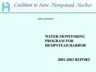
Tables and Graphs
Tables and Graphs. WATER-MONITORING PROGRAM FOR HEMPSTEAD HARBOR. 2001-2003 REPORT. Section 3. Graphs Depicting Seasonal Averages for Years 1995-2003, CSHH #1, 2, and 3. Fish Graph: Average DO (June-October), CSHH #1 - Beacon 11. 5.85. 5.90. 5.64. 5.17. 5.16. 4.64. 4.63.

Tables and Graphs
E N D
Presentation Transcript
Tables and Graphs WATER-MONITORING PROGRAM FOR HEMPSTEAD HARBOR 2001-2003 REPORT
Section 3 Graphs Depicting Seasonal Averages for Years 1995-2003, CSHH #1, 2, and 3
Fish Graph: Average DO (June-October), CSHH #1 - Beacon 11 5.85 5.90 5.64 5.17 5.16 4.64 4.63 4.60 4.39
Fish Graph: Average DO (June-October), CSHH #2 – Bell Marker 6 6.10 5.67 5.45 5.44 5.46 7.14 4.54 5.11 4.55
Fish Graph: Average DO (June-October), CSHH #3 –Glen Cove Creek, Red Channel Marker 6.54 6.47 6.32 6.16 5.26 5.20 5.21 7.44 5.14
Bar Graph: Comparing Seasonal Averages for Four Parameters, CSHH #1-Beacon 11
Bar Graph: Comparing Seasonal Averages for Four Parameters,CSHH #2-Bell Marker 6
Bar Graph: Comparing Seasonal Averages for Four Parameters,CSHH #3-Glen Cove Creek, Red Channel Marker
Section 4 2001-2003 Weekly Data and Graphs for Water Temperature, DO, pH, Salinity, and Air Temperature, CSHH #1, 2, 3, and 8
Section 4a 2001 Weekly Data Tables and Graphs, CSHH #1, 2, 3, and 8
Section 4b 2002 Weekly Data and Graphs, CSHH #1, 2, 3, and 8
Section 4c 2003 Weekly Data and Graphs, CSHH #1, 2, 3, and 8
Section 5 CSHH Weekly Data Integrated with IEC Data: CSHH #1-Beacon 11 with IEC #H-D and CSHH #2-Bell 6 with IEC #H-C
Purpose of Integrating Data The purpose of integrating the data from the two sources—IEC and CSHH—is to provide a broader picture of water-quality conditions in Hempstead Harbor, despite expected variations in data produced by differences as to the date, time, and location of data collection. By combining the data, we have a better view as to when trends in DO, temperature, etc., begin to change. These tables also help to validate the quality and accuracy of the data collected by showing the data from two sources. Note that the dates on which the Interstate Environmental Commission (IEC) (formerly Interstate Sanitation Commission—ISC) conducted water-quality testing in Hempstead Harbor are preceded by “IEC #H-D” or “IEC #H-C” (see the following page). IEC #H-D is the station closest to CSHH #1-Beacon 11, and IEC #H-C is the station closest to CSHH #2-Bell Marker 6 (see the map on the preceding page).
Section 6 2001 Coliform Data (NCDH) and Rainfall Graphed for Five Hempstead Harbor Beaches Many factors cause great variation in coliform results, including tides, currents, rainfall, and immediate inputs from waterfowl. See printed Appendix 3 for detailed data sheets.
Section 6a Comparison of 2001Total and Fecal Coliform Levels for Five Hempstead Harbor Beaches In most cases, increases in total coliform will accompany increases in fecal coliform but to different degrees.