Iceberg Detection Service
Iceberg Detection Service. Supports safe shipping and other offshore operations structures by providing near real-time (NRT) detection of icebergs based on satellite SAR imagery. End-users: International Ice Patrol and Canada-Newfoundland Offshore Petroleum Board

Iceberg Detection Service
E N D
Presentation Transcript
Iceberg Detection Service • Supports safe shipping and other offshore operations structures by providing near real-time (NRT) detection of icebergs based on satellite SAR imagery. • End-users: International Ice Patrol and Canada-Newfoundland Offshore Petroleum Board • Policy Sector: Transportation and offshore operations safety Environment
Summary • Canada-Newfoundland Offshore Petroleum Board • International Ice Patrol • Iceberg Detection Service • End-User Feedback • Iceberg Detection Process Chain • Future
CNOPB • Derives its authority from the Atlantic Accord Implementation Acts • Other relevant policies: Canada's Oceans Act, Canadian Environment Protection Act (CEPA 1988) • Manages the petroleum resources in the Newfoundland offshore area • Responsible for approval of operations plans
CNOPB • Presently depend on the offshore operators to provide information • Archived satellite imagery combined with other sources of data could provide iceberg frequency statistics for a particular area of interest • NRT satellite imagery provides contaminant discharge monitoring
6 – 12 NM 1 – 6 NM < 1 NM Threat Analysis
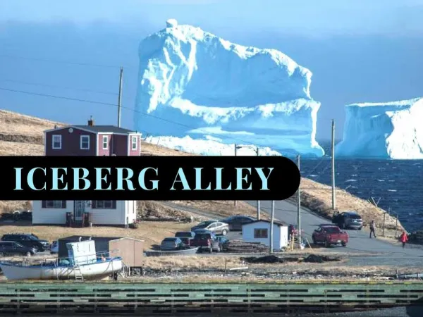
International Ice Patrol (IIP) • Operates under authority of International Maritime Organization, International Convention for the Safety of Life at Sea (SOLAS 1974); • Funded by 17 countries • Promote safe navigation of the Northwest Atlantic Ocean when the danger of iceberg collision exists • Monitor iceberg danger near the Grand Banks of Newfoundland and provide the limits of all known ice to the maritime community • Information is collected primarily from air surveillance flights and ships operating in or passing through the ice area.
IIP • Iceberg data, along with ocean current and wind data are fed into a computer model at IIP to predict iceberg drift • The predicted iceberg locations are used to estimate the limit of all known ice • This information is available to the U.S., Canada, Europe for the benefit of all vessels transiting North Atlantic. • NRT satellite imagery will increase the confidence and frequency of iceberg data available
Iceberg Detection Service for IIP • Service duration: May 1 – July 11 • RADARSAT SAR and ENVISAT ASAR • Weekly contact with IIP confirming Area of Interest • Iceberg Detection Reports delivered for each image • Several teleconferences to discuss progress and receive feedback
Platforms IIP Service Area
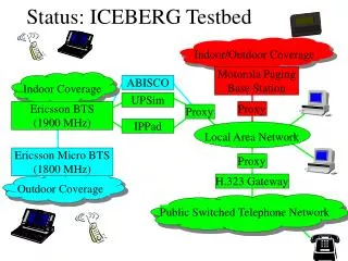
C-CORE Iceberg Detection Service Start Client Acquisition Planning Action Incorporate MANICE file into IIP operations center Image Acquired Direct Downlink to CDPF IDS FTP Image Quality Control Service Process Flow
Image Acquisition Planning • Initial Contact to establish Acquisition plan over a 24-day cycle – frequency, AOI • 24-day cycle repeated until completion of ice season • Images ordered 2-3 weeks in advance to ensure priority and allow time for conflict resolution • Images ordered on a weekly basis to allow changes in AOI based on iceberg forecasts
Image Downlink and FTP • Data captured by satellite and downlinked to the CDPF (Gatineau station ) • Data processed into image format • NRT delivery of images (downlink to ftp start time) ~ 3-4 hours • FTP transfer of images to C-CORE ~ 30 minutes
Iceberg Detection Algorithm • Algorithm proceeds in two stages: target detection and target discrimination • Target detection: modelling of ocean clutter distribution and calculation of threshold based on statistics yields targets (ships and icebergs) • Target discrimination: exploitation of different spectral response and shape characteristics to classify ships and icebergs
IIP Operations • MANICE file is integrated with into the IIP operations system • Data used to plan future air reconnaissance flights • Data compared with other iceberg data entered into the system – analysis not complete
IDS Output Product TEXT FILE MANICE FILE
IIP Feedback • Text file format converted to MANICE format for easier ingestion to the IIP Ice Management System • Iceberg information received from C-CORE ~4-5 hours after image acquisition – within accepted time delay of information • Analysis of data to be completed at the end of the ice season • Very enthusiastic about Phase I and hope to continue to Phase II • “It seems satellites are our future”