Download
1 / 18
180 likes | 296 Views
USGS Support During SOCAL Fires. Elizabeth Lile U.S. Geological Survey Rocky Mountain Geographic Science Center. GeoMAC. Geospatial Multi-Agency Committee The need for status, location and proximity of wildfires to values at risk prompted the formation of GeoMAC

E N D
USGS Support During SOCAL Fires Elizabeth Lile U.S. Geological Survey Rocky Mountain Geographic Science Center
GeoMAC • Geospatial Multi-Agency Committee • The need for status, location and proximity of wildfires to values at risk prompted the formation of GeoMAC • Internet mapping application that helps fire personnel evaluate hazards in context, close to real-time • Sponsored by The National Interagency Fire Center (NIFC) • Web design and development: USGS
Rapid Data Delivery System (RDDS) • AOI defined from map service • Select desired vector and raster products • Select projection & datum • Select delivery option • Input incident & contact information
TransportationHyrography etc Tonal balanced imagery Raster Map - DRG DEM – Shaded Relief RDDS Products
Debris Flow Models • 26 fires • Inputs • 10 meter Digital Elevation Models • Slope • Burn severity • Soils • Rainfall • Watershed • Perimeters • Outputs • Debris Flow Outlooks • USGS open file report
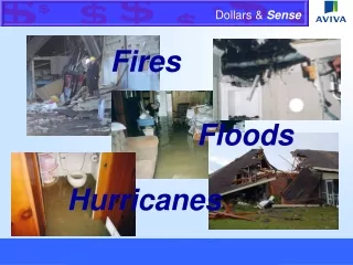
CA Firestorm Direct Economic Impacts • Witch Fire - San Diego County • Assessed value of improvements from county parcel data. • Damage level from county personnel field assessments between October 23rd and 30th, 2007. • 503 destroyed structures within burn perimeter valued at $115 million.
CA Firestorm Indirect Economic Impacts • Buckweed Fire - L.A. County • Labor market data from California Employment Development Department. • Business establishments, employees, and payroll by industry super sectors in zip codes intersecting burn area. • $137 million in payroll. • 1,526 of 1,697establishments are“small” businesses withless than 20 employees.
USGS Study Finds Ash from Southern California Fires May Pose Problems to Health and the Environment Samples collected from two residential areas burned by the Grass Valley and Harris wildfires indicate that the ash contains caustic alkali materials and can contain somewhat elevated levels of metals such as arsenic, lead, zinc and copper. Witch Fire Harris Fire
Data acquisition: • In PIXIA • Loaded all historical and current fire perimeter data • 14 scenes QuickBird RGB from Oct 22-25 • In HDDS • 4 EO-1 hyperion and ALI images • 7 scenes Landsat 7 • Updated fire perimeters/shapefiles (daily) • 1 scene AWIFS Oct 26, 07 (restricted) • 8 BARC datasets listed by fire • 1 scene TerraSAT-X Oct 29, 07 • 7 NASA/Ikhana UAS files, listed by fire • 2 scenes SPOT (restricted) • 7 scenes ALOS (restricted) • 13 scenes Quickbird (restricted) • 14 scenes IKONOS (restricted) • 667 images of San Diego – 1st Sanborn shipment • 4 scenes Aster (L1A &B)
Links • geomac.gov • firedata.cr.usgs.gov • landslides.usgs.gov/research/wildfire/07sca • webcam: ca.water.usgs.gov/webcams/ • nhss.cr.usgs.gov • hdds.usgs.gov • Ash Open-File Report: http://pubs.usgs.gov/of/2007/1407 • streamstatsags.cr.usgs.gov/ca_ss/default.aspx