Download

1 / 14
140 likes | 367 Views
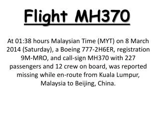
SEARCHING AND HUNTING MAPPING AND PLANNING PROCESS FOR MH370. ( MH370/MAS370 ) was a scheduled international passenger flight from Kuala Lumpur to Beijing that lost contact with air traffic control on 8 March 2014 at 01:20 MYT,less than an hour after takeoff At 07:24

E N D
SEARCHING AND HUNTING MAPPING AND PLANNING PROCESS FOR MH370
(MH370/MAS370) was a scheduled international passenger flight from Kuala Lumpur to Beijing that lost contact with air traffic control on 8 March 2014 at 01:20 MYT,less than an hour after takeoff At 07:24 Malaysia Airlines (MAS) reported the flight as missing.The aircraft, a Boeing 777-200ER, was carrying 12 Malaysian crew members and 227 passengers (239 totally) from 14 nations mostly Chinese
after 7 week from real unexpected great incredibly search and rescue process which world don't forget this effortS unfortunately the jet is still missing
RESCUE AND SEARCHING PROCESS CONCLUSION (1) NO VISUALLY EVIDENCE (2) NO FLOOTING OBJECT'S FROM DEBRI (3) NO DEBRIS FOUND (4) NO FLOATING LIQUIDS (ENGINE oil fluids OR HYDRAULIC fluids ) (5) NO SIGNS FOR WRECKAGE UNDERWATER ,,, never (6) NO HUNTING FOR WRECHAGE UNDERWATER TILL NOW (7) YES PICKED-UP 5 PING'S
this results leads us to believes and saying with full confidence that mh370 ended in Indian ocean after crashing to water surface then plunged into seabed (2) the plane diving into seabed It is one block from the not any fractures or cracks in the fuselage (3) location of crash is the possible route between the last location tracked by Malaysian military radar and the location for pings (4) location of plane : in the deepest point underwater "seabed" (5) most likely this pings from black box
after this events we can re-planning and struct the mapping " searching and hunting " (1) satellite data of plane : final location,speed,altitude,direction,heading angle at vanishing time (2) Water penetration and diving to reach to the seabed there's must be a specific angle of the falling(contact the water) and also a certain flying and falling speed + center of graffiti this parameters must be known ,, vi (3) basic information about fuselage structure and the weight of plane during flying especially at last location tracked (plane+weight+cargo+fuel,,etc,,,) we need the weight of plane in falling time! + last speed of plane all this parameters at vanishing time (4) determine weather status : wind speed , direction ,,all parameters at vanishing time (5) determine ocean status : underwater currents speed,direction all parameters at vanishing time (6) From (1) + (2) + (3) + (4) = (CA)(CA) = CRASH AREA
ping's locations PING'S LOCATION = (PL) CRASH AREA = (CA) CASE KEY the distance between (CA) & (PL) = (PP) POSIBBLE PATH = (PP) FROM(CA)&(PL)&(PP) = (SA) SEARCH AREA = (SH)
DEPTH we need some calculations (1) fuselage jet structure,,jetweight,,certain speed and angle of falling,, (2) fuel capasity if there cause may be at falling time fuel is empty (3) weather status full parameters seabed status full parameters all this parameters at vanishing time
SEARCHING & HUNTING PROCESS (1) buoys acoustic equipment (RAAF) (2) towed pinger locator's (ADV) (3) auv_bluefin_21 (ADV) (4) HMS ,,, submarines (5) aircrafts from the air (6) ships over surface (7) divers (8) satellite's for thermal emission and object's and any unusual actions
THE IMPORTANT FACTOR IN THIS PLAN IS ALL DEVICES,MACHINES,PLANES,SHIPS,SATELLITES, HMS,PERSONAL SELF EFFORT ALL'S WORKING IN PARALLEL IN SAME TIME !!! THIS IS CONDITION LEADS US TO ACCOMPLISH SEARCH AND HUNTING RECUE PROCESS SUCCESSFUL !!! FINALLY: THE HUNTING KEY IS : EXPECTING THE WORST NOT THE BETTER
<<1>> • KUALA LUMPUR • TAKES OFF • 8 MARCH @ 12:40AM • HEADING FOR BEIJING • <<2>> • 1:07AM • ACRAS OFF • 1:20AM • LAST CONTACT • LAST CIVIL AUR TRAFFIC CONTROL • TURNED WEST • 35,000ft • <<3>> • 1:45AM • EYE WITNESS • VAMPI • WAYPOINT • <<4>> • 2:15AM • LAST LOCATION TRACKED • MALAYSIAN MILITARY RADAR • 35,000ft • GIVAL WAYPOINT • NORTH WEST • <<5>> • 2:40AM • LAST TRACKED LOCATION • MALAYSIAN MILTARY RADAR • IGREX WAIPOINT • PERAK ISLAND P PERTH <<7>> PINGS LOACATIONS <<8>> SEARCHING AREA <<6>> POSSIBLE PATH