Download
1 / 42
440 likes | 596 Views
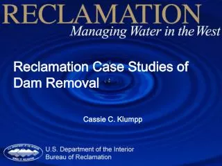
Reclamation Case Studies of Dam Removal. Cassie C. Klumpp. Dam Removal . 75,000 dams greater than 5 feet in United States 50,000 dams greater than 50 ft. in height 2 million dams total in the United States

E N D
Reclamation Case Studies of Dam Removal Cassie C. Klumpp
Dam Removal • 75,000 dams greater than 5 feet in United States • 50,000 dams greater than 50 ft. in height • 2 million dams total in the United States • Dams are removed, in most cases, because of the age of the dams, not environmental reasons
Potential harmful effects of dams • Hydropower operations may harm fish and other biota by changing timing of flow releases • Sediment transport is also altered by dams. Slower velocities cause aggradation upstream of a dam and downstream channels may become armored causing channel incisement, bank erosion and loss of riparian habitat
Effects of dams • Vital functions to man including water supply, navigation, recreation and hydro-electric power • Dams may reach a point where removal is necessary because of economics or dam safety issues
Sediment transport and dam removal • Dams slow down velocities in rivers • Sediment settles out • Aggradation occurs upstream of a dam • Clear water releases downstream can result in erosion of the banks or armoring
Prediction of channel morphology • After dam removal, it is important to predict channel morphology • Looking at undisturbed reaches can serve as a starting point • However, sediment stored behind dams differs greatly from the undisturbed river reaches
Prediction of channel morphology continued • Pizzuto and Doyle have proposed models of channel evolution following dam removal • Channel evolution following dam removal could be similar to the models of evolution of incised channels • With a conceptual model to start from, sediment transport analysis and modeling post dam removal would be improved
Coordinated research and dissemination of information on dam removal • Pull together current case studies on dam removal • Integrate links between geomorphic processes for other events that cause stream channel change and develop conceptual and numerical techniques that can be applied to dam removal projects • Unification of the current research in dam removal would provide the necessary knowledge to help guide future management decisions on how and when or whether or not to remove a dam
Three Reclamation Case Studies on Dam Removal • Savage Rapids Dam on the Rogue River in Oregon • Matilija Dam on the Ventura River in California • South and Coleman Dams on Battle Creek, California
Savage Rapids Dam • Run of the river dam • Stores 153,000 cu m of sediment • Dam is raised 3.35 m. during the irrigation season • Fish ladders exist for the dam but are inadequate and or are not working properly
Savage Rapids Dam Location Map Rogue River Agness n LostCreekDam a e c O Rogue River c i f Grants Pass i c a P Gold Beach Savage Rapids Dam Illinois River Applegate River Medford Oregon ApplegateDam California
Savage Rapids Dam • Concrete Dam that is 12 m. in height and20 m. long • Dam is used for irrigation • Fish Ladders are old and do not meet current fish criteria
Savage Rapids Dam • Reservoir sediments consist of mostly sands and gravels • Silt and clay are primarily responsible for increases in turbidity • The volume of reservoir sediments is estimated to be only 153,000 m3, most of which is located downstream of the public boat ramp
Savage Rapids Sediment Modeling Results 200,000 Dam removal followed by dry years 150,000 Dam removal followed by wet years Volume of Sediment (yds3) 100,000 50,000 0 0 1 2 3 4 5 6 7 8 9 10 Years Following Dam Removal
Reservoir Sediments Water Surface Deposition Downstream Eroded: 76% Erosion in Reservoir Channel Bottom Sediment modeling results after 6 months 960 940 920 900 Savage 880 Rapids Dam 860 104 105 106 107 108 109 River Miles
Savage Rapids Dam • Virtually all of the reservoir sediments would be eroded and transported to the ocean. • 3/4 of the reservoir sediments would be eroded in the first year. • Sediment concentrations would initially be high, but of short duration. Concentrations would also increase during high flows, but the levels would decrease with each subsequent high flow.
Matilija Dam • Matilia Dam contrasts with Savage Rapids Dam • 58 meters tall, with the current crest elevation at 334 m • Located 26 km upstream of the ocean on a tributary of Ventura River
Drainage Area 360 sq km and reservoir is located in coastal watershed
Sediment Deposition 4.6 million cu m= stored behind dam
Watershed of Matilija Dam • Watershed includes rugged mountains • Rangeland with brush and shrubs comprises 75 percent of the watershed • Rangeland produces the larges amount of the sediment
Matilija Dam • Large volume of sediment stored behind dam • Sediment was stored rapidly behind the dam • Effects of dam included losses of spawning areas of • 4,000 to 5,000 steelhead trout • Loss of riparian and wildlife habitat
Sediment stored behind the dam • Reservoir pool stores 1.6 m. cu m of sediment and is mostly silts and clays • Delta stores 1.9 m. cu m. of sediment and it is silty-sand material • Upstream channel stores more than 1.0 million cu. m. of silty sand
GSTARS-1D was used to model sediment transport • Greimann modeled the dam removal project with a combination of the Parker equation for gravel and the Engelund and Hansen formula for sand load • Three scenarios were modeled and included complete dam removal in one notch, removal of the dam to an elevation of 317 m, and no dam removal
Matilija Sediment Modeling • Scenarios modeled with the 20 year peak flood • 396 cu m/s
Concentrations downstream after 1998 flood for the No Action Alternative
Change in thalweg elevation for 1998 storm in reach 7 at various times from start of simulation of alternative 2a.
Change in thalweg elevation for 1998 storm in one of the reaches at various times from start of simulation for one of the dam removal alternatives
South and Coleman Dams on Battle Creek • Battle Creek is a cold-water mountain stream located in North California. • Tributary of the Sacramento Rivers • National Fish Hatchery
Battle Creek Fishery • One of three remaining tributaries in Sacramento basin where steelhead trout and spring and winter run salmon exist • Very productive habitat for salmon
Dam Removal – what is needed? • One of the challenges is to determine the magnitude, timing and range of environmental attributes that can be expected following dam removal • Large numbers of dam removal projects are starting to provide a framework to understand how different types of streams in different climates will behave following dam removal • Conceptual models to help predict channel changes • after dam removal have been proposed by various researchers including Doyle and Pizzuto
Collection of data post dam removal • More and more dams are being removed • A larger volume of studies are now available to help the designer determine responses post-dam removal • Additional guidelines and technical reports should be prepared to help the practitioner • Shifts in sediment movement have been one of the most prominent responses
Need for integrated framework to study sediment post dam removal • Research and practical need to compile current dam removal studies and identify responses of streams to dam removal • Integrated framework would be important to help identify ecological responses • Outcome of this meeting is the hope to integrate a number of good papers to identify research needs and summarize the current technical development of dam removal studies
Improving dam removal studies and ecological responses • One dimensional sediment transport models may only capture reach averaged changes in transport and bed material size • Many models do not capture all of the physical processes of sediment transport that occur during dam removal • Continue to utilize l quantitative and qualitative responses of dams following removal. • Utilize results of current studies to develop conceptual models that will help predict future stream responses of dam removal
Dam removal and prediction of sediment dynamics • Current results of dam removal projects are limited because of the lack of good conceptual models of all of the processes • A numerical model cannot model all of the responses following dam removal if the full range of geomorphic processes has not be conceptualized • Good prediction of silt and clay and sand and gravel mixtures is still rudimentary limiting the ability of models to predict the future response of the stream • More data collection and monitoring is needed to help validate models