About the Maps
About the Maps. Each of the following slides depicts a Geologic Map of the Earth at point

About the Maps
E N D
Presentation Transcript
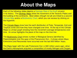
About the Maps Each of the following slides depicts a Geologic Map of the Earth at point in its history. The Geology Maps show the movement of the Tectonic Plates and the building of the continents. Most slides (though not all) are linked to a second Climate Map and/or a Biodiversity Chart, which you can access by clicking on the Hyperlink. The Climate Maps show how the earth distribution of Polar, Temperate, Arid and Tropical zones and how they have changed over time. At the top of the Climate Maps is a linear graph showing how the movement average temperatures over time. An arrow highlights the place of the map on the time line. The Biodiversity Chart shows number of Biological Genera identified by Paleontologists over the span of the Phanerozoic Eon. It shows where Mass Extinctions and Recoveries have occurred over the last 600 Million Years. The Maps begin with the Late Proterozoic Eon (c 600 million years ago), when the Earth’s Atmosphere acquired a composition of mostly Nitrogen and Oxygen.
Of Eons, Eras, Periodsand Epochs • Each Eon (or Age) can be subdivided into smaller time units called Eons, • Eras, Periods and Epochs, respectively. This provides a tree like • structure we can outline as: • Eons (the longest) • 1.1 Eras (next longest) • 1.1.1 Periods (shorter than above) • 1.1.1.1 Epochs (the shortest) • Each of these time blocks is identified by characteristics in its Geology, • Climate and Biosphere. (Q2,3) Eons Eras Periods Epochs
Eons of Earth History • The Earth’s Natural History can be divided into segments based • on developments in its Geoshpere (Geology), Atmosphere • (Climate) and Biosphere (Flora and Fauna). • The longest divisions are the Eons, of which there are four: • The Hadean, before there was life on the planet ………………. • The Archean, a period when the Earth was filled with Anaerobic microbes ………………………………………………... • The Proterozoic, in which Anaerobic life made possible the development of Aerobic, oxygen breathing microbes ………….. • And the present Phanerozoic ……………………………………. • The following slides link Geologic Maps to Climate Maps as well • as to a Biodiversity-Over-Time Chart to demonstrate relationships • between these different Earth Systems over Earth’s Eons of • History. (Q1) Length of Eon in Mn Years 0 to 3,800 3,800 to 2,500 2,500 to 540 540 to present
3.0 PROTEROZOIC AGE 1.0 Hadean 2.0 Archaean 4.0 Phanerozoic
The Late Proterozoic Eon The single continent breaks up into four continental land masses, including, what will eventually become, Asia, Europe and North America. Anaerobic organisms, having lived for 100’s of millions of years, have succeeded in building a Nitrogen/Oxygen atmosphere. Single and multi-celled Aerobic organisms now flourish. (Q5)
4.0 PHANEROZOIC AGE 1.0 Hadean 2.0 Archaean 3.0 Proterozoic 4.1 Paleozoic Cambrian Ordovician Silurian Devonian Carboniferous Permian 4.2 Mesozoic Triassic Jurassic Cretaceous 4.3 Cenozoic Paleogene Neogene*
Early Cambrian Geology THE CAMBRIAN PERIOD A long Ice Age retreats. The Proterozoic Eon ends and the Phanerozoic Eon begins. It is subdivided into three Eras: the Paleozoic, the Mesozoic, & the Cenozoic. The first Period is the Cambrian. In the Cambrian Period Aerobic multicelled Organisms diversify into many different Phyla. These are the first to become fossilized.
Early Cambrian Climate Observation: There are no Ice Caps to be seen.
Late Ordovician Geography THE MIDDLE & LATE ORDOVICIAN PERIOD The Earth has already seen several Ice Ages. However, Ice Ages are new to the first terrestrial plants. The explosion of life that began in the Early Ordovician Period is cut short by falling temperatures. Sea Levels falls as water turns to ice. (Q10)
Late Ordovician Climate Mass Extinction Observation: Ice Caps form, sea levels drop.
Ordovician BIOSPHERE* Cm Cambrian O Ordovician S Silurian D Devonian C Carbonifer P Permian Tr Triassic J Jurassic K Cretaceous Pg Paleogene N Neocene The 1st Mass Extinction
Silurian Geography THE SILURIAN PERIOD The Ice Caps retreat, ocean levels rise. Europe and North America are virtually merged. There is an explosion of new life. The first vascular plants, Arthropods, Armored Fish and Jawed fish appear. (Q11)
Silurian Climate Observation: Ice Caps retreat.
Middle Devonian Geography THE MIDDLE DEVONIAN The massive continent of Africa, Anartica, Australia, India and South America has shifted. First amphibians appear and animals begin to proliferate on land. Their proliferation is cut short by the return of Ice, and a second mass extinction occurs. (Q13)
Middle Devonian Climate Mass Extinction
Middle Devonian BIODIVERSITY Chart* Cm Cambrian O Ordovician S Silurian D Devonian C Carbonifer P Permian Tr Triassic J Jurassic K Cretaceous Pg Paleogene N Neocene The 2nd Mass Extinction
Lower Carboniferous Geography THE CARBONIFER PERIOD The first large trees, first land vertebrates appear. The earliest primitive jawed sharks appear. (Q14)
Upper Carboniferous Geography THE LATE CARBONIFER Europe has sunk below sea level, and North America has Linked to Africa. The first insects, reptiles and coral appear. Moderate temperatures keep life subdued and the effects of a Late Carbonifer Ice Age are blunted. (Q15)
Upper Permian Geography THE LATE PERMIAN Life has held pretty stable through out the Permian Period. However, in the Late Permian, temperatures drop and a third Ice Age ensues. A third mass extinction follows that eliminates nearly 95% of all life. (Q16)
Upper Permian Climate Stalled Recoveries
Upper Permian BIODIVERSITY* Cm Cambrian O Ordovician S Silurian D Devonian C Carbonifer P Permian Tr Triassic J Jurassic K Cretaceous Pg Paleogene N Neocene The 3rd Mass Extinction Stalled Recoveries
Upper Triassic Geography THE LATE TRIASSIC Asia emerges as a large portion of Northern Pangaea. The Flora and Fauna spread out. Life remains suppressed. There occurs a fourth mass extinction which eliminates Approximately 20% of all life. However, its causes are not Known. (Q17)
Upper Triassic Climate Mass Extinction
Late Triassic BIODIVERSITY* Cm Cambrian O Ordovician S Silurian D Devonian C Carbonifer P Permian Tr Triassic J Jurassic K Cretaceous Pg Paleogene N Neocene The 4th Mass Extinction
Lower Jurassic Geography THE JURASSIC PERIOD The giant continent of Pangaea breaks up. The fourth mass extinction of the Late Triassic Period is followed by an explosion of life. (Q18)
Upper Jurassic Geography THE LATE JURASSIC PERIOD The Late Jurassic sees the two continents, Gondwana and Laurasia, break up. The temperature drops and there is a mild cool period. This in turn causes major extinctions, but of lesser intensity. (Q19)
Lower Cretaceous Geography THE CRETACEOUS PERIOD The break up of the continents continues and some rudimentary outlines of the present world continents can be discerned. After the minor extinction event of Late Jurassic, life again explodes. Flowering Plants, Marsupials, and Placental Mammals appear. (Q20)
Middle Cretaceous Geography THE MIDDLE CRETACEOUS PERIOD All the present day continents can be seen, although not yet in the shape as we know it. Note the India Subcontinent off the coast of Africa, and the Australian Continent still attached to Antarctica.
Upper Cretaceous Geography THE LATE CRETACEOUS The global climate continues to warm. The remains of polar caps are melted causing the seas to rise. Most of North America and Saharan Africa are submerged by shallow seas.
Early Paleocene Geography THE PALEOGENE PERIOD (also known as Tertiary) The Cretacious Period ends when an asteroid impacts the Earth in the present day Gulf of Mexico. The violence coincides with a mass extinction in which the Ages of the Dinosaur ends. This marks the beginning of the present Geologic Era known as the Cenozoic. (Q21)
Early Paleocene Climate Mass Extinction
Earl Paleocene BIODIVERSITY Chart* Cm Cambrian O Ordovician S Silurian D Devonian C Carbonifer P Permian Tr Triassic J Jurassic K Cretaceous Pg Paleogene N Neocene The 5th Mass Extinction Engaged Recover
Early Eocene Geography THE EOCENE EPOCH Within the Paleogene Period, there are three Epochs, The Paleocene, the Eocene and Oligocene. This is the time when modern plants, large mammals, and sea mammals proliferate, filling niches left open dieing Dinosaurs. (Q22)
Early Oligocene Geography THE OLIGOCENE EPOCH North and South America, Africa and Australia are clearly Recognizable. The Indian Subcontinent has moved away From Africa and is plunging toward Asia. Though temperatures plunge, life prospers. Angiosperm (flowering plants) proliferate. (Q23)
Miocene Geography THE NEOCENE PERIOD Following the Oligocene Epoch there is a new Period. It has four Epochs, the Miocene, the Pliocene, the Pleistocene and the Halocene. Temperatures continue to plunge and the Earth goes into another Ice Age. In the Miocene Epoch, the first Hominoids appear. (Q24)
Pliocene Geography THE PLIOCENE EPOCH Temperatures continue to remain low, and ice spreads over the North and South Polar regions. The shape of the continents is very recognizable. This is the time when Australopithecines appear, along with modern Mammals and Mollusks. (Q25)
Pliocene BIODIVERSTIY* Cm Cambrian O Ordovician S Silurian D Devonian C Carbonifer P Permian Tr Triassic J Jurassic K Cretaceous Pg Paloegene N Neocene Re-Engaged Recovery
Pleistocene Geography THE PLEISTOCENE EPOCH In the midst of a long Ice Age, the first identifiable Humans appear. (Q26)
Late Pleistocene Geography THE LATE PLIESTOCENE EPOCHDuring the Late Pleistocene Epoch, the Earth was in one of its severe Ice Ages. As the ice receded, the Earth entered a new Epoch called the Holocene. During this Epoch, Human Civilization would appear and man would come to be a powerful force in shaping nature and the Earth’s Systems.
The Holocene Geography THE ANTHROPOCENE EPOCH (?) The Earth today is in the Phanerozoic Eon, the Cenozic Era, the Neogene (also called the Quaternary) Period and the Holocene Epoch. Human civilization has emerged as major force shaping the planet. So much of an influence has modern man that many Geologists and Paleontologists have suggested that the Earth has moved from the Holocene to a whole new Epoch which they call the Anthropocene Epoch. (Q27)
A BIODIVERSITY Comparison* The biodiversity Graph is here shown next to an Extinction intensity Graph using common time scales. The two graphs show how, as biodiversity increases, the Intensity of Extinction reduces. In addition, recovery is much faster in higher diversity ecosystems. (Q28,29) Cm Cambrian O Ordovician S Silurian D Devonian C Carbonifer P Permian Tr Triassic J Jurassic K Cretaceous Pg Paloegene N Neocene