Download
1 / 16
160 likes | 302 Views
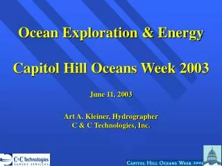
Ocean Exploration & Energy Capitol Hill Oceans Week 2003 June 11, 2003 Art A. Kleiner, Hydrographer C & C Technologies, Inc. C & C TECHNOLOGIES, INC. SURVEYING & OCEAN MAPPING COMPANY HEADQUARTERED IN LAFAYETTE, LA SURFACE & SUBSURFACE MARINE POSITIONING WORLD WIDE EXPERIENCE

E N D
Ocean Exploration & Energy Capitol Hill Oceans Week 2003 June 11, 2003 Art A. Kleiner, Hydrographer C & C Technologies, Inc.
C & C TECHNOLOGIES, INC. • SURVEYING & OCEAN MAPPING COMPANY • HEADQUARTERED IN LAFAYETTE, LA • SURFACE & SUBSURFACE MARINE POSITIONING • WORLD WIDE EXPERIENCE • ESTABLISHED IN 1992 • 170 EMPLOYEES
Technology Providing Detailed Data in Deep Water
Deep Towed Systems • Also includes winch, handling system, and over 20,000 meters of tow cable.
2000m 50m Data Resolution in 2,000m of Water • Surface Ship: • 7.0m Vertical Accuracy • 50m Horizontal Accuracy • Deep Towed System • 0.2m Vertical Accuracy • 30m Horizontal Accuracy
Deep Towed Data Acquisition SONAR POSITION 6 km TOW VESSEL TOW CABLE SONAR DATA 2 km SONAR POSITION 4 HOUR SHIP TURNS 2.5 kts SONAR POSSIBLE BOTTOM COLLISION 30 m POSITIONING ACCURACY
Autonomous Underwater Vehicle (AUV) Data Acquisition X 30m POSITIONING ACCURACY 4m POSITIONING ACCURACY X X SONAR POSITION 6 km TOW VESSEL X X TOW CABLE SONAR DATA AUV POSITION & DATA 2 km X X 4 HOUR SHIP TURNS 4.0 kts AUV 2.5 kts POSSIBLE BOTTOM COLLISION
C & C’s Autonomous Underwater Vehicle (AUV) • 22,000 linear km mapped to date • Large client list (23 to date) • World wide Operations • Productivity of Deep Tow x 5 The U-166 rests in 5,000 feet of water
AUV U-166 Investigation 33 Track Lines 450 Meters Long 10 Meter Line Spacing 15 Meter Altitude 5000 Feet Depth Survey Time = 2 Hrs.
AUV Data UNFORGIVING OBSTACLES
AUV data at the base of the Sigsbee Escarpment (approx. 2,500m depth) reveals a furrowed sea floor
AUV Data AUV Multibeam Data Collected as Concentric Circles Around an Oil Platform
Ocean Exploration & Energy Capitol Hill Oceans Week 2003 June 11, 2003 Art A. Kleiner, Hydrographer C & C Technologies, Inc.