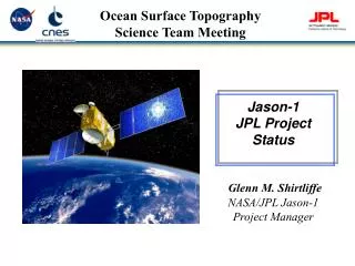
Ocean Surface Topography Constellation
Co lead : Francois Parisot EUMETSAT Stan Wilson NOAA. Ocean Surface Topography Constellation. Status of the Constellation Actions AR-09-02a_15 and 17. Altimeter missions in orbit

Ocean Surface Topography Constellation
E N D
Presentation Transcript
Co lead : Francois Parisot EUMETSAT Stan Wilson NOAA Ocean Surface Topography Constellation
Status of the ConstellationActions AR-09-02a_15 and 17 Altimeter missions in orbit Jason 2: All products now available to all users. OSTST meeting in Seattle has confirmed the excellent quality, availability and timeliness of products, Jason-1 orbit has been changed to optimise coverage and benefits of the missions ENVISAT – performance OK Missions in development CryoSat-2 – Good progress for launch in early 2010 (February 28th) SARAL – Launch second semester 2010 – Discussion CNES / ISRO / EUMETSAT for operational delivery of data to users Pending approval by EUMETSAT Member States, EUMETSAT will process and disseminate NRT product in synergy with what is done on Jason-2 Sentinel-3A (2013) and -3B approved at last ESA Ministerial Council Sentinel 3A Phase C/D studies are progressing well : launch date April 2013 Contract for Sentinel 3B procurement is planned to kick-off before end of 2009. the combined S3A/S3B production schedule will be further optimized for cost/efficiency. Launch is intended for 2017
Status of the Constellation Mission in development (con’t) HY-2A Launch planned in late 2010 or early 2011 CNES/SOA negotiations, DORIS for POD, access to DATA NOAA and EUMETSAT have also approached SOA to seek operational access to data Missions in planning Jason-3 Europe:Programme opened to subscription at EUMETSAT, entry into force expected by the end of the year, U.S.:Jason-3 has been included as proposed in the Appropriation Bill for both Houses of Congress and is awaiting approval by the Congress and President Jason-CS (Continuity of Service) ESA, EC, EUM are consolidating programmatic and funding approach for a series of Jason-3 Follow-on satellites GFO-2 The US Navy appears to be close to getting approval for its GFO-2 On going studies for new altimeter concepts CNES, NASA, ESA running concept feasibility studies
10 11 12 13 14 15 16 17 18 19 20 08 22 09 Saral/AltiKaIndia/France HY-2B, -2C, -2D HY-2AChina ENVISAT ESA Sentinel-3C, -3D CRYOSAT-2 ESA SWOT/WaTER-HMUSA/Europe Jason evolution demonstrator Jason-2 Europe/USA In orbit Approved Needed Planned/Pending approval Ocean Surface Topography Constellation Roadmap 21 SSH from high-inclination sun-synchronous orbit Sentinel-3A, 3B Europe Non sun-sync. mission GFO-2 (US Navy) Future missions Reference Mission,SSH from low inclination non sun-synchronous orbit, Jason-1 Fr./USA Jason-3 Europe/USA Jason-CS
Next 15 Years of Satellite Altimetry Taking into account The successful launch of Jason-2/OSTM in June 2008, and the continuing operation of Jason-1 and Envisat, these missions working as a Constellation The recommendations from the ESA-CNES Symposium held in Venice, Italy, in March 2006 Their refinement with regard to sea level monitoring at the UNESCO Workshop held in Paris, France, in June 2006 The additional recommendations for the user workshop held in January 2008 in Assmannshaussen, Germany EUMETSAT and NOAA have initiated a study which aims at using these series of recommendations based on well-established user requirements to derive an upper-level Requirements Document that would guide future programme planning for the operational oceanography user community in the 15-years to come The study was led by the French company CLS (Dr P. Escudier) with the contribution of Dr J.-L. Fellous (co-president of JCOMM). Both experts have been deeply involved in past altimetry missions over the last 25 years.
Study content and approach The study included extensive consultation with other experts in the various application fields of altimetry, e.g.: Second draft of the document was released in April and sent Mid-May to a wide panel of users and experts from implementing agencies including ISRO and SOA. The comments were reviewed during Ocean Surface Topography Science Team meeting in Seattle, WA, June 22-24, 2009. New title : Ocean Surface Topography Constellation User Requirement Document Introduction of “Guidance” concept, addressing design point that are key to meet the requirements More focused on Ocean as primary application as opposed to secondary applications (coastal, ice, geodesy…) A side meeting has been organized during the OceanObs09 Conference in Venice The document is now available !
Requested SIT and CEOS Support Continued support to secure funding for Jason-3 in time to provide continuity of the Jason-quality data stream, in addition to recurrent units for high-inclination Sentinel-3 mission Engage key officials of the State Oceanic Administration to collaborate in altimetry - to extend data availability beyond that available from existing constellation