Download
1 / 20
200 likes | 328 Views
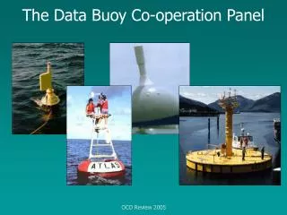
Data Buoy Cooperation Panel Ship Observations Team OceanSITES. Hester Viola viola@jcommops.org. Observing networks. OceanSITES Deep Ocean Reference Stations – Moorings, SOOP Lines and Gliders/Profilers Data Buoy Cooperation Panel Drifting Buoys Moored Buoys Ship Observations Team

E N D
Data Buoy Cooperation PanelShip Observations Team OceanSITES Hester Viola viola@jcommops.org
Observing networks • OceanSITES • Deep Ocean Reference Stations – Moorings, SOOP Lines and Gliders/Profilers • Data Buoy Cooperation Panel • Drifting Buoys • Moored Buoys • Ship Observations Team • Surface Meteorology and SST (some Automated) • Aerological Soundings (Temperature, RH) • XBTs, TSGs, XCTDs (thermal profiles)
GTS Delays • In general, the delay between observation time and GTS dissemination has decreased this year to less than 120 minutes for 85% of the data.
Monthly Maps • Status maps updated monthly or annually PNG and PDF with layers
Monthly Maps • Status maps updated monthly or annually PNG and PDF with layers - (clickable) • Google Earth Files (Monthly & Daily) http://www.jcommops.org/dbcp/dbcpmaps
Data Access • The Data Buoy Archive is managed by Canada (ISDM) • http://www.meds-sdmm.dfo-mpo.gc.ca/ • Real time data is available monthly for GTS data • Delayed mode data (with Currents) is available within ~ 3 months
Voluntary Observing Ships • Surface Meteorology and SST • Extensive metadata • Data Archive (GTS and delayed mode): Met Office UK
Quality Control Feedback • DBCP Quality Information Relay Mechanism
XBT Sampling Success & Metadata • Data Archive: http://www.nodc.noaa.gov/GTSPP/ • Metadata text files: http://www.jcommops.org/FTPRoot/SOT/SOOP/Survey/
OceanSITES • Deep Ocean Reference Stations • Time-series measurements of ocean and atmosphere • Multi-disciplinary physical and biogeochemical • Mostly moored (with profilers/gliders)
OceanSITES status • Most data will be on GTS, with special Ids • Extensive metadata is being documented • Project Office at JCOMMOPS
OceanSITES data • Argo Data Management processes are being adopted • Data Archive: GDACs • Coriolis • ftp://ftp.ifremer.fr/ifremer/oceansites/ • US National Data Buoy Center • ftp://data.ndbc.noaa.gov/data/oceansites/ • Metadata files (documents or SensorML) • NetCDF file formats
Working as part of GODAE • Which data is being used? • Information about platforms that are/are not assimilated is of interest to the network operators/managers. • Quality Control Feedback, with checks against models • JCOMMOPS can assist with Data Access