Download
1 / 45
460 likes | 585 Views
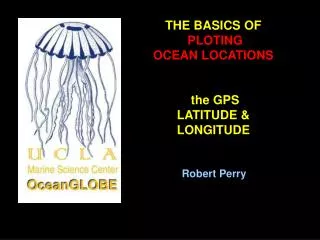
THE BASICS OF PLOTING OCEAN LOCATIONS the GPS LATITUDE & LONGITUDE. Robert Perry. DISCLAIMER: The images, maps and diagrams in this presentation were taken from the public domain on the world wide web. This slide show is for non- commercial, educational purposes ONLY !

E N D
THE BASICS OF PLOTING OCEAN LOCATIONS the GPS LATITUDE & LONGITUDE Robert Perry
DISCLAIMER: The images, maps and diagrams in this presentation were taken from the public domain on the world wide web. This slide show is for non- commercial, educational purposes ONLY ! e-mail: zalophus@UCLA.edu
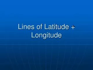
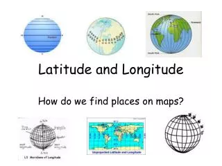
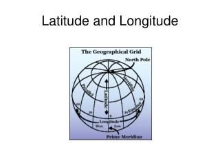
LATITUDE & LONGITUDE LINES: LATITUDE Lines go east and west. LONGITUDE Lines go north and south. Map: http://worldatlas.com/aatlas/imageg.htm
a GLOBAL POSITIONING SATELLITE RECEIVER is used to measure and record the LATITUDE and LONGITUDE of a LOCATION in DEGREES, and MINUTES.
LATITUDE LONGITUDE Minutes latitude 34O 06.54’ N North of equator Degrees
Ground Tracks for the 27 Global Positioning Satellites (effective 9/28/98)
X Y Z & T At least 4 GPSatellites must be locked in to give Latitude, Longitude, Elevation and GPS Time.
SAMPLE ACTIVITY: PLOT THE POSITIONS OF A FEW LOCATIONS ON A CHART
Materials needed for this sample activity: Copies of Santa Monica Bay or southern California chart pencils Ruler or straight-edge Location data (from GPS)
STEPS TO FOLLOW IN THIS ACTIVITY: 1- FIND THE LATITUDE LINE AND DRAW IT IN PLACE USING YOUR PENCIL AND RULER. 2- FIND THE LONGITUDE LINE AND DRAW IT IN PLACE USING YOUR PENCIL AND RULER 3. PLACE AN “X” TO MARK THE SPOT WHERE LATITUDE AND LONGITUDE LINES CROSS.
Our activity area
DEPTHS ARE SHOWN BY DARKER COLORS 2. LOCATION OF OCEAN AND DEPTHS.
DEGREES of LATITUDE GET BIGGER GOING NORTH 3. DEGREES OF LATITUDE (horizontal lines).
DEGREES of LONGITUDE GET BIGGER GOING WEST 4. DEGREES OF LONGITUDE (vertical lines).
NOTICE THAT THE GRIDLINES ON THIS CHART ARE EQUAL TO 5’ (minutes) EACH.
SAMPLE PROBLEM #1: LOCATE THE SANTA MONICA PIER
GIVEN: THE SANTA MONICA PIER IS LOCATED AT 34O 00.50’N and 118O 29.10’W
GIVEN: THE SANTA MONICA PIER IS LOCATED AT 34O 00.50’N and 118O 29.10’W First, we’ll draw the LATITUDE LINE using your ruler and a pencil.
GIVEN: THE SANTA MONICA PIER IS LOCATED AT 34O 00.50’N and 118O 29.10’W 34O 00.50’N (green line) is just a tiny bit North of 34O 00.00’N
GIVEN: THE SANTA MONICA PIER IS LOCATED AT 34O 00.50’N and 118O 29.10’W 34O 00.50’N [our location is someplace along this green line]
GIVEN: THE SANTA MONICA PIER IS LOCATED AT 34O 00.50’N and 118O 29.10’W Next, let’s draw the LONGITUDE LINE using your ruler and a pencil.
GIVEN: THE SANTA MONICA PIER IS LOCATED AT 34O 00.50’N and 118O 29.10’W 118O 29.10’W (yellow line) is just a tiny bit before 118O 30.00’W
GIVEN: THE SANTA MONICA PIER IS LOCATED AT 34O 00.50’N and 118O 29.10’W The Santa Monica Pier is located where the two lines cross each other.
GIVEN: THE SANTA MONICA PIER IS LOCATED AT 34O 00.50’N and 118O 29.10’W X “X” marks the spot !
SAMPLE PROBLEM #2: LOCATE THE MANHATTAN BEACH PIER X
GIVEN: THE MANHATTAN BCH. PIER IS LOCATED AT 33O 53.00’N and 118O 24.90’W X
GIVEN: THE MANHATTAN BCH. PIER IS LOCATED AT 33O 53.00’N and 118O 24.90’W X 33O 53.00’ is between 33O 50’ and 33O 55’
GIVEN: THE MANHATTAN BCH. PIER IS LOCATED AT 33O 53.00’N and 118O 24.90’W X
GIVEN: THE MANHATTAN BCH. PIER IS LOCATED AT 33O 53.00’N and 118O 24.90’W X
GIVEN: THE MANHATTAN BCH. PIER IS LOCATED AT 33O 53.00’N and 118O 24.90’W X LAT and LON cross here
GIVEN: THE MANHATTAN BCH. PIER IS LOCATED AT 33O 53.00’N and 118O 24.90’W X X “X” marks the spot !
SAMPLE PROBLEM #3: LOCATE THE ZUMA BEACH, MALIBU X X
GIVEN: ZUMA BEACH, MALIBU IS LOCATED AT 34O 01.25’N and 118O 49.50’W X X
GIVEN: ZUMA BEACH, MALIBU IS LOCATED AT 34O 01.25’N and 118O 49.50’W X X
GIVEN: ZUMA BEACH, MALIBU IS LOCATED AT 34O 01.25’N and 118O 49.50’W X X
GIVEN: ZUMA BEACH, MALIBU IS LOCATED AT 34O 01.25’N and 118O 49.50’W X X LAT and LON cross here
GIVEN: ZUMA BEACH, MALIBU IS LOCATED AT 34O 01.25’N and 118O 49.50’W X X X “X” marks the spot !
SUMMARY: TO PLOT A LOCATION ON A CHART 1. FIND THE LATITUDE LINE 2. FIND THE LONGITUDE LINE 3. PLACE AN “x” WHERE THE TWO LINES CROSS
“X” marks the spot !