
Discover Mazovia Province: Land of Farming and Orchards
Explore Mazovia Province on the Mazovia Lowland, where the Vistula River and its tributaries support vast farmland. Covering 35,597 square kilometers, it's the largest administrative region in Poland, known for its thriving agriculture, including potatoes, cereals, and fruit orchards. With a population of 5,065,000, the province is also a major business hub, hosting 18% of all registered businesses in the country. Discover the unique climate with average temperatures of -2oC in the coldest month and 19oC in the hottest month.

Discover Mazovia Province: Land of Farming and Orchards
E N D
Presentation Transcript
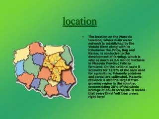
location • The location on the Mazovia Lowland, whose main water network is established by the Vistula River along with its tributaries the Pilica, Bug and Narew, is conducive to the development of farming, which is why as much as 2.4 million hectares in Mazovia Province falls to farmland. On the national scale it accounts for 12.9% of the area used for agriculture. Primarily potatoes and cereal are cultivated. Mazovia Province is also the largest fruit-growing region in the country; concentrating 28% of the whole acreage of Polish orchards. It means that every third fruit tree grows right here!
Mazovia province Mazovia Province covers an area of 35,597 square kilometers and is the largest administrative region of the country. Its area accounts for 11.4% of Poland's territory.
information Mazovia Province consists of 38 poviats(districts), 4 cities with poviat(district) rights and 325 communities (gminas). Warsaw is the capital of the region.The area of Mazovia Province is 35,597 square kilometers; population amounts to 5,065,000 people.
Economy • Mazovia Province is the unquestionable business leader. It concentrates nearly 18% of all businesses registered in the country. There are 8,926 enterprises in the public sector, which accounts for only 2.1%. The remainder, almost 330,000, are private companies.
climate • In the coldest month the average temperature is –2oC. • In the hottest month the average temperature is 19oC