Download
1 / 15
150 likes | 263 Views
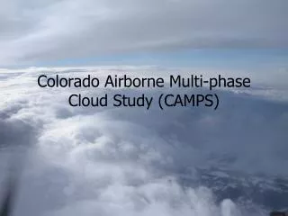
The Colorado Airborne Multi-phase Cloud Study (CAMPS) was conducted from December 15, 2010, to February 28, 2011, with 29 research flights totaling 98 flight hours. The study focused on sampling various cloud conditions, including thick precipitating clouds, mixed-phase clouds, and pure liquid or ice clouds. Utilizing advanced instrumentation from the University of Wyoming, the study generated extensive datasets that are available through a password-protected archive. Key research topics included particle phase measurements and the relationship between cloud phase and environmental conditions.

E N D
Colorado Airborne Multi-phase Cloud Study (CAMPS) • December 15, 2010 to February 28, 2011 • 29 research flights totaling 98 flight hours • Over 10,500 km (30 hrs) in clouds • Flights sampled a variety of conditions: • Thick precipitating clouds • Mixed-phase clouds with range of ice/liquid fractions • Pure ice and pure liquid clouds • Wave clouds • Cumulus/convective clouds
King Air Instrumentation • Remote: Wyoming Cloud Radar (up/down); Wyoming Cloud Lidar (mostly down) • Particles: FSSP, 2D-P, 2D-C, CIP, CDP • Water Content: PVM-100, CLH, LWC-100 (hotwire), Rosemount Icing • Other: Chilled mirror hygrometer, LiCor H2O and CO2, state parameters
Data Availability • All data are available through the Wyoming archive (password protected) • In situ data and aircraft parameters in single netCDF file for each flight • Information from 2D probes and CIP in separate files • Radar, lidar images are online; raw data available from investigators • CAMPS site: http://flights.uwyo.edu/projects/camps11/
Data Quality and Issues Some additional information on CAMPS website
Flight patterns • Typically a set of three to five 30 nm legs along a fixed heading • Altitudes variable to maximize cloud encounters • Tried to pass over SPL when possible
Flights of Interest Note: Flights 4, 7, 8, 24, 25 took place over Wyoming due to ATC restrictions (8, 15 and 17 Jan; 19 and 20 Feb)
Research Topics • Zhien Wang (UWyo) • Comparison of measurements from particle probes on aircraft • Comparison of lidar and radar data with in situ water content and particle size distributions
Research Topics • Sam Dorsi (Avallone student) • Can we determine phase of cloud water from in situ aircraft observations? • Can cloud phase be predicted by environmental conditions? • How abundant are mixed phase clouds?
Cloud scales • Frequency of cloud phase by length • - Glaciated: 86.7% (3764 segments) • - Mixed-phase: 13.2% (1476 segments) • Liquid-only: 0.1% (88 segments) • Power law relationship • - Glaciated: a1 = -1.3 ± 0.2 • - Mixed-phase: a1 = -1.3 ± 0.4
Case Study Examples • January 17 (RF 8) – CloudSat overpass • Mixed-phase clouds from 21,000 to 16,000 ft • February 1 (RF 15) Cold and Ice formation • Flight through very thin clouds at 18,000 ft and -38 C. Possibly homogeneous nucleation • February 7 (RF 19) High LWC • Above Storm Peak Laboratory two distinct cloud decks, upper layer cloud ~20,000 composed entirely of ice and lower cloud deck that appeared more wavelike in structure. Over the course of flight, upper deck dissipated and lower deck thickened; Lower deck, mostly liquid with a few large ice particles; we encountered high CLWC's up to 1.0 g/m3