Download
1 / 26
260 likes | 273 Views
Dive into the history of Mayan, Incan, and Aztec civilizations through this colorful travel brochure. Discover ruins, facts, and more!

E N D
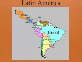
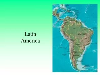
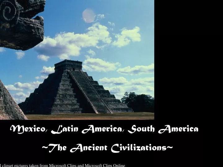
Mexico, Latin America, South America ~The Ancient Civilizations~ * All clipart pictures taken from Microsoft Clips and Microsoft Clips Online
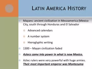
Teaching & Studying the Ancient Civilizations of Mexico, Central, and South America Ms. Beth Houseman 6th Grade Social Studies Owensville Middle School
General Objective: Students will identify and discuss causes and effects of the historical developments in the Mayan, Incan, and Aztec civilizations and create a travel brochure that takes the reader to their ancient ruins.
DESE Missouri State GLE’s Page 21 of 52 of Missouri GLE’s
Gasconade County R-II Curriculum See Curriculum 6th Grade Social Studies General Objective 6-6 & 6-7
Excellent 100 – 90 % • Brochure is complete, aligned properly, and tri-folded. • Full color brochure • Colorful cover page w/graphics • All Mayan, Aztec & Incan cultural facts are included with graphics • Good 90 – 80 % • Brochure is complete, aligned, and tri- folded • Colorful • Cover page w/graphics • Facts included • Fair 80 – 70 % • Brochure is mostly complete • Various color is used • Cover page w/some graphics • Minimal facts used • Poor 60 – Below • Incomplete brochure *Little color with little or no graphics • Few facts listed Social Studies Rubric Travel Guide
Ancient Civilizations Video found @ unitedstreaming.com Ancient_civilizations
The Mayas Video found @ unitedstreaming.com The_Mayas
The Aztecs Video found @ unitedstreaming.com The_Aztecs
The Inca Video found @ unitedstreaming.com Bolivia_s_History_Rich and Varied
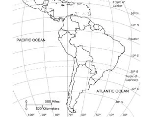
What river cuts through the desert and forms a border between Mexico and the United States? • What mountains in the western portion of South America – home to many ancient civilizations – run roughly parallel • to the Pacific coast for more than 5, 000 miles? • What is the main mountain range in western Mexico that runs roughly parallel to the Pacific coast? • What is the huge plateau that covers most of central Mexico and is surrounded by mountains? • What are the highlands in the northern portion of South America that separate Venezuela, Suriname, & • French Guiana from Brazil? • What is the large lake in the northern tip of the South American continent that has a small opening into the • the Atlantic Ocean? • What is the major river in the northern portion of South America that winds from the Guiana Highlands to the • Atlantic Ocean? • What is the large peninsula in Mexico – much of which is covered by rain forest – that extends into the Gulf • of Mexico? • What is the long river in South American that winds from Peru through an immense rain forest in northern Brazil, • and empties into the Atlantic Ocean? • What is the main mountain range in eastern Mexico – containing Mexico’s highest peak – that begins south of the • Rio Grande? • What lake is situated high in the Andes mountains and forms part of the border between Peru and Bolivia? • What is the plain the extends through northern Argentina, Paraguay, and southern Bolivia?
Cont… • What is the grassy plateau located in southern Argentina, Paraguay, and southern Bolivia? • What is the fertile plain that covers most of central Argentina? • What is the desert located in northern Chile that is bordered by the Pacific Ocean to the west and the Andes • Mountains to the east? • What is the vast river basin that covers most of northern Brazil and parts of Bolivia, Peru, Ecuador, Colombia, • and Venezuela? Questions taken & Sited from: Version 1.1 of Teachers’ Curriculum Institute / Civilizations of the Americas
What river cuts through the desert and forms a border between Mexico and the United States? Rio Grande • What mountains in the western portion of South America – home to many ancient civilizations – run roughly parallel • to the Pacific coast for more than 5, 000 miles? Andes Mountains • What is the main mountain range in western Mexico that runs roughly parallel to the Pacific coast? Sierra Madre Occidential • What is the huge plateau that covers most of central Mexico and is surrounded by mountains? Plateau of Mexico • What are the highlands in the northern portion of South America that separate Venezuela, Suriname, & • French Guiana from Brazil? Guinea Highlands • What is the large lake in the northern tip of the South American continent that has a small opening into the • the Atlantic Ocean? Lake Maracaibo • What is the major river in the northern portion of South America that winds from the Guiana Highlands to the • Atlantic Ocean? Orinoco River • What is the large peninsula in Mexico – much of which is covered by rain forest – that extends into the Gulf • of Mexico? Yucatan Peninsula • What is the long river in South American that winds from Peru through an immense rain forest in northern Brazil, • and empties into the Atlantic Ocean? Amazon River • What is the main mountain range in eastern Mexico – containing Mexico’s highest peak – that begins south of the • Rio Grande? Sierra Madre Oriental • What lake is situated high in the Andes mountains and forms part of the border between Peru and Bolivia? Lake Titicaca • What is the plain the extends through northern Argentina, Paraguay, and southern Bolivia? Gran Chaco
Cont… • What is the grassy plateau located in southern Argentina, Paraguay, and southern Bolivia? Patagonia • What is the fertile plain that covers most of central Argentina? Pampas • What is the desert located in northern Chile that is bordered by the Pacific Ocean to the west and the Andes • Mountains to the east? Atacama Desert • What is the vast river basin that covers most of northern Brazil and parts of Bolivia, Peru, Ecuador, Colombia, • and Venezuela? Amazon River Questions taken & Sited from: Version 1.1 of Teachers’ Curriculum Institute / Civilizations of the Americas
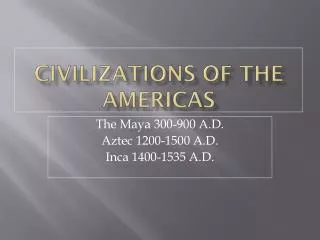
The Mayans, Incas & Aztecs Microsoft Clipart
Tenochtitlan The Great City of the Aztec • Built before Columbus arrived in the Americas • One of the most advanced civilizations in the western hemisphere • An Aztec capital with a population of over 200,000 people • Built on an island in Lake Texcoco now the site of Mexico City • Enclosed by tropical rain forests & high latitude it enjoys a mild climate • 3 major city-states = Tenochtitlan, Texaco, and Tlatelolco which became the Aztec Empire
Sacred Round Calculations Using the Mayan Calendar ________ ________ ________ ________ ________ ________ Day 1 Day 2 Day 3 Day 4 Day 5 Day 6 ________ ________ ________ ________ ________ ________ Day 7 Day 8 Day 9 Day 10 Day 11 Day 12 ________ ________ ________ ________ ________ ________ Day 13 Day 14 Day 15 Day 16 Day 17 Day 18 _______ ________ ________ ________ ________ ________ Day 19 Day 20 Day 21 Day 22 Day 23 Day 24 ________ ________ ________ ________ ________ ________ Day 25 Day 26 Day 27 Day 28 Day 29 Day 30 ________ ________ ________ ________ ________ ________ Day 31 Day 32 Day 33 Day 34 Day 35 Day 36 ________ ________ ________ ________ ________ ________ Day 37 Day 38 Day 39 Day 40 Day 41 Day 42 ________ ________ ________ ________ ________ ________ Day 43 Day 44 Day 45 Day 46 Day 47 Day 48
Mayan Math = represented the number “0” zero . _ = represented the number “1” one = represented the number “5” five Example: ..is “7”
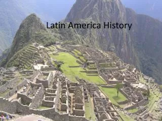
Clipart picture taken from Microsoft clips online Machu Picchu was rediscovered in 1911 by explorer Hiram Bingham. It sits one and a half miles high on a mountaintop in Peru once inhibited by the Inca civilization. Bingham thought it must have been a special religious city because of the fine stonework, however archaeologists believe it was some type of vacation resort for Inca nobles. Over 3,000 steps connect the levels of the city and farming terraces. It could only be reached by a log bridge on a sheer cliff. If enemies threatened the citizens there, they would simply draw back the bridge.
Possible Causes of Collapse of Classic Mayan Civilization • Lack of Resources *Enormous Population • Water - Food - Materials -Lack of modern agricultural • tools like the plow. • Revolution against the Government -Depletion of the soil • -Attack against the kings -Peasant uprising -Too many people to feed • Invasion • foreign - tribal; Toltecs • Trade routes • Shifting toward the North - Increase use of water routes • Location • -Possible weather / climate concerns - Earthquakes, hurricanes • -Epidemics of disease • Calendar prophesies • -They Mayans believed they were headed for collapse because their calendar said they were, therefore they thought they should move to new centers