Report by WVDOT
Report by WVDOT. Yueming Wu GIS Unit Leader, GTI Section Program Planning & Administration Division WVDOT-Highways May 13, 2013. Ongoing Major GIS Projects at WVDOT. Ongoing Major GIS Projects. Services for ERP( wvOASIS ) Our Advanced Solution with Integrated Systems

Report by WVDOT
E N D
Presentation Transcript
Report by WVDOT Yueming Wu GIS Unit Leader, GTI Section Program Planning & Administration Division WVDOT-Highways May 13, 2013
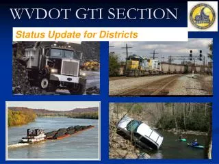
Ongoing Major GIS Projects at WVDOT
Ongoing Major GIS Projects • Services for ERP(wvOASIS) • Our Advanced Solution with Integrated Systems • Enterprise LRS Development • Esri’s Roads & Highways (R&H) Deployment • Enterprise GIS Development • New GIS Portal • ArcGIS Online for Organization • New Highway Maps • ProjectWise Implementation • Web Mapping Applications • New Straight Line Diagram Viewer • Transportation GIS Data Collection • 3D GIS
Phase A Envision Build Achieve Phase B Envision Build Achieve Achieve Phase C Envision Build Phase D Envision Build Achieve Build Phase E Envision Build Achieve Facilities & Real Estate August 2013 January2014 July 2014 January 2015
WVDOT Geospatial Resources • Open to the Public • GTI Web Portal • Continuously Operating Reference Stations (CORS) Network • WVDOT • GTI Web Portal • CORS Network • Fleet Management • Videolog Viewer • GIS Portal • Straight Line Diagram Viewer • WVDOH District GIS Coordinator Network • GIS/GPS Training • Other Services (Transportation GIS User Group, etc.)
GTI Web Portal http://www.transportation.wv.gov/highways/programplanning/gti/Pages/default.aspx
Data Catalog • Bridges • Byways & Backways • Guardrails • Major Roads by Sign/District/County • Railroads • River Ports • Public Airports • WVDOT Facilities • WVDOT Rest Areas • WVDOT Substations • Etc. • http://www.transportation.wv.gov/highways/programplanning/gti/GIS/Pages/DataCatalog.aspx
GIS Web Services • EsriArcGIS Server • REST & SOAP APIs • UTM & Web Mercator (WM) • Future GeoData Services • Future Image Services • Future Data Exchange Network • http://www.transportation.wv.gov/highways/programplanning/gti/GIS/Pages/WebMapServices.aspx
GIS Data Exchange • GIS Web Services • Data Exchange Network • Shapefiles for Downloading
WVDOT Transportation Maps • City Maps (205) • General Highway County Maps (55) • State Functional Classification Maps • State General Highway Maps • State Highway Base Map • Urban Area Maps (26) • http://www.transportation.wv.gov/highways/programplanning/gti/GIS/MAPS/Pages/default.aspx
Web Mapping Applications • WVDOT Facility Locations • WVDOT Statewide Transportation Improvement Program • WVDOT River Port Locations • WVDOT Airport Locations • WVDOT Snow Removal & Ice Control (SRIC) • WV American Recovery and Reinvestment (ARRA) Reporting • WVDOT Coal Resource Transportation System (CRTS) http://www.transportation.wv.gov/highways/programplanning/gti/GIS/Pages/MappingApplications.aspx
Newest Station State Police in Franklin, WV 35 STATIONS TRANSMITTING TO NETWORK 169 Subscriptions 109 Organizations 187 Users 2011 22 WV STATIONS INSTALLED
WVDOT CORS Network Cooperative Effort Site Owners Include USCOE NRAO WVDNR WVDEP WVRJA WVU, MU, FSU, SCTC, EWVTC, Marshall, Braxton, and Wirt County Schools Partnerships – Surrounging State Ohio Kentucky Pennsylvania Virginia http://wvcors01.cors.us/
WVDOT GeoManagerGPS Fleet Management Upgrade to System Embrace Latest Technology User Friendly Online Training for Managers Fleet Productivity Fuel Reduction Driver Safety Environmental Impact Asset Utilization Diagnostics & Messaging NMEA GPS Data Feed NMEA WiFi Data Feed
Overwhelmed or Confused? GTI Web PORTAL CORS FLEET MANAGEMENT SLD VIDEOLOG VIEWER OTHERS
Yueming Wu GIS Unit Leader, GTI Section Program Planning & Administration Division WVDOT-Highways (304) 558-7437 yueming.wu@wv.gov