Download
1 / 2
20 likes | 171 Views
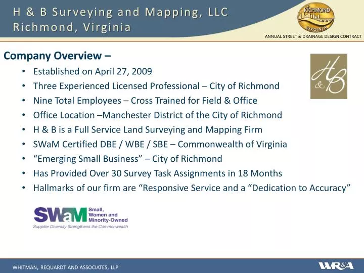
H & B Surveying and Mapping, LLC Richmond, Virginia. Company Overview – Established on April 27, 2009 Three Experienced Licensed Professional – City of Richmond Nine Total Employees – Cross Trained for Field & Office Office Location –Manchester District of the City of Richmond

E N D
H & B Surveying and Mapping, LLCRichmond, Virginia Company Overview – • Established on April 27, 2009 • Three Experienced Licensed Professional – City of Richmond • Nine Total Employees – Cross Trained for Field & Office • Office Location –Manchester District of the City of Richmond • H & B is a Full Service Land Surveying and Mapping Firm • SWaM Certified DBE / WBE / SBE – Commonwealth of Virginia • “Emerging Small Business” – City of Richmond • Has Provided Over 30 Survey Task Assignments in 18 Months • Hallmarks of our firm are “Responsive Service and a “Dedication to Accuracy”
H & B Surveying and Mapping, LLCRichmond, Virginia Project Experience – Cannon Creek Bike Trail • Survey Control for 2+ Mi. Bike Trail • Coordination of Aerial Mapping Service • Phased Project - Complete Location Survey to VDOT Standards for Phase I Willow Oaks Stream Restoration • Survey of (6) areas of Subdivision • Our Crews are Sensitive to Landowners • Rough Terrain – Detailed Field Run • Topographic Survey with 1’ Contour Intervals Intersection Improvement Surveys • Jeff Davis Hwy @ Walmsley, Bells Rd., Ruffin / Castlewood • Belvidere @ Idlewood, Canal & Cary • W. Broad Street @ N. Allison & Malvern