Chain Surveying
Chain Surveying. Surveying. Primary divisions of surveying: 1. Plane Surveying 2. Geodetic Surveying. Plane surveying does not take into account the curvature of the earth’s surface, and the surface of the earth is treated as a plane surface.

Chain Surveying
E N D
Presentation Transcript
Surveying Primary divisions of surveying: 1. Plane Surveying 2. Geodetic Surveying Plane surveying does not take into account the curvature of the earth’s surface, and the surface of the earth is treated as a plane surface. If the area to be surveyed is more than 1000 km2, the angles measured on the surface of the earth can not be in a plane surface, but are in a curved surface. Therefore, Geodetic surveying (which consider curvature of earth) is used for achieving high precision for large areas.
Classification of Surveying Classification of surveying broadly based on: • The function of survey • Instruments employed Classification based on function of survey: Land surveying City surveys Route surveys Mine surveys Geological surveys Military surveys etc. Classification based on Instruments Employed: Chain survey Compass survey Plane-table survey Levelling survey Photogrammetric survey EDM survey
Principles of surveying • Fixing a point in relation to points already fixed • Working from the whole to the part
Definitions of some basic terms Level surface: is the equipotential surface of the earth’s gravity field. - A body of still water provides the best example of a level surface. Horizontal line: A line tangent to a level surface is a horizontal line. Horizontal plane: is a plane which is tangential to a level surface at a particular point. Horizontal angle: An angle measured between two intersecting lines in a horizontal plane. Vertical Line: is a line perpendicular to the horizontal plane Vertical Plane: A plane containing a vertical line Vertical Angle: Angle between two intersecting lines in a vertical plane Elevation: The vertical distance of a point from an assumed datum or mean sea level.
Difference between a PLAN and a MAP The distinction between plan and map is arbitrary. It is difficult to say exactly when a plan becomes map. In general a PLAN is ORTHOGRAPHIC REPRESENTATION of features on or near earth on a horizontal plane. The earth’s curvature is not taken into account. Therefore preferable for smaller areas to avoid distortions due to curvature of the earth. A MAP is also a graphical representation of features but differs from a PLAN when the scale is small and is constructed usinga projection system other than ORTHOGRAPHIC. In general MAPS will give some additional information such as about the topography with the help of contours.
Land Surveying • Need:- • To secure necessary data of a part of land for the purpose of demarcating its boundaries, determining its area, preparing its plan or map, execution of engineering project etc. • Collection of Data:- • Collection of data can be done by any one or combination of surveying methods. • Ex;- Chain surveying, compass surveying, theodolite surveying, remote sensing etc. • Factors controlling the type of surveying:- • Depending on accuracy required • Extent and type of the area to be surveyed • Time available for the survey work • Economic aspects
Execution of surveying Surveyor has to choose the best approach so that work can be completed within given time-frame and available funds.
Measurement of Horizontal Distances • The commonly used techniques in the basic engineering are: • Pacing • Measuring Wheel • Taping and/or Chaining • Electronic distance measuring devices • Optical devices
Pacing • A pace is defined as ONE STEP • A stride is consider TWO steps • The ability to pace distance is very useful • A person can determine their pace by counting the number of paces necessary to walk a distance that has been previously measured.
Electronic Distance Measurement (EDM) Systems EDMs are very useful in measuring distances that are difficult to access or long distances
Chain Surveying Chain surveying the simplest method of surveying in which only linear measurements are made and no angular measurements are taken. The area to be surveyed is divided into a number of triangles and the sides of the triangles are directly measured in the field. Since the triangle is a simple plane geometrical figure, it can be plotted from the measured length of its sides alone. In chain surveying, a NETWORK of TRIANGLES is preferred. Preferably all the sides of a triangle should be nearly equal having each angle nearly 60o to ensure minimum distortion due to errors in measurement of sides and plotting. Generally such an ideal condition is not practical always. Usually attempt should be made to have WELL CONDITIONED TRIANGLES in which no angle is smaller than 30 o and no angle is greater than 120o.
Chain Surveying The arrangement of triangles to be adopted in the field depends on the shape, topography and the natural or artificial OBSTACLES met with. • Chain surveying is suitable for the following cases: • Ground fairly level and open with simple details • Large scale plans (1 cm = 10 m) • Extent of the area comparatively small • Chain surveying is unsuitable for the following cases: • Area crowded with many details • Wooded countries • Undulating areas • Extent of large area
Chain Surveying • Definitions: • Main survey stations • Is a point where TWO SIDES OF A TRIANGLE MEET. • THESE ARE THE POINTS AT THE BEGINNING AND AT THE END OF THE CHAIN LINE. • Tie stations (or) subsidiary stations: • These are the points selected on the main survey lines for running auxiliary lines. • Main survey lines: • These are chain lines joining the main survey stations • Tie or subsidiary lines • The chain lines joining the tie stations or subsidiary stations are called as tie or subsidiary lines. • These lines help in locating the interior details which are far away from the main survey lines.
Chain Surveying • Definitions: • Base Line • the longest of the main survey line • various survey stations are plotted w.r.t. this line. • Check Lines: • Those lines which are run to check the accuracy of the field work are called as check lines or proof lines. • The length of the check line in the plan must agree with its measured length in the field. • each triangle must be provided with a check line. • Offsets: • Offsets are lateral distances measured from survey lines • Offsets are taken from survey lines to determine the locations of details. • Perpendicular offsets are called as simply “OFFSETS” • Oblique offsets are called as oblique offsets.
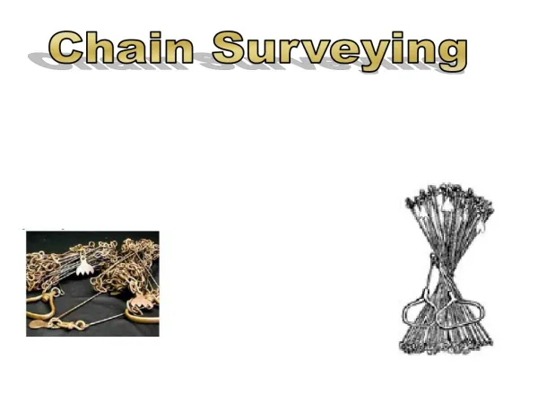
Chain Surveying Tape and Chain
Chain Surveying Metric surveying chains: Length of chain: 20 m or 30 m Number of links per meter length : 5 Length of each link : 20 cm Tallies are provided at every 5 m Small brass rings are provided at every meter except where tallies are provided. Metallic tape: Length of tape: 20 m or 30 m The linen tape is reinforced with fine brass or copper wires to prevent stretching or twisting of fibres and is then called as a metallic tape.
Chain Surveying Arrows: These are also called as marking or chaining pins 10 arrows are provided along with each chain. Used to mark end of the chain during the process of chaining. Cross Staff: - used to make perpendicular lines
Basic Trignometry A2 + B2 = C2 a C B a+ b+ c = 180o b c A