Download
1 / 11
110 likes | 201 Views
Learn about the 2011 operation of Lower Granite Dam for various purposes including navigation, in accordance with Minimum Operating Pool provisions. Collaboration with stakeholders ensured safe navigation during the fish migration season.

E N D
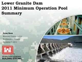
Lower Granite Dam2011 Minimum Operation Pool Summary Doug Baus Reservoir Control Center Northwestern Division December 7, 2011
Objectives Operate Lower Granite (LWG) Dam for authorized purposes such as navigation Operate LWG in accordance with Minimum Operating Pool (MOP) provisions identified in the 2008 Federal Columbia River Powersystem Biological Opinion (BiOp) Coordinate operations with regional stakeholders when it is challenging to achieve the multipurpose objectives associated with LWG
Navigation Survey Data Less than the 14 foot depth authorization in the Federal Navigation Channel BiOp indicates LWG will be operated at Minimum Operating Pool (MOP) defined as 733.0 to 734.0 ft. LWG MOP operations would not provide sufficient depth in the Federal Navigation Channel
System Operation Request (SOR) 2011-01 • Objective of the SOR was to provide safe navigation and marine facility access in the Lower Granite Pool during the fish migration season.” • From Columbia River Towboat Association, Port of Clarkston, Port of Lewiston, Lewis and Clark Terminal, Valley Vision, Inc. • Received on March 23, 2011
Coordination with TMT • PNWA Presented SOR March 30 • In Coordination with TMT the Corps determined the modified MOP operation would provide adequate depth in the Federal Navigation Channel • Action Agencies implemented the SOR during the 2011 Fish Migration Season (April 3-Aug 31)
Variable MOP Operation • MOP+2 April – August did not appear to be necessary to provide safe navigation • To minimize duration of time at a MOP plus operation coordinated the following variable MOP operation: • LWG Inflow Dependent Ranges • Inflow >= 120 kcfs 733.0-734.0 feet (MOP) • Inflow >= 80 kcfs and < 120 kcfs 734.0-735.0 feet (MOP+1) • Inflow >= 50 kcfs and < 80 kcfs 734.5-735.5 feet (MOP+1.5) • Inflow < 50 kcfs 735.0-736.0 feet (MOP+2) • Implemented from April 3 through August 31, 2011
Summary • Unique opportunity to working with regional partners developed creative solutions to balance the needs of various requirements • Provided modified MOP operation to provide safe navigation • Coordinated operations with Regional Partners through TMT consistent with the intent of the RPA
Acknowledgements • Technical Management Team • Glenn Vanselow - Pacific Northwest Waterways Association • John Pigott – Columbia River Towboat Association • Wanda Keefer – Port of Clarkston • David Doeringsfeld – Port of Lewiston • Arvid Lyons – Lewis and Clark Terminal • Doug Matoon, Valley Vision, Inc. • Steve Barton – Corps • Bill Proctor - Corps • Steve Hall – Corps • Lisa Wright - Corps • Tracy Schwartz – Corps • Richard Turner – Corps • Karl Kanbergs – Corps • John McCoskery - Corps • Steve Burrell – Corps • Greg Bowers – Corps • Gregg Teasdale – Corps • Ann Glassley - Corps