Download

1 / 8
80 likes | 189 Views
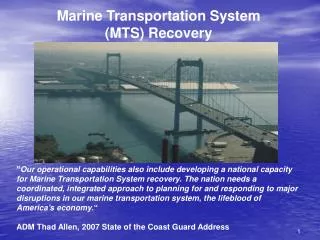
RIS - RIVERS INFORMATION SYSTEM Our “Invisible” Transportation Network. Richard C. Lockwood Chief, Operations Division U.S. Army Corps of Engineers, Pittsburgh District. Permanent International Association of Navigation Congresses - PIANC July 15, 2008. RIS GOALS

E N D
RIS - RIVERS INFORMATION SYSTEMOur “Invisible” Transportation Network Richard C. Lockwood Chief, Operations Division U.S. Army Corps of Engineers, Pittsburgh District Permanent International Association of Navigation Congresses - PIANC July 15, 2008
RIS GOALS • RIS will be an electronic system that will pull data from various existing sources both Government and commercial and process and display that information in customizable user friendly formats • RIS will modify or replace existing USACE systems to achieve a single system that will inform and be informed by the systems already in use by our navigation partners.
RIS will use existing technology, Electronic Navigation Charting and data summarizing to provide all partners with the specific information they need to staff, operate and use the Inland Navigation system. • RIS will eliminate duplication of data entry and ensure seamless transfer between USACE systems and Navigation and Government partners. • RIS will generate confidence both within and outside the Government that the Inland Waterways System is an efficient, safe and reliable transportation system.
CONSTRAINTS • RIS must protect sensitive and proprietary information of the commercial Navigation partners. • RIS must fit seamlessly into the bigger CRIS service and use existing standards for data coding and classification • RIS must be capable of informing and being informed by USCG’s AIS (Automated Identification System) and other existing commercial systems for tow tracking and scheduling • RIS must be capable of informing and being informed by other USACE systems (Asset Management, OMBIL, CWMS, etc) and other Partner systems (NWS, USGS, IRS, Customs, etc.) • Navigation data (current, wind speed, lock condition, gauge readings, dam operating data, etc.) provided via or by RIS must not expose USACE to any liability concerning the use of that data.
RIVER INFORMATION SERVICE USACE ASSET MANAGEMENT OMBIL NATNL WEATHER SER TOWING VESSELS USGS CWMS IRS SYSTEM DATA RIS LOCK USCG AIS LOCAL DATA DHS PORT AUTHORITIES CUSTOMS TOWING COMPANIES DOE SHIPPERS RECREATIONAL BOATERS TERMINAL OPERATORS
CURRENT INITIATIVES • CRIS PM and Champion have asked LRP to define: • What information is needed from the Corps • What data needs to be stored and what is for local use • How to broadcast locally used information • What should be done by Industry or Govt • What equipment will industry need to have • “SOURCES SOUGHT” – INDUSTRY DAY • DEFINE DISPLAYS • LOCKMASTER DISPLAY – LRD/MVD INITIATIVE • TOW MASTER/PILOT DISPLAY – AWO • USACE MANAGEMENT DISPLAY – ASSET MANAGEMENT LINKAGE
Questions? ?Questions? www.lrp.usace.army.mil