Download
1 / 41
410 likes | 580 Views
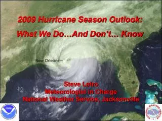
2009 Hurricane Season Outlook: What We Do…And Don’t… Know. Steve Letro Meteorologist in Charge National Weather Service, Jacksonville.

E N D
2009 Hurricane Season Outlook: What We Do…And Don’t… Know Steve Letro Meteorologist in Charge National Weather Service, Jacksonville
1. Recap Of 2008 Season and Outlook Verification2. Meteorological & Climatological Factors That Influence Hurricane Activity3. Seasonal Forecasts OVERVIEW…
The Early Season 2008 Outlook NOAAGRAYACTUAL NAMED STORMS:12-16 15 16 HURRICANES: 6-9 8 8 MAJOR HRCNS: 2-5 4 5 NET TROPICAL CYCLONE ACTIVITY:100-210% 160% 164%
The Main Weather Patterns Expected To Influence The 2009 Season: • Atlantic MultiDecadal Oscillation (AMO) • El Nino/La Nina (ENSO) • Surface Atmospheric Pressures • Madden-Julian Oscillation (MJO)
Warm Sea Surface Temperatures (SST) Are A Prime Ingredient In Hurricane Formation… Providing The Necessary “Fuel” To Power The Storm SST Departures From Normal: 1995-2008 SST Departures From Normal: 1981-1994 Average Number of Hurricanes: 4.7 Average Number of Hurricanes: 8.0
The Atlantic Multi Decadal Oscillation… A Rearrangement Of Atlantic Sea Surface Temperatures (SST) In 25-40 Year Cycles… Has Been In A Warm Phase Since 1995… With A Corresponding Increase In Hurricane Activity Avg. # Hurricanes = 8.0 Atlantic Multi Decadal Oscillation (AMO) Index Avg. # Hurricanes = 4.7
The Impact Of Sea Surface Temperature: Inactive vs. Active Seasons 1997 2004-2005 3 Hurricanes, 1 Major 2 Year Avg: 12 Hurricanes, 6.5 Majors
El Niño versus La NiñaThe Two Phases Of ENSO El Niño causes extra thunderstorm development over the central and eastern equatorial Pacific. This causes a response in the atmosphere over the Atlantic basin of increased shear and sinking air, causing a drier and more stable atmosphere. Upper winds La Niña causes a reduction and westward shift in thunderstorms. This forces the maximum sinking air to be located over the eastern Pacific and allows air to rise more freely over the Atlantic basin, in addition to less shear. Upper winds
Wind Shear Changes In Wind Speed & Direction With Height
Upper (~40,000 ft) Winds In General, It Is Normal For There To Be Lots Of Shear In The Basin: In Active Seasons, Environmental Factors Act To Decrease The Shear Lower (~5,000 ft) Winds
Wind Shear During June-July of 10 ENSO (El Nino vs La Nina) Events. El Niño La Niña
Sea-Level Pressure • Known to influence hurricanes for at least 70 years. • Pressure is a proxy for multiple qualities in the atmosphere. • Lower pressures are linked to less sinking, which leads to a more moist atmosphere. • Higher pressures in the subtropical high linked to stronger winds, and cooler water temperatures through increased upwelling.
Composite Map Of June-July Anomalous Surface Pressures During 10 Active Hurricane Seasons Higher Than Normal Lower Than normal
Madden-Julian Oscillation • Discovered in the early 1970s by Roland Madden and Paul Julian. • An eastward propagating wave that circles the globe in about 40-50 days involving tropical convection. • Detected in the Outgoing Longwave Radiation (OLR) and wind fields across the tropics. • Later papers showed that it is an important modulator of TC activity, especially in the Pacific Ocean.
MJO Effects in the Atlantic Basin • The MJO Can Lose Much Of Its Strength Before Entering The Atlantic Basin. • In Addition, The MJO Is Weakest During The Late Summer, Near The Peak Of Atlantic Activity. • Western Part Of The Basin Most Strongly Affected • The Atlantic Basin Is Most Active When Tropical Convection Is Suppressed In The Central Pacific Ocean And Enhanced In The Indian Ocean.
Active MJO and corresponding TS and H tracks • Active MJO In The Western Caribbean Sea And Gulf Of Mexico Produces More Storms Due To: • Increase In Low-level Convergence (ITCZ Moves Farther North) • Low-level Rotation Is Also Increased Due To Westerly Low-level Flow Meeting Easterly Trades • Upper Divergence Is Stronger Than Average During The Westerly Phase, With A Drop In Shear As Well Inactive MJO and corresponding TS and H tracks Adapted from Maloney and Hartmann (2000)
The MJO And Tropical Cyclone Genesis Points Most Genesis Points Are Near Or Behind The Upper- Level Divergence Center (Green Shading).
With All This In Mind, Here Is What We DO “Know” Regarding The Upcoming Hurricane Season …We’ll Start With The Status Of The Atlantic Multi-Decadal Oscillation (AMO)
North Atlantic SST Annual Anomalies… Remember The 25-40 Year Cycle? We’re Not Nearly Done! 1 2009-2020 1995-2008 ? 1926 1969 0.5 0 - 0.5 1925 1970 1994 -1 1900 1910 1920 1930 1940 1950 1960 1970 1980 1990 2000 2010 2020
AMO Trends Over The Last Year… More Favorable Less Favorable
Pressures Were Well Above Normal In The East Atlantic This Spring… Leading To Upwelling Along The African Coast and Cooler SST’s
ENSO Status (El Nino/La Nina) After Spending Most Of The Last Couple Of Years In La Nina Territory… The Index Is Now Switching Toward At Least Weak El Nino Values El Nino La Nina
As We’ve Seen… El Nino Conditions… Especially Stronger Ones… Often Lead To Greater Wind Shear Across The Tropical Atlantic …Over The Last Month, Wind Shear Has Been Stronger Than Normal Over The Deep Tropical Atlantic
IF The Evolution Of This Event Does Continue As The Forecasts Indicate… …The Typical Expected Impacts Would Include Fewer Strong Storms, Especially In The Deep Tropics, With Storms Likely Forming At Higher Latitudes Where Shear Values Are Lower
The Madden Julian Oscillation… • Individual MJO Events Are… Unfortunately… Unpredictable Beyond About 20 Days, Both In Onset, Strength, and Longevity. • It’s Also Unclear Exactly What Role The Interaction With A Developing El Nino May Play. • The MJO Must Be Watched Closely… Unusually Strong and Long Lasting MJO Events Are Often Accompanied By Lower Shear and Other Atmospheric Factors That Favor Tropical Cyclone Development
When Storms Do Form… Can We Tell Where They Might Be Likely To Go?
H • “MDR” Tropical cyclones are “steered” westward across the Tropics along the underside of this Atlantic high, before eventually recurving around the western edge.
It’s Difficult To Make Conclusive Statements About How The Atlantic High Will Change Over The Course Of The Season… But We’ve Seen That Springtime Pressure Patterns May Offer At Least Some Clue …
Springtime Pressure Patterns During Two Recent “Active” Seasons… 2004 & 2005 L H H H H White Lines Indicate The Preferred, Or Most Common Tracks For MDR-Originating Storms During The Respective Seasons.
Springtime Pressure Patterns During Two Recent “Quiet” Seasons… 2006 & 2007 L H H H White Lines Indicate The Preferred, Or Most Common Tracks For MDR-Originating Storms During The Respective Seasons.
2008 Spring Sea Level Pressure Pattern vs. Observed Hurricane Motion This Method Continued To Work Fairly Well In 2008… At Least For The Hurricanes!
Fay & Hanna Were Vivid Reminders That…Especially With Weaker Storms… No Matter What The General Storm Tracks May Be… Any Given Storm Will Move According To The Specific Steering Environment Present At A Given Time
Putting It All Together… • IF Current Trends Hold… The Combination Of El Nino Impacts In The Caribbean And The Currently Suppressed AMO Would Tend To Reduce The Number Of Strong Hurricanes Coming Out Of The Deep Tropics (Note That The Operative Term Here Is “Reduce”… NOT Eliminate!) • This Pattern Is Often Characterized By Storms Forming At More Northerly Latitudes And In The Gulf Of Mexico… Many Of Which Tend To Be “Hybrid” Or Not Purely Tropical Systems (Especially Early or Late In The Season). • These Types Of Storms Do Not Typically Gain Great Intensity.
With That In Mind…And For What It’s Worth… Here’s The 2009 Outlook • NAMED STORMS:9-14 • HURRICANES:4-7 • MAJOR HURRICANES:1-3 • NET TROPICAL CYCONE ACTIVITY 65-130% • U.S. STRIKES ? • U.S. HRCN STRIKES: ? • MAJOR U.S. HRCN STRIKES ?
CAUTION!!! The Atlantic Basin Is A BIG Area… It’s Almost Impossible To Find Either Uniformly Favorable… Or Unfavorable Conditions Over The Entire Basin For The Entire Hurricane Season… 1983 1992 Even In The Quietest Seasons… There Is Often At Least 1 System That Finds A Window Of Opportunity… And Goes On To Cause Big Problems For Someone!
The 2009 Springtime “Steering” Pattern Does Bear Some Uncomfortable Resemblances To The Pattern In 2004… Though Not As Strong Spring 2009 Spring 2004 This Type Of Pattern… When Strong… Can Allow Storms To Get Dangerously Close To The East Coast Before Recurving Northward
This Pattern… Combined With A Likely Preferred Genesis Area Farther North Due To Possible El Nino Influences… Implies Tracks Of This Sort…
Very Important Caveats!!! • The Preceding Is Based On Only Some Very General Correlations I Have Observed And NOT On Any Formal Research. • These Correlations ONLY Apply To Storms Originating In The Main Development Region…Many Storms Don’t Originate There! • The Correlations Are Most Valid For Fully Developed Hurricanes… NOT Weaker Systems. It Also Says Nothing About Whether There Will Actually BE Strong Storms In Those Areas. • Even If The General Patterns Do Turn Out This Way… It In No Way Precludes The Possibility Of Any Individual Storm Following A Very Different… And Possibly Much More Dangerous Path (see Charley 2004 & Wilma 2005) !!!
The End! www.srh.noaa.gov/jax Steve Letro: 904-741-4411 (office) 904-294-1594 (cell)