Download

1 / 70
700 likes | 923 Views
Forest Legacy Assessment of Need Identifying Future Forest Legacy Areas. Governor’s Commission for Protecting the Chesapeake Bay through Sustainable Forestry December 21, 2005. Charge to the Commission. Provide guidance and recommendations in the preparation of an updated

E N D
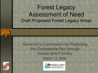
Forest Legacy Assessment of NeedIdentifying Future Forest Legacy Areas Governor’s Commission for Protecting the Chesapeake Bay through Sustainable Forestry December 21, 2005
Charge to the Commission Provide guidance and recommendations in the preparation of an updated Forest Legacy Assessment of Need that identifies 1)environmentally important forestlands that are 2) threatened by present or future conversion to nonforest uses
Today’s Objectives: • Review proposed process to identify and evaluate Forest Legacy Areas • Evaluate potential new areas • Revisit currently designated Forest Legacy Areas • Receive your comments to further refine Assessment of Need
Two Key Components to Consider… • Identification of Forest Legacy Areas • Evaluation of specific projects • Which projects get nominated State-wide? • How well will nominations compete at a National level?
Identifying Focus Areas, i.e. narrowing our window of opportunity • Use existing Landscape Analysis Tools • Strategic Forest Lands Assessment (SFLA) • Ecological, Economic and Vulnerability models • Forest Stewardship Spatial Analysis Project (SAP) • Adopt a regional approach • Western, Central, Southern and Eastern forest management regions • Distinct management issues within each region
Strategic Forest Lands Ecological Assessment Evaluates the ecological values important to land conservation programs. • The ecological model gives priority or greater weight to large forest blocks, particularly those with: • More forest “interior” conditions • Greater diversity of habitat types • More stream or erodible soils protection • More closely located to other forest blocks vs isolated patches
Strategic Forest Lands Economic Assessment Evaluates the potential of forest land to yield economic benefits associated with timber management activities. • Biophysical, environmental, socioeconomic and • policy factors include: • Species composition • Soil productivity • Environmental constraints on timber harvest operations • (wetlands, steep slopes, streams) • Population density • Parcelization • Role of the forest products industry in the local economy • Existing working landscape protection initiatives (e.g. Rural Legacy and Forest Legacy Areas) • Existing public and private forest land protection
Strategic Forest Lands Vulnerability Assessment Evaluates the vulnerability of a given acre of forest to development as well as factors that make its conversion less likely. • Factors used to determine how vulnerable an area is include: • Current level of protection arising from public ownership, conservation or agricultural easements • Development constraints imposed by environmentally sensitive features, including wetlands and riparian areas, steep slopes, and sensitive habitats. • Proximity to population centers • Road access and density • Existing or planned water and sewer service areas • Local zoning
Forest Stewardship Spatial Analysis Project (SAP) Evaluates the potential benefits and suitability of privately owned forest land for the Forest Stewardship Program. • Higher priorities are given to forest land that are: • Ecologically important (similar to SFLA Ecological Model) • Near existing protected lands • Adjacent to privately owned forests covered by Forest Stewardship Management Plans
SFLA Ecological Model Tools to SupportForest Legacy Needs Assessment FLA Eligibility Criteria Available Assessment Tools • Important Public Values • Scenic resources • Recreational opportunities • Public water supply protection • Wetlands • Interior forest habitat • Rare, threatened and endangered species habitat • Chesapeake Bay water quality improvement • Forest products utilization • Threatened by conversion to non-forest uses
Tools to SupportForest Legacy Needs Assessment FLA Eligibility Criteria Available Assessment Tools • Important Public Values • Scenic resources • Recreational opportunities • Public water supply protection • Wetlands • Interior forest habitat • Rare, threatened and endangered species habitat • Chesapeake Bay water quality improvement • Forest products utilization • Threatened by conversion to non-forest uses Forest Stewardship SAP
SFLA Economic Model Tools to SupportForest Legacy Needs Assessment FLA Eligibility Criteria Available Assessment Tools • Important Public Values • Scenic resources • Recreational opportunities • Public water supply protection • Wetlands • Interior forest habitat • Rare, threatened and endangered species habitat • Chesapeake Bay water quality improvement • Forest products utilization • Threatened by conversion to non-forest uses
SFLA Vulnerability Model Tools to SupportForest Legacy Needs Assessment FLA Eligibility Criteria Available Assessment Tools • Important Public Values • Scenic resources • Recreational opportunities • Public water supply protection • Wetlands • Interior forest habitat • Rare, threatened and endangered species habitat • Chesapeake Bay water quality improvement • Forest products utilization • Threatened by conversion to non-forest uses
Locating Focus Areas • IDENTIFYEcologically and Economically Important Forest Lands • Medium and High valued forests (SFLA) • FILTER • At least 50% forest cover/assessment area • Medium to High Stewardship Potential (SAP) • Medium to High Vulnerability (SFLA) • RELATEto other programs and objectives • Maryland’s Green Infrastructure • 1995 Forest Legacy Areas • Rural Legacy Areas • Existing Protected Lands
Today’s Draft Focus Areas are … • A starting point only • Located through GIS analysis; each step is a map layer • Defined through a select set of spatial, or mapped data What else should we consider?
Demonstration • Western Region example • Step through the process • Illustrate the “Regional” approach • High, Medium, Low rankings determined on regional basis vs Statewide basis • Results for remaining regions
IDENTIFY: Ecologically Important Forest Lands Western Region SFLA Ecological Rank Low Medium High Mapping unit = 30 m2 (~1/3 acre) grid cell Very Fine Grained Resolution Difficult for isolating significant “Focus Areas”
IDENTIFY: Ecologically Important Forest Lands Western Region SFLA Ecological Rank Low Medium High hexagon vs grid cell Mapping unit = 2.5 km hexagons Summarizes fine grained information for broader “Focus Area” evaluation By 2.5 km hexagons (natural breaks)
IDENTIFY: Economically Important Forest Lands Western Region SFLA Economic Rank Low Medium High
IDENTIFY: Economically Important Forest Lands Western Region SFLA Economic Rank Low Medium High By 2.5 km hexagons (natural breaks)
IDENTIFY: Ecologically AND Economically Important Forest Lands Western Region Focus Areas SFLA Ecologic and Economic Composite Score Low Medium High By 2.5 km hexagons (natural breaks)
IDENTIFY: Ecologically AND Economically Important Forest Lands Western Region Focus Areas SFLA Ecologic and Economic Composite Score Medium High Removing watersheds with low composite SFLA score IDENTIFY: Ecologically AND Economically Important Forest Lands By 2.5 km hexagons (natural breaks)
FILTER: At least 50 % Forest Cover Western Region Percent Forest Cover (2002) By 2.5 km hexagons (natural breaks)
FILTER: At least 50 % Forest Cover Western Region Focus Areas SFLA Ecologic and Economic Composite Score Medium High Removing watersheds with forest cover <50% IDENTIFY: Ecologically AND Economically Important Forest Lands FILTER: At Least 50% Forest Cover By 2.5 km hexagons (natural breaks)
FILTER: Medium to High Stewardship Potential Western Region Spatial Analysis Project (SAP) Score Low Medium High
FILTER: Medium to High Stewardship Potential Western Region Spatial Analysis Project (SAP) Score Low Medium High By 2.5 km hexagons (natural breaks)
FILTER: Medium to High Stewardship Potential Western Region Focus Areas SFLA Ecologic and Economic Composite Score Medium High Removing watersheds with low stewardship potential IDENTIFY: Ecologically AND Economically Important Forest Lands FILTER: At Least 50% Forest Cover FILTER: Medium to High Stewardship Potential By 2.5 km hexagons (natural breaks)
FILTER: Medium to High Vulnerability Western Region SFLA Vulnerability Rank Not at Risk Low Risk Medium Risk High Risk
FILTER: Medium to High Vulnerability Western Region SFLA Vulnerability Rank Low Medium High By 2.5 km hexagons (natural breaks)
FILTER: Medium to High Vulnerability Western Region Focus Areas SFLA Ecologic and Economic Composite Score Medium High Removing watersheds with low vulnerability IDENTIFY: Ecologically AND Economically Important Forest Lands FILTER: At Least 50% Forest Cover FILTER: Medium to High Stewardship Potential FILTER: Medium to High Vulnerability By 2.5 km hexagons (natural breaks)
IDENTIFY: Ecologically AND Economically Important Forest Lands Western Region Focus Areas SFLA Ecologic and Economic Composite Score Medium High Removing watersheds with low composite SFLA score IDENTIFY: Ecologically AND Economically Important Forest Lands By 2.5 km hexagons (natural breaks)
FILTER: At least 50 % Forest Cover Western Region Focus Areas SFLA Ecologic and Economic Composite Score Medium High Removing watersheds with forest cover <50% IDENTIFY: Ecologically AND Economically Important Forest Lands FILTER: At Least 50% Forest Cover By 2.5 km hexagons (natural breaks)
FILTER: Medium to High Stewardship Potential Western Region Focus Areas SFLA Ecologic and Economic Composite Score Medium High Removing watersheds with low stewardship potential IDENTIFY: Ecologically AND Economically Important Forest Lands FILTER: At Least 50% Forest Cover FILTER: Medium to High Stewardship Potential By 2.5 km hexagons (natural breaks)
FILTER: Medium to High Vulnerability Western Region Focus Areas SFLA Ecologic and Economic Composite Score Medium High Removing watersheds with low vulnerability IDENTIFY: Ecologically AND Economically Important Forest Lands FILTER: At Least 50% Forest Cover FILTER: Medium to High Stewardship Potential FILTER: Medium to High Vulnerability By 2.5 km hexagons (natural breaks)
RELATE: Rural Legacy Areas Western Region Focus Areas SFLA Ecologic and Economic Composite Score Medium High Rural Legacy Areas By 2.5 km hexagons (natural breaks)
RELATE: Green Infrastructure Western Region Focus Areas SFLA Ecologic and Economic Composite Score Medium High Green Infrastructure Hubs and Corridors By 2.5 km hexagons (natural breaks)
RELATE: Existing Protected Lands Western Region Focus Areas SFLA Ecologic and Economic Composite Score Medium High Protected Land Acquisitions Easements By 2.5 km hexagons (natural breaks)
Central Region Focus Areas Deer Creek FLA Elk Neck FLA SFLA Ecologic and Economic Composite Score Medium High By 2.5 km hexagons (natural breaks)
RELATE:Forest Legacy Areas and Rural Legacy Areas Central Region Focus Areas Deer Creek FLA Elk Neck FLA SFLA Ecologic and Economic Composite Score Medium High Forest Legacy Areas Rural Legacy Areas By 2.5 km hexagons (natural breaks)
RELATE: Green Infrastructure Central Region Focus Areas Deer Creek FLA Elk Neck FLA SFLA Ecologic and Economic Composite Score Medium High Green Infrastructure Hubs and Corridors By 2.5 km hexagons (natural breaks)
RELATE: Existing Protected Lands Central Region Focus Areas Deer Creek FLA Elk Neck FLA SFLA Ecologic and Economic Composite Score Medium High Protected Lands Acquisitions Easements By 2.5 km hexagons (natural breaks)
Southern Region Focus Areas Crownsville FLA SFLA Ecologic and Economic Composite Score Medium High Doncaster FLA Battle/ Parkers FLA By 2.5 km hexagons (natural breaks)
RELATE: Forest Legacy Areas and Rural Legacy Areas Southern Region Focus Areas Crownsville FLA SFLA Ecologic and Economic Composite Score Medium High Forest Legacy Areas Rural Legacy Areas Doncaster FLA Battle/ Parkers FLA By 2.5 km hexagons (natural breaks)