Download
1 / 8
80 likes | 233 Views
Advanced Activities with GPS: RoboGeo & Google Earth. Prepared by:. John McGee Jennifer McKee. With support from:. NSF DUE-0903270. in partnership with:. Geospatial Technician Education Through Virginia’s Community Colleges (GTEVCC). Photo2GPS.

E N D
Advanced Activities with GPS:RoboGeo & Google Earth Prepared by: John McGee Jennifer McKee With support from: NSF DUE-0903270 in partnership with: Geospatial Technician Education Through Virginia’s Community Colleges (GTEVCC)
Photo2GPS • A free software program that associates GPS track files with digital photographs • Created by the Geospatial Extension Educator at the University of Connecticut • Only works with Windows XP (does not work with Vista or Windows 7....) • Can be downloaded from http://clear.uconn.edu/geospatial/GPSResources.htm
Photo2GPS (software) • We are not going to work with Photo2GPS, but I wanted you to be aware of it... • We are going to work with RoboGEO
RoboGEO • RoboGeo is very similar to Photo2GPS • It is a bit more “powerful” • More functionality... • User-friendly • There is a “free trial version” • 1 license of the real version costs $79 • 10 license “lab kit” is $399 • More information at: www.robogeo.com
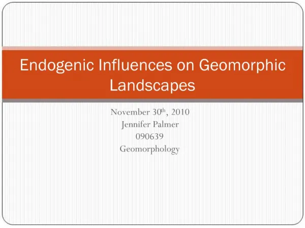
Final Product Red icons are photos Click on icon to see photo taken at that location
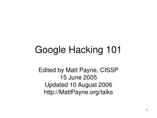
Work Flow Carry GPS receiver and automatically collect trackpoint data GPS tracks RoboGeo Software KML file Take photo of GPS unit with Time displayed Take pix. photos University of Connecticut, Geospatial Technology Program
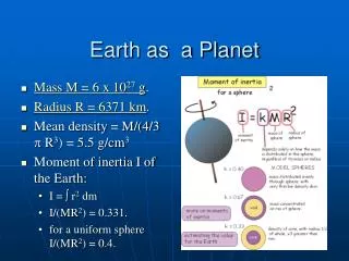
Interpolated Photo Locations 24 seconds between track points 2007/04/02-15:42:32 2007/04/02-15:42:44 2007/04/02-15:42:18 2007/04/02-15:42:03 15:42:28 Track points w/ date and time displayed Picture taken at 15:42:28 which puts the picture at 2/3 of the distance between the track points University of Connecticut, Geospatial Technology Program
Using RoboGeo • Detailed instructions have been developed. These instructions are available from the Virginia Geospatial Extension Program Website • http://www.gep.frec.vt.edu (under “Cool Tools”)