Download
1 / 64
670 likes | 1.01k Views
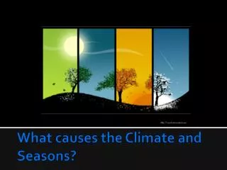
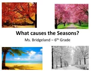
What causes most places on the Earth to have seasons?. The Earth is closer to the Sun in summer and farther away in winter The spin axis is tilted 23.5° to the plane of the Earth’s orbit, causing solar radiation to vary in angle as the Earth revolves around the Sun

E N D
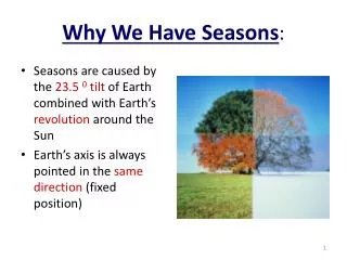
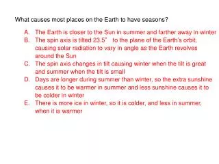
What causes most places on the Earth to have seasons? The Earth is closer to the Sun in summer and farther away in winter The spin axis is tilted 23.5° to the plane of the Earth’s orbit, causing solar radiation to vary in angle as the Earth revolves around the Sun The spin axis changes in tilt causing winter when the tilt is great and summer when the tilt is small Days are longer during summer than winter, so the extra sunshine causes it to be warmer in summer and less sunshine causes it to be colder in winter There is more ice in winter, so it is colder, and less in summer, when it is warmer
What causes most places on the Earth to have seasons? The Earth is closer to the Sun in summer and farther away in winter The spin axis is tilted 23.5° to the plane of the Earth’s orbit, causing solar radiation to vary in angle as the Earth revolves around the Sun The spin axis changes in tilt causing winter when the tilt is great and summer when the tilt is small Days are longer during summer than winter, so the extra sunshine causes it to be warmer in summer and less sunshine causes it to be colder in winter There is more ice in winter, so it is colder, and less in summer, when it is warmer
If you travel by airplane from New York to Paris (approximately east to west across the Atlantic Ocean), which way do you have to steer the airplane to arrive in at the Paris airport? • Slightly north of a direct line between airports • Slightly south of a direct line between airports • Along the straight line between airports, because there is no effect on east-west motion • Straight north, allowing the Earth’s rotation to carry the airplane eastward • Straight south, allowing the Earth’s rotation to carry the airplane eastward
If you travel by airplane from New York to Paris (approximately east to west across the Atlantic Ocean), which way do you have to steer the airplane to arrive in at the Paris airport? • Slightly north of a direct line between airports • Slightly south of a direct line between airports • Along the straight line between airports, because there is no effect on east-west motion • Straight north, allowing the Earth’s rotation to carry the airplane eastward • Straight south, allowing the Earth’s rotation to carry the airplane eastward
In general surface temperature does what as you go from low to high latitudes. • a. increases • b. remains relatively constant • c. decreases • d. increases then decreases
In general surface temperature does what as you go from low to high latitudes. • a. increases • b. remains relatively constant • c. decreases • d. increases then decreases
5. A force which causes an apparent deflection to the right in the Northern Hemisphere is ___. a. gravity b. Coriolis c. wind d. ocean currents
5. A force which causes an apparent deflection to the right in the Northern Hemisphere is ___. a. gravity b. Coriolis c. wind d. ocean currents
Bottom water in the oceans originates in ______. a. high latitudes b. temperate waters c. low latitudes d. high salinity areas
Bottom water in the oceans originates in ______. a. high latitudes b. temperate waters c. low latitudes d. high salinity areas
The deep circulation of the ocean is driven mainly by _______ . a. surface currents b. density differences c. the rotation of the earth d. none of these
The deep circulation of the ocean is driven mainly by _______ . a. surface currents b. density differences c. the rotation of the earth d. none of these
In normal (non-El Nino) years, the slope of the thermocline from west to east can best be characterized by which of the following? a. slopes upward b. no noticeable slope c. slopes downward d. has a wave-like form
In normal (non-El Nino) years, the slope of the thermocline from west to east can best be characterized by which of the following? a. slopes upward b. no noticeable slope c. slopes downward d. has a wave-like form
4. What will an area that experiences semidiurnal tides have? a. one high tide and one low tide daily b. one low tide and two high tides daily c. two nearly equal low tides and two nearly equal high tides d. none of these
4. What will an area that experiences semidiurnal tides have? a. one high tide and one low tide daily b. one low tide and two high tides daily c. two nearly equal low tides and two nearly equal high tides d. none of these
5. What is the name of the location around which tides rotate as standing rotary waves? a. amphidromic points b. turning points c. tidal points d. gravitational points
5. What is the name of the location around which tides rotate as standing rotary waves? a. amphidromic points b. turning points c. tidal points d. gravitational points
1. Unequal solar heating at the earth’s surface is due to which of the following? a. the rotation of the earth b. the curvature of the earth's surface c. the difference in specific heat of land as compared to the ocean d. the greenhouse effect
1. Unequal solar heating at the earth’s surface is due to which of the following? a. the rotation of the earth b. the curvature of the earth's surface c. the difference in specific heat of land as compared to the ocean d. the greenhouse effect
2. What is one of the main processes responsible for determining the salinity of surface waters in most of the open ocean? a. river runoff b. melting and freezing of sea ice c. evaporation d. solar heating
2. What is one of the main processes responsible for determining the salinity of surface waters in most of the open ocean? a. river runoff b. melting and freezing of sea ice c. evaporation d. solar heating
3. The temperature profile of a polar region can best be described as ______ . a. having a strong thermocline b. isothermal c. having a weak thermocline
3. The temperature profile of a polar region can best be described as ______ . a. having a strong thermocline b. isothermal c. having a weak thermocline
4. OTEC is a concept that takes advantage of which Of the following vertical gradients in the oceans? a. pressure b. salinity c. density d. temperature
4. OTEC is a concept that takes advantage of which Of the following vertical gradients in the oceans? a. pressure b. salinity c. density d. temperature
6. The tendency for isotherms to run in an east-west direction allows them to be characterized as_____ . a. tropical b. longitudinal c. normal d. zonal
6. The tendency for isotherms to run in an east-west direction allows them to be characterized as_____ . a. tropical b. longitudinal c. normal d. zonal
2. An eastern boundary current in the North Atlantic is which of the following?a. Canary Current b. Bengula Current c. Peru Current d. California Current
2. An eastern boundary current in the North Atlantic is which of the following?a. Canary Currentb. Bengula Current c. Peru Current d. California Current
3. Gulf Stream Rings serve to mix which of the following from one side to the other.a. salt b. heat c. plants d. animals e. all of these
3. Gulf Stream Rings serve to mix which of the following from one side to the other.a. salt b. heat c. plants d. animals e. all of these
4. The slope of the sea surface in the gyres is maintained by a balance between what two factors? a. solar heating and winds b. coriolis and gravity c. solar heating and gravity d. temperature and salinity
4. The slope of the sea surface in the gyres is maintained by a balance between what two factors? a. solar heating and winds b. coriolis and gravity c. solar heating and gravity d. temperature and salinity
All of the following factors are responsible for the formation of oceanic gyres except . a. solar heating b. winds c. westward intensification d. gravity
All of the following factors are responsible for the formation of oceanic gyres except . a. solar heating b. winds c. westward intensification d. gravity
6. The increased surface height in oceanic gyres is . a. right in the middle of the gyre b. offset to the eastern side c. offset to the southern side d. offset to the western side
6. The increased surface height in oceanic gyres is . a. right in the middle of the gyre b. offset to the eastern side c. offset to the southern side d. offset to the western side
Gyres are semi-enclosed current systems or complexes. In the northern hemisphere they rotate in which direction? a. counterclockwise b. clockwise c. to the east d. to the west
Gyres are semi-enclosed current systems or complexes. In the northern hemisphere they rotate in which direction? a. counterclockwise b. clockwise c. to the east d. to the west
Why is ocean climate (and the entire Earth for that matter) divided into latitude parallel zones that become progressively colder from equator to pole? • Winds are stronger at higher latitudes, so cooling is greater at higher latitudes • Precipitation and cloud cover increase with latitude, causing higher latitudes to be cooler • Greater amounts of ice occur at higher latitudes, making it cooler at higher latitudes • Cold ocean deep water returns to the surface at high latitudes, causing cooling • The average solar radiation (sunlight) striking the surface declines from equator to poles
Why is ocean climate (and the entire Earth for that matter) divided into latitude parallel zones that become progressively colder from equator to pole? • Winds are stronger at higher latitudes, so cooling is greater at higher latitudes • Precipitation and cloud cover increase with latitude, causing higher latitudes to be cooler • Greater amounts of ice occur at higher latitudes, making it cooler at higher latitudes • Cold ocean deep water returns to the surface at high latitudes, causing cooling • The average solar radiation (sunlight) striking the surface declines from equator to poles
With respect to speed and vertical thickness, western boundary current can be best characterized by which of the following? a. fast and shallow b. fast and deep c. slow and shallow d. slow and deep
With respect to speed and vertical thickness, western boundary current can be best characterized by which of the following? a. fast and shallow b. fast and deep c. slow and shallow d. slow and deep
Strong upwelling occurs in all of the following except which one? • a. between the North and South Equatorial Currents • b. where water is constantly pushed away from a coastline • c. in areas of surface current divergence • d. where thermohaline currents are formed
Strong upwelling occurs in all of the following except which one? • a. between the North and South Equatorial Currents • b. where water is constantly pushed away from a coastline • c. in areas of surface current divergence • d. where thermohaline currents are formed
An internal wave might form under which of the following conditions? a. at the boundary between the atmosphere and the ocean b. at the boundary between the ocean and the seafloor c. at a density boundary within the ocean d. only as a result of tidal activity
An internal wave might form under which of the following conditions? a. at the boundary between the atmosphere and the ocean b. at the boundary between the ocean and the seafloor c. at a density boundary within the ocean d. only as a result of tidal activity
2. What process can produce unusually large surface waves at sea other than large storms such as hurricanes? a. destructive wave interference b. wave refraction c. tsunamis d. constructive interference
2. What process can produce unusually large surface waves at sea other than large storms such as hurricanes? a. destructive wave interference b. wave refraction c. tsunamis d. constructive interference