Download
1 / 19
190 likes | 325 Views
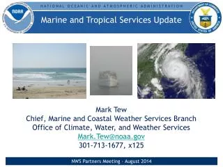
Marine and Tropical Services Update. Mark Tew Chief, Marine and Coastal Weather Services Branch Office of Climate, Water, and Weather Services Mark.Tew@noaa.gov 301-713-1677, x125. Marine Program Overview. Increasing Decision Support Services

E N D
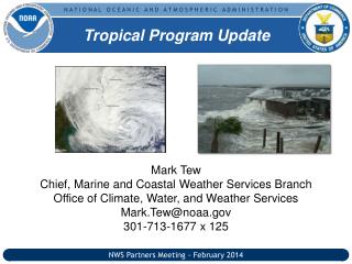
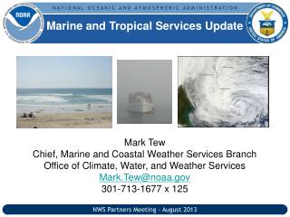
Marine and Tropical Services Update Mark Tew Chief, Marine and Coastal Weather Services Branch Office of Climate, Water, and Weather Services Mark.Tew@noaa.gov 301-713-1677, x125 NWS Partners Meeting - August 2014
Marine Program Overview • Increasing Decision Support Services • Experimental Beach Hazards Statement is planned to be operational in March 2015 • Shift in focus in rip current outreach and education NWS Partners Meeting - August 2014
Decision Support Services: U.S. Coast Guard • Vision: Through a collaborative effort, deploy nationwide a NWS Coast Guard Briefing Page with a consistent user interface while providing regionally-specific data based on the diverse needs of each Coast Guard sector, district, or group • 24/7 high-quality DSS to Coast Guard Air Stations • Template is now being used at several WFOs to support Coast Guard partners NWS Partners Meeting - August 2014
Experimental Beach Hazards Statement • New segment & VTEC code (BH.S) in the NWS Coastal Hazard Message (CFW) • Provides information about hazardsaffecting people in coastal/beach areas and in the surf zone • Locally significantweather-relatedhazards issued from all participating test offices • Ecological-relatedhazards at select offices (partnership w/NOAA LOs or gov’t agencies) • Experimental at initial WFOs since 2012 • 20 coastal WFOs currently participating in the experiment • Operational by March 2015 • All CR Great Lakes WFOs Issue Recreational Beach Forecast (SRF) and BHS NWS Partners Meeting - August 2014
Rip Current Outreach and Education • Outreach and Education focusing on how to avoid a rip current • Check conditions before going out • Learn how to spot a rip current • Fatalities in 2014 are less than ½ of 2013 (through July 31) NWS Partners Meeting - August 2014
2014 Tropical Program Changes • Experimental Potential Storm Surge Flooding Map • Operational Implementation of P-Surge 2.0 • Experimental 5-day Graphic Tropical Weather Outlook • NHC Products in Mixed Case NWS Partners Meeting - August 2014
Experimental Potential Storm Surge Flooding Map • Issued when a hurricane watch/ warning is in effect anywhere along the Gulf and Atlantic coasts • Represents the storm surge heights that a person should prepare for before a storm • Takes uncertainty in the forecast into account • Lays the foundation for extra-tropical inundation graphic (beyond 2015) Additional info: http://www.nhc.noaa.gov/experimental/inundation/ NWS Partners Meeting - August 2014
Probabilistic Storm Surge 2.0 • Operational on July 8, 2014 • Uses latest SLOSH basins - NAVD88 • Tide included in above ground and above datum (NAVD-88) guidance • Timing component (incremental and cumulative probabilities) available for above ground guidance • Available 1 hour after the NHC nominal advisory time (i.e., 5 am, 11 am, 5 pm, 11 pm) • Available over the SBN, NDGD and http://www.nws.noaa.gov/mdl/psurge2.0 NWS Partners Meeting - August 2014
Experimental 5-day Graphical Tropical Weather Outlook Weather Outlook Graphics • Indicates the formation potential of individual disturbances • Areas are color coded based upon development likelihood (yellow <30%, orange 30 - 50%, red >50%) • Mouse over shaded areas for details; click on shaded areas or disturbance numbers to switch views NWS Partners Meeting - August 2014
Tropical Program Changes for 2015 • Experimental Storm Surge Watch/Warning • Watch/Warning Process (HLS, TCV) • New Interactive Tropical Web Page NWS Partners Meeting - August 2014
Transformation of Tropical Cyclone Watch/Warning Program • Start Transformation by the 2015 Hurricane Season • New Storm Surge Watch and Storm Surge Warning product • Disseminated through a TCV-like product from NHC andWFOs • New WFO Tropical Cyclone VTEC (TCV) • Largely automated and includes all local watches and warnings and meteorological information in a one zone-one segment basis • Replaces the Hurricane Local Statement (HLS) as the WFO tropical cyclone watch/warning product • Updated Hurricane Local Statement (HLS) • Discussion preparedness product conveying a succinct message on local impacts – No VTEC, Non-Segmented Product • Reformatted based on social science research NWS Partners Meeting - August 2014
New HLS • Affected Area • Headline/Primary Message • New Information primarily pulled from TCP and grids • Brief Overview for entire CWA
New HLS • Potential Impacts • Uncertainty wording • Order based on largest expected impact • Some info such as damage category can be pulled from grids
New WFO TCV • New product header • Segment Information including tropical VTEC • Tropical headlines • Hazard definition when hazards are NEW • Locations in this segment • Wind information including potential impacts and specific meteorological details tailored to the scenario
New WFO TCV • Surge potential impacts and scenario-specific details • Rainfall potential impacts • Tornado potential impacts • Zone/county websites
Interactive Tropical Web Page • Provides all tropical information from the National Centers and WFOs on one interactive web site • Contains the hazard information from the new TCV and TCIG products • Enables user access to all the derived from these new products to be easily accessible through a new web interface NWS Partners Meeting - August 2014
HLS/TCV/Storm Surge Key Milestones NWS Partners Meeting - August 2014
Questions Mark Tew mark.tew@noaa.gov 301-713-1677, x125 NWS Partners Meeting - August 2014