Download
1 / 41
410 likes | 598 Views
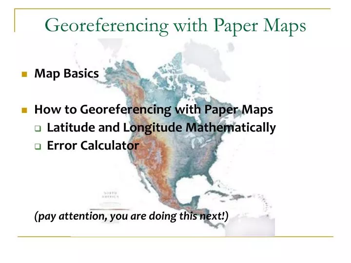
Georeferencing with Paper Maps. Map Basics How to Georeferencing with Paper Maps Latitude and Longitude Mathematically Error Calculator (pay attention, you are doing this next!). Pros and Cons of Paper Maps. Pros

E N D
Georeferencing with Paper Maps • Map Basics • How to Georeferencing with Paper Maps • Latitude and Longitude Mathematically • Error Calculator (pay attention, you are doing this next!)
Pros and Cons of Paper Maps Pros • Necessary for certain localities, such as distances by road and topographic features, especially when GIS layers are not readily available • Extents more readily obtained • Old paper maps may be the only option for obtaining coordinates for historic localities Cons • Time-consuming • Good quality paper maps may be hard to find • Map printing errors
Map Basics • Projection • Map Anatomy: • Scale • Graticule • Datum • Citing Map as Georeferencing Source
Projection Map projection is about rendering 3D into 2D. Map projection is about compromises in order to preserve either area, linear distance or shape. Which compromise is right for the map?
Projection Geographic preserves NS distance Mercator preserves shape (terrible for poles, distorts area)
Projection Winkel Tripel (NGS solution) reduced distortion in both area and distance
“Butterfly” map – Cahill 1909 • emphasis on symmetry • preserves area, shape • contiguous land masses Projection
Projection: Regional Squat California (Geographic) vs. Equal-Area California (Teale Albers)
Map Anatomy: Map Scale Header
Map Anatomy: Map Scale • Usually recorded as a ratio, such as 1:100,000, or a fraction, such as 1/100:000 • “Large scale” (Fine scale) maps, such as 1/10,000, show finer detail, less area • “Small scale” (Broad scale) maps, such as 1/500,000, show less detail, greater area • Think of “large” & “small” scale as the value of 1 in the fraction. • Example 1/10,000 > 1/500,000
Map Anatomy: Map Scale 1:1,000,000 Small Scalesmaller than before
Map Anatomy: Grid Map with no grid labeled
Map Anatomy: Grid • Shows the placement of the parallels and meridians on maps • Used to determine latitude and longitude • Maps with graticule cannot be used to determine coordinates – only to determine extents • Can have more than one grid system in place (e.g., easting and northings for UTM and latitude and longitude)
The Grid/ Graticule UTM Northings UTM Eastings
Map Anatomy: Datum Map with no grid labeled
Map Anatomy: Datum • If datum is recorded, usually found near the map scale or publisher’s name • Use Horizontal Datum, not Vertical • Occasionally, if no datum is recorded but the reference ellipsoid is, then one can determine the datum using the pdf document found at http://earth-info.nga.mil/GandG/publications/tr8350.2/wgs84fin.pdf (Use Appendix B)
Determining Coordinates from Paper Maps: Georeferencing Source • For Georeferencing Sources be sure to include the following: • Publisher name • Map Date • Map Scale • Map name • Example: USGS 15’ Topographic Series Boone 1956 or • USGS Topoquad 1:24000 Key West 1962
Determining Coordinates from Paper Maps • Paper maps are necessary when gazetteers will not report needed coordinates • Especially useful for distances by roads and topographic features like rivers and mountain ranges • Pay special attention to the grid lines and the hemisphere (latitudes in the southern hemisphere are negative, and longitudes in the western hemisphere are negative) when reporting in decimal degrees
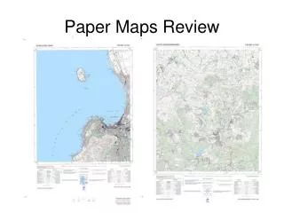
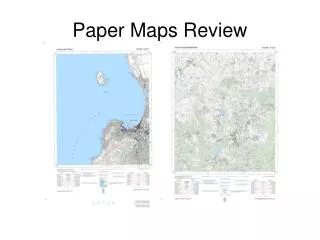
Determining Coordinates from Paper Maps Nauru Island, Pacific Islands Geographic Society, 1960 1:12,000
Determining Coordinate Precision Determining Coordinate Precision for the Georeferencing Calculator: The smallest measurement using our rulers is 1 mm ( = 0.1 cm), therefore we need to convert millimeters to minutes: 0.1 cm x (2 minutes/14 cm) = 0.014 min Choose the next largest fraction of a minute on the calculator. For 0.014 minutes, select 0.1 minutes.
In Conclusion • Pay attention to whether you should add or subtract the offsets to the grid points • Measure from the center of your feature to the edge for extent • Plot your coordinates to double check your work • Explain any decisions you had to make in the GeoreferenceRemark field • Explain any errors in the locality description in the LocalityErrors field
For Georeferencing Source be sure to include the following: • Publisher name • Map Date • Map Scale • Map name • Example: United States Geological Society (USGS) Topographic Map California, 1956, map scale 1:24,000, map name “Boone” • Determining Lat and Long: Determining Coordinate Precision: • 0.1 cm x (2 minutes/14 cm) = 0.014 min • Round up to 0.1 minute precision
Determining Coordinates Using the Error Calculator • Find a set of coordinates on the map from which lat and long increase. This is your “starting point” • Measure orthogonal offsets from these coordinates • Use calculator to determine “end point” coordinates • Use the calculator a second time for the error calculation Latitude Increases Longitude Increases
Measuring Orthogonal Offsets from Grid Coordinates Measure distance south of latitude grid line. Measure distance east of longitude grid line.