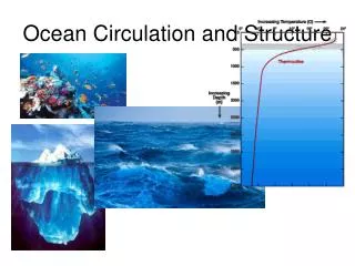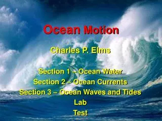
Ocean Structure and Motion
Ocean Structure and Motion. Tides. Essential Questions. What are tides? What are the different types of tides? How do we measure and predict tides? What are the consequences of tides?. What are tides?. Definition.

Ocean Structure and Motion
E N D
Presentation Transcript
Essential Questions • What are tides? • What are the different types of tides? • How do we measure and predict tides? • What are the consequences of tides?
Definition • Tides are the regular rising and falling of the sea. Tides are very long-period waves that move through the oceans in response to the forces exerted by the moon and sun • When it is HIGH tide, the water has come a long way up the beach and at LOW tide you will see lots of the shore because the sea has gone a long way out. • There are about TWO high tides and TWO low tides a day.
Cause? • Tides are due to the gravity of the Moon trying to pull the part of the sea closest to it towards it. • The Sun also has a gravitational effect on the sea. Although the Sun is larger than the Moon, it is further away from the Earth, which means that it has less effect on our tides. High Tide Low Tide
The Earth rotates once every 24 hours • The Moon rotates around the Earth once every 27 days • The result is a tidal period which is 24 hours and 50 minutes • Most places on Earth have 2 high and 2 low tides each separated by 12 hours and 25 minutes • High tide and low tide are separated by 6 hours and 12.5 minutes • Twice a month, during the new moon and the full moon, the Moon and the Sun are in line with the Earth and so they pull together. This causes very high high tides and very low low tides
What causes the 2 Bulges • On the side of the Earth facing the moon (the near-side) gravity pulls the water towards the Moon • On the side of the Earth away from the moon (the far-side) the Moon’s gravity is not strong enough to cause a bulge. • Here inertia causes the water to continue to travel away from Earth, resulting in the far-side bulge
What affects Tide heights • Tidal heights are also strongly influenced by the shape of the shoreline • When oceanic tidal bulges hit wide continental margins, the height of the tides can be magnified. • Conversely, mid-oceanic islands not near continental margins typically experience very small tides of 1 meter or less • The shape of bays and estuaries also can magnify the intensity of tides. • Funnel-shaped bays in particular can dramatically alter tidal magnitude • Narrow inlets and shallow water also tend to dissipate incoming tides
Weather and winds • Strong offshore winds can move water away from coastlines, exaggerating low tide exposures. • Onshore winds may act to pile up water onto the shoreline, virtually eliminating low tide exposures • High-pressure systems can depress sea levels, leading to clear sunny days with exceptionally low tides. • Conversely, low-pressure systems that contribute to cloudy, rainy conditions typically are associated with tides than are much higher than predicted
Based on pattern of appearance Diurnal Semi-diurnal Mixed Based on tidal range Spring Neap Tide Types
Tides based on pattern of appearance • Diurnal • When there is only 1 high and 1 low tide per day • Semi-diurnal • When the 2 high tides and 2 low tides are about the same height • Mixed • When the 2 high tides and 2 low tides are different heights
Types of tides based on tidal range • Neap Tide • Tides with a lower high tide and a higher low tide, results in a less than average tidal range • Occur during the first and third quarters of the moon • A result of the gravitational forces of the Sun and Moon being cancelled out
Spring Tide • Tides with the highest high tides and the lowest low tides, results in a larger tidal range • Occur during the full or new moons • A result of the combined gravitational force of the Sun and Moon
Tidal Terms • Tidal range • The difference in height between the high tide and the low tide • Flood current • incoming tide along the coast and into the bays and estuaries • Ebb current • the outgoing tide
Tidal Terms continued • National Tidal Datum Epoch – • The specific 19-year period adopted by the National Ocean Service as the official time segment over which tide observations are taken and reduced to obtain mean values for tidal datums. • Mean Higher High Water (MHHW) • The average of the higher high water height of each tidal day observed over the National Tidal Datum Epoch. • Mean High Water (MHW) • The average of all of the high water heights of each tidal day observed over the NTDE. • Mean Sea Level (MSL) • The arithmetic mean of hourly heights observed over the NTDE.
Tidal Terms continued • Mean Tide Level (MTL) • The arithmetic mean of mean high water and mean low water. • Mean Low Water (MLW) • The average of all of the low water heights of each tidal day observed over the NTDE. • Mean Lower Low Water (MLLW) • The average of the lower low water height of each tidal day observed over the NTDE.
Today's recorders send an audio signal down a half-inch-wide sounding tube and measure the time it takes for the reflected signal to travel back from the water's surface. The sounding tube is mounted inside a 6-inch diameter protective well • This system also records 11 different oceanographic and meteorological parameters. These include wind speed and direction, water current speed and direction, air and water temperature, and barometric pressure.
Stations collect data every six minutes • Timing is controlled on stations by a Geostationary Operational Environmental Satellite (GOES). • The stations also use these satellites to transmit their data hourly to NOAA headquarters. • In the event of a storm, the stations can be programmed to transmit their data every six minutes. • Field teams can quickly check and maintain the systems using laptop computers. • In addition, all of the raw and processed data are available over the Internet.
Who uses tidal information • Commercial and recreational fishermen use their knowledge of the tides and tidal currents to help them improve their catches • Navigation of ships into ports • Coastal zone engineering projects, including the construction of bridges, docks, etc. • Scientists are concerned with tides, water levels and tidal currents – tidal mixing, pollutants, ocean circulation, climate, movement of floating species • Recreational beachgoers and surfers
Erodes the shoreline and the near shore sea bottom. • Deposits or removes items from the shore. • Brings food and removes waste from tidal communities.