Download
1 / 32
340 likes | 868 Views
Quantifying the impact of soil erosion. Nesrin Negm Helene Pühringer. Overview. Introduction Objectives General description of the problem Models and Methods USLE RUSLE SEMMED INRA PESERA Difficulties Conclusion. Introduction. Growing importance of soil erosion

E N D
Quantifying the impact of soil erosion Nesrin Negm Helene Pühringer
Overview • Introduction • Objectives • General description of the problem • Models and Methods • USLE • RUSLE • SEMMED • INRA • PESERA • Difficulties • Conclusion
Introduction • Growing importance of soil erosion • Actions taken to prevent future hazardous events • Overall objective of quantification of soil erosion: Prevention of soil erosion and its impacts • Necessity of quantifying impacts: policy makers laws on a scientific and measurable basis Comparison
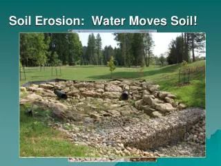
Introduction • Soil erosion: • Is a natural process that determines soil formation • Accelerated by human activities • Caused by inappropriate agricultural practices, deforestation, overgrazing and construction activities • Natural: by wind and water • Runoff plays the biggest role • Irreversible degradation of soil • leads to loss of nutrients and organic matter • negative impact on water holding capacity and soil structure • Development of models to quantify impacts
Actual soil erosion risk in Europe, (Source: Grimm et al., 2001)
Models and Methods • For development of models differentiation between expert based and model based methods • Expert based: Qualitative appraoch • Eg: RIVM soil erosion model, CORINE programme, GLASOD (Global Assessment of Soil Degradation), Hot Spots map commissioned by the EEA • Model based: Quantitative approach • USLE (Unversal soil loss equation) • RUSLE (Revised USLE) • SEMMED (Soil erosion model for mediterranean regions) • INRA (Institute national de la recherche agronomique) • PESERA (Pan European soil erosion risk assessment)
USLEUniversal Soil Loss Equation • Empirical model based on regression analysis • Most used due to low data demand and simple and robust application • Standardised approach • Used at many different scales • Originally developed for long term erosion on agricultural field • Production of first European map of quantitative rill and sheet erosion • not suitable for the prediction of the occurrence of mass movements like landslides
USLEUniversal Soil Loss Equation A = R ⋅ K ⋅ L ⋅ S ⋅C [t ha-1 a-1] Where: A : Mean (annual) soil lossR : Rainfall erosivity factorK : Soil erodibility factorL : Slope factorS : Slope length factorC : Cover management factor
USLEUniversal Soil Loss Equation Rainfall erosivity factor R: • Intensity of rainfall • Relation between rainfall energy E and a maximum of 30 Minutes rainfall intensity I30 • data are mostly not available at standard meteorological stations • another estimation for R had to be found • best way: use correlation between readily available meteorological parameters and the R factor
USLEUniversal Soil Loss Equation Rainfall erosivity factor R: • For Germany/ representative for northern-European conditions (Rogler& Schwertmann)R= 10 *(-1.48 + 1.48 *Ns) • Where :R : Mean annual erosivity (MJ.mm.ha-1 h-1 y-1)Ns : Mean rainfall amount in summer (May-October) (mm) • For Italy/representative for southern Europe conditions (Zanchi)R = α *PP: Annual rainfall (mm)α:1.1-1.5
USLEUniversal Soil Loss Equation Rainfall erosivity factor R: • Approaches give only an overview of patterns of erosion risk • very simplified • not suitable for a detailed quantitative analysis
USLEUniversal Soil Loss Equation Soil erodibility factor K: • Rate of soil loss per unit of R • widely used in several soil erosion models • determined by the use of runoff plots • unreliable results are produced when applied to soils with textural extremes (European conditions)
USLEUniversal Soil Loss Equation Soil erodibility factor K: With:K : Soil erodibility factor (t ha h ha‐1 MJ‐1 mm‐1)Dg : Geometric mean weight diameter of the primary soil particles (mm)
USLEUniversal Soil Loss Equation Slope and Slope Length Factor S&L: • accounts for the effect of topography on soil erosion • based on the angle of the slope Where:As : Specific contributing area (m2/m)β : Slope angle (degrees)
USLEUniversal Soil Loss Equation Cover Management Factor C • percentage of vegetation cover and growth stage • effect of mulch cover, crop residues and tillage operations influence C • defined as the ratio of soil loss from land cropped under certain conditions to the loss from continuous fallow • NOAA AVHRR (‘Advanced Very High Resolution Radiometer) used to determine approximate C-factor values
USLEUniversal Soil Loss Equation • due to the small scale used, almost impossible to assess the effect of management practices (one of most important factors for erosion) • Improvements: • Using a more detailed digital elevation model • Better illustration of rainfall erosivity • Satellite data with better spectral and geometric properties for estimating the vegetation cover • More detailed soil data (soil depth, stone volume, surface texture)
RUSLERevised USLE • Improved version of USLE • revised determining factors are as following: • some new and revised maps • a time‐varying approach for soil erodibility factor • a new equation to reflect slope length and steepness • a new conservation‐practice values • a subfactor approach for evaluating the cover‐management factor
SEMMED ModelSoil erosion model for mediterranean regions • Input variables used in this model based on standard meteorological data, soil maps, multitemporal, satellite imagery, digital elevation models and a limited amount of field data • allows assessement of erosion risks over large and spatially diverse areas • Application of this model makes extensive field surveys redundant • By now applied for producing regional erosion risk maps of parts of southern France
INRA Institute national de la recherche agronomique • mid-step in the direction of a “state of the art erosion modelling at the European scale” following USLE & before the introduction of the PESERA project • Using empirical rules • combining data on land use, vulnerability towards soil crusting, soil erodibility, relief and meteorological data • Units for presentation of results: • Administrative units (EC nuts regions) • Watershed catchment units
INRA Institute national de la recherche agronomique • Objectives: • developing and applying a methodology that is grounded on current knowledge and available data for assessing soil erosion risk at European level • Assessing mean seasonal erosion risk at the regional scale • Assumption • Key factors influencing runoff and erosion risk: • Land cover • Crust formation • Soil Erosion due to surface runoff, moves soil downslope
INRA Institute national de la recherche agronomique • Outcome: • Single homogeneous map of erosion risk at European scale • Allows comparison between regions • Depending on land use, different types of erosion are considered • Seasonal maps can be producedshow efffect of seasonality on erosion • Possibility to adjust results to various user needs • Model is easy to alter • Possibility of using heterogeneous data resolution and quality
PESERA Pan European soil erosion risk assessment First main objective: • developing and calibrating a process-based and spatially distributed model in order to quantify soil erosion by water and in a further step assess its risk in Europe • It’s planned to include estimates of tillage and wind erosion
PESERA Pan European soil erosion risk assessment Second main objective: • validation of the model’s development at low and high resolutions and through diverse agro-ecological zones,comparing the model’s output with other methods or models in the field of erosion risk assessment • Demonstration of the model’s performance with different data input and at different resolutions provides information on its robustness and flexibility
PESERA Pan European soil erosion risk assessment Third main objective: • ensuring the relevance of the model for policy-makers • Establishment of a strong expert and end-user network across Europe important for enabling further developments
PESERA Pan European soil erosion risk assessment • At europeanscale, necessary to develop an effective tool for erosion risk assessment and to offer it as a part of decision support systems for exploring the implications of policy options • Assessing the impact of the physical loss of soil is a high importance for policy making • The model sticks tight to hydrological models, takes spatial distribution patterns of sediment loss into account • By a sediment transport equation (with terms for topography, overland flow runoff and soil erodibility) erosion rates in individual storms can be estimated
Difficulties • Quantitative models show problems at regional or larger scale • Models developed on a smaller scale (plot or field) • intended for generating point estimates of soil loss • Example: USLE developed for prediction of rill- and inter-rill erosion not appropriate forareas that are affected by gully erosion or mass movements like landslides and rockfalls • On regional scale downscaling to field scale is almost impossible results in parameter values that are more inexact than field survey • Result of model is rather a broad overview of the pattern of the relative differences than accurate erosion rates at individual points
Conclusion • Still questionable how good the conversion of vulnerability of land use systems and its corresponding degradation by erosion into information is, which is available for policy maker works, so that they can develop a suitable mitigation strategy • There has already been big step done towards an appropriate soil erosion prevention in Europe but there is still a lot to improve