Download
1 / 24
240 likes | 399 Views
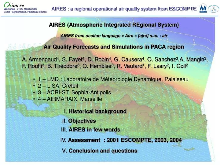
I. Historical background. II. Objectives. III. AIRES in few words. IV. Assessment : 2001 ESCOMPTE, 2003, 2004. V . Conclusion and questions. AIRES (Atmospheric Integrated REgional System) AIRES from occitan language « Aire » [ajré] n.m. : air

E N D
I. Historical background II. Objectives III. AIRES in few words IV. Assessment : 2001 ESCOMPTE, 2003, 2004 V. Conclusion and questions AIRES (Atmospheric Integrated REgional System) AIRES from occitan language « Aire » [ajré] n.m. : air Air Quality Forecasts and Simulations in PACA region • A. Armengaud4, S. Fayet4, D. Robin4, G. Causera4, O. Sanchez3,A. Mangin3, • F. Rouffi3, B. Théodore3, O. Hembise3, R. Vautard1, F. Lasry2, I. Coll2 • 1 – LMD : Laboratoire de Météorologie Dynamique, Palaiseau • 2 – LISA, Creteil • 3 – ACRI-ST, Sophia-Antipolis • 4 – AIRMARAIX, Marseille
HISTORICAL background 2001 : SCIENTIFIC PROGRAM ESCOMPTE EMISSIONS INVENTORY CADASTRE MODELLING EXERCICE ESCOMPTE 2005 : OPERATIONAL REGIONAL SYSTEM ESCOMPTE Spin-off DAILY FORECAST AND SIMULATION OF AIR QUALITY IN PACA REGION
Forecasts 24h, 48h OBJECTIVES Daily Observations Network PACA Monitoring survey Analyse and valuation Air Quality Tomorrow Yesterday Today Tendancy • Improvement of monitoring survey • Improvement of understanding • Maps
AIRES in few words • AIRES (Atmospheric Integrated REgional System) : • Air quality forecast and simulation system in PACA region (Provence Alpes Côte d’Azur). Daily 3D forecasts of ozone, nitrogen oxides, aerosols and others pollutants. • based on CHIMERE and MM5 models (www.mmm.ucar.edu/mm5/). • Chemical boundary conditions : from PREV’AIR (www.prevair.org). • AIRES provides fine resolution forecasts at 12h, 24h and 48h over 3 different areas (ESCOMPTE, NICE and whole PACA). • Partners : ACRI-ST (www.acri-st.fr), IPSL and LISA, CHIMERE research team (http://euler.lmd.polytechnique.fr/chimere/index.html).
AIRES in few words Monitoring Survey Model + obs. Geostatistical process (from INERIS) 3 modes : Forecast Scenario Outside of PACA CHIMERE MM5 www.prevair.org 1km-3km
MESO-NHC Assessment AIRES is taking part in the ESCOMPTE modelling exercise with ACRI-ST participation. Example of comparison between MESO-NHC, CHIMERE-ACRI and observations 12h T.U. 21st of June 2001, IOP2a. CHIMERE-ACRI Observations
Assessment Comparison between ozone temporal profile from AIX PLATANES ground station (black dots) and CHIMERE-ACRI (model, bold violet line). Others color lines represent all models involved in the ESCOMPTE modelling exercise.
Assessment Comparison between ozone vertical profile from ALTO LIDAR (observations, left) and CHIMERE-ACRI (model, right) during IOP2b.
Begining of the episode 30thof July for 1st of August Assessment SUMMER 2003 : first try by Dr. Robert Vautard MM5+CHIMERE over ESCOMPTE 240 µg/m3 180 µg/m3 From 1/08/2003 to 16/08/2003 16 consecutives days
OBS D+1 Still no O3 31st of july D+2
OBS D+1 Begining of the episode 1st of August D+2
During the episode SUMMER 2003 240 µg/m3 180 µg/m3 From 1/08/2003 to 16/08/2003 17 consecutives days 03 peak
OBS D+1 D+2
OBS D+1 Etc … D+2
SUMMER 2003 Finally : 15th for 17th 240 µg/m3 180 µg/m3 From 1/08/2003 to 16/08/2003 16 consecutives days 03 peak
OBS D+1 D+2
PERSISTENCE SUMMER 2003 START END 240 µg/m3 180 µg/m3 From 1/08/2003 to 16/08/2003 16 consecutives days 03 peak
SUMMER 2004 240 µg/m3 180 µg/m3 Example : 23rd of July
OBS D-1 This system was operational in summer 2004 South West Breaze 23 July 2004
OBS D+1 D+0 D+2 23 July 2004
STATISTICS SUMMER 2004 40 days [O3] > 180 µg/m3 28 dys : 2000 66 dys : 2003 Forecasted / Observed % validated by a expert 04 84 J : 90 % J+1 : 80 % 06 J : 100 % J+1 : 85 % J : 100 % J+1 : 50 % Composed Breaze : Weak Mistral + South Breaze OVER-ESTIMATION In VAR Link with Boundary Conditions. NCEP download. Met files are not always available at the right moment. 83 13 J : 60 % J+1 : 50 % J : 78 % J+1: 68 %
CONCLUSION • AIRES is • Operationnal : Forecast, survey, scenario • Validated : (still in progress) • summers 2001 (ESCOMPTE), 2003 and 2004 • Provide daily datasets to experts who analyze air quality over the PACA region. • This information is taken into account for regional regulation information. • Upgreadeable et modular(links with IPSL, LISA, ACRI-ST) • In the near future: • AIRES will be involved in the PRIMEQUAL SCENARIOS PROGRAM. • It will be able to evaluate the different impacts of reductions emissions scenarios. • (I. COLL and F. LASRY – LISA) 16h20 today !
QUESTIONS • We are looking for tracks : forecast improvements in PACA region • Does-it possible to start earlier D-1 computation ? Spin-up pb. For the first hours ? • CHIMERE DUST version ? • - Users returns ? • - specials needs (inventory) ? • - computer time versus « CHIMERE GAS version » • - parallel version ? • Exchange with others CHIMERE’s users • Specially with people who are faced with Breazes Phenomena • Pond Breaze • Sea Breaze • Valley Breaze