Download
1 / 31
310 likes | 528 Views
Crisis Mapping applications of google maps engine. Joel Irish | GEOG 596A Peer Review Presentation | May 5, 2014. Introduction. Why did I chose this capstone project? Crisis Mapping is young Google Maps Engine is even younger. Research Gap. Personal. Academic.

E N D
Crisis Mapping applicationsof google maps engine Joel Irish | GEOG 596APeer Review Presentation | May 5, 2014
Introduction Why did I chose this capstone project? Crisis Mapping is young Google Maps Engine is even younger. Research Gap Personal Academic Professional
Introduction Refining the problem Crisis Management Crisis Mapping Crisis Mapping with Google Maps Engine
Top-level Problems When crises occur, one of the most valued commodities among stakeholders is geospatial information. Acquiring and communicating actionable data is challenging. Data should be: Timely Accurate Complete Contextual Different stakeholders, different problems…
Top-level Problems Emergency Management Problems Damaged infrastructure Multi-jurisdictional data management communication Differing degrees of preparedness Systems reliability Phases of Emergency Mgt
Top-level Problems Victims within an impacted area Family and friends of those victims Damaged infrastructure No information Unreliable information Evacuation routes Shelter Food and water
Top-level problems In the heat of a crisis, complete, accurate, contextualinformation may not reach the broader community. Media NGOs, Non-Profit Orgs Governments
What is crisis mapping? And how does it address these issues in crisis management?
Literature review Defining the “crisis map”: Crisis maps draw on multiple disciplines to gather, analyze and communicate a variety of geospatial information in support of crisis management efforts. Modern history of crisis maps Google Hurricane Katrina 2005 Ushahidi Kenya Elections 2007 Ushahidi Haitian earthquake 2010
Literature review Current expectations of crisis maps Cloud architectures Web cartography & geovisual analytics Usability design Interactive and distributable Mobile support
Literature review Data Source Trade-offs
Second-level Problems Crisis Map technology is evolving faster than our ability to completely understand its suitability, effectiveness and impact. [Shanley, 2013] Acknowledging risks Privacy Security Espionage Additional Challenges Costs Reliability Ubiquity Distribution
Final Problem Statement: Research Gap It is still unclear how well and in which ways Google Maps Engine has served and can serve as an effective crisis mapping platform.
Google Maps Engine 101 Overview and history Software as a Service What it does, its purpose Continuously developing and growing as a product
The GME “TriForce” Cost Function
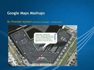
Examples of GME crisis maps Producer: User
Examples of GME crisis maps Producer: Government
Examples of GME crisis maps Producer: Google
purpose Determine how well and in which ways Google Maps Engine has served and can serve as an effective crisis mapping platform.
Methodology • Step 1: Quantitative analysis on the existing corpus of GME crisis maps • Step 2: Conduct verbal protocol analysis and cognitive Interviews with new GME users • Step 3: Investigate advantages of non-Google crisis maps • Step 4: Synthesize conclusions
Methodology Step 1:Quantitative analysis on the existing corpus of GME maps • Collect as many GME crisis maps as possible Currently, 75 GME Crisis Maps collected and counting. • Early distribution of GME crisis maps • Hotspots • Boulder flooding • Typhoon Haiyan • Winter storms in Sioux Falls and Atlanta • Violence in Syria
Methodology (b) Run quantitative analysis on numerous map criteria
methodology Step 2:Usability testing: protocol analysis and cognitive interviews Perform small usability test • Authoring; • Interpreting; • Using verbal protocol assessment to explore how new users behave and succeed using GME maps. Process design 1. Gather group of ~10 end users who have not used GME at all 2. Allow him/her to explore GME for 5 minutes 3. Once acclimated, ask them to complete a series of tasks and articulate what they are doing and thinking as they go. 4. Give a series of tasks, from very simple to very complex. 5. Ask follow up questions when the user get stuck, or when they do something in a strange way. 6. End with cognitive interview: let them discuss the experience
methodology Step 3:Evaluate a sample of non-Google crisis maps • Producer, Contributors, Audience • Data sources and other metadata • Portability • Responsiveness • Data visualization • Interactivity • Complexity • Usability • Mobile support
Methodology Step 4:Synthesize conclusions Determining whether the existing usage and functionality of GME versions (because they could be different) are suitable for crisis mapping.
Early Findings Pros: Highly reliable Lite & Pro are low cost Lite & Pro easy to use Full Google Maps Engine is flexible Cons: Lite & Pro inadequate for most authoritative data Full Google Maps Engine too complex for casual use Full Google Maps Engine too costly for most users Lack of versioning Lack of temporal animation
timeline • Preparing research (February - April) • Conducting research, writing abstract (May - June) • Developing conclusions (July - August) • Presenting results (September - October)
Further work to be done • What are the most common avenues for GME crisis map sharing? • Are map authors validating crowdsourced maps? How? • How are Google, its partners and its competitors approaching legal and licensing obstacles before and during crises?
Works cited Baxter, Anthony. “Google Crisis Response | Hurricane Sandy”. October 2012. http://aemi.edu.au/EMC/assets/9-google-crisis-response---hurricane-sandy---anthony-baxter-.pdf Cavelty, Myriam Dunn and Jennifer Giroux. “Crisis Mapping: A Phenomenon and Tool in Emergencies”. CSS Analysis in Security Policy. November 2011. http://isn.ethz.ch/Digital-Library/Publications/Detail/?lng=en&id=133958 Chamales, George. “Towards trustworthy social media and crowdsourcing”. Policy Memo Series, Vol 2. May 2013. http://www.wilsoncenter.org/sites/default/files/TowardsTrustworthySocialMedia_FINAL.pdf Cisco. “Cisco Visual Networking Index: Global Mobile Data Traffic Forecast Update, 2013–2018” February 5, 2014 http://www.cisco.com/c/en/us/solutions/collateral/service-provider/visual-networking-index-vni/white_paper_c11-520862.html Edwards, Jim. “Twitter’s ‘Dark Pool’: IPO Doesn’t Mention 651 Million Users Who Abandoned Twitter”. Business Insider. November 6, 2013. http://www.businessinsider.com/twitter-total-registered-users-v-monthly-active-users-2013-11 Elwood, Sara. “Critical issues in participatory GIS: Deconstructions, reconstructions, and new research directions”. 2006. Transactions in GIS, 10(5), 693–708. Fung, Vincent. “Crisis Mapping and Disaster Risk Reduction.” December 16, 2011. http://www.unisdr.org/archive/24223 Gilbert-Knight, Ariel. “Social media, crisis mapping and the new frontier in disaster response”. The Guardian, Global Development Professionals Network. 8 October 2013. http://www.theguardian.com/global-development-professionals-network/2013/oct/08/social-media-microtasking-disaster-response. Goodchild, Michael F., and J. Alan Glennon. “Crowdsourcing geographic information for disaster response: a research frontier”. International Journal of Digital Earth. April 15, 2010. http://www.tandfonline.com/doi/pdf/10.1080/17538941003759255 Greenberg, Brandon. “Why is Crisis Mapping So Popular?” Emergency Management, Disaster Preparedness & Recovery. October 23, 2013 http://www.emergencymgmt.com/disaster/Crisis-Mapping-Popular.html. Liu, Sophia B. and Leysia Palen. “The New Cartographers: Crisis Map Mashups and the Emergence of Neogeographic Practice”. March 14, 2013. https://www.cs.colorado.edu/~palen/Home/Articles_by_Year_files/TheNewCartographersLiuPalen.pdf Mann-Jackson, Nancy. “Google Maps Engine Streamlines Emergency Management”. Acronym Online. September 24, 2012. http://acronymonline.org/google-maps-engine-streamlines-emergency-management/ Mayer, Robinson. “How Online Mapmakers Are Helping the Red Cross Save Lives in the Philippines”. The Atlantic. November 12, 2013. http://www.theatlantic.com/technology/archive/2013/11/how-online-mapmakers-are-helping-the-red-cross-save-lives-in-the-philippines/281366/ McDougall, Kevin. “An Assessment of the Contribution of Volunteered Geographic Information During Recent Natural Disasters”. August 31, 2012. http://www.gsdi.org/gsdiconf/gsdi13/papers/227.pdf. Meier, Patrick. “How Crisis Mapping Saved Lives in Haiti”. National Geographic, Explorers Journal. July 2, 2012. http://newswatch.nationalgeographic.com/2012/07/02/crisis-mapping-haiti/ Meier, Patrick. “Crisis Maps: Harnessing the Power of Big Data to Deliver Humanitarian Assistance” Forbes. May 2, 2013. http://www.forbes.com/sites/skollworldforum/2013/05/02/crisis-maps-harnessing-the-power-of-big-data-to-deliver-humanitarian-assistance/ OCHA. “Big Data and Humanitarianism.: 5 things you need to know”. 27 June, 2013 http://www.unocha.org/top-stories/all-stories/five-things-big-data-and-humanitarianism Poblet, Marta. “Visualizing the law: Crisis mapping as an open tool for legal practice”. Journal of Open Access to Law. Vol., No. 1 , 2013. http://ojs.law.cornell.edu/index.php/joal/article/download/12/13 Raymond, Nathaniel, Caitlin Howarth and Jonathan Hutson. “Crisis Mapping Needs an Ethical Compass”. Global Brief. February 6, 2012. http://globalbrief.ca/blog/2012/02/06/crisis-mapping-needs-an-ethical-compass/ Robinson, Anthony C, Robert E Roth, and Alan M. MacEachren. “Challenges for Map Symbol Standardization in Crisis Management” Proceedings of the 7th International ISCRAM Conference. Seattle. May 2010. http://www.geovista.psu.edu/publications/2010/222-Robinson_etal.pdf Shanley, Lea. “Tweeting up a Storm: the promise and perils of crisis mapping”. October 2013. http://www.wilsoncenter.org/publication/tweeting-storm-the-promise-and-perils-crisis-mapping Thomas, J. J. and Cook, K. A. ”Illuminating the Path: The Research and Development Agenda for Visual Analytics” IEEE, Los Alametos, CA. 2005.
Works cited Questions? Comments?
Appendix: • Example of the verbal protocol analysis