Download
1 / 23
230 likes | 350 Views
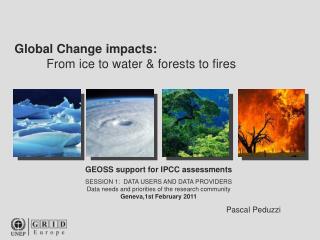
The WCRP (World Climate Research Programme) Workshop, held from February 1-4, 2011, focused on enhancing climate projections at global and regional levels, addressing observational data sets, reanalyses, and the challenges faced in climate modeling. With contributions from leading scientific organizations like WMO, IOC of UNESCO, and ICSU, the workshop fostered collaborative efforts including CMIP5 to provide higher-resolution climate data. Key areas such as decadal predictions, regional downscaling, and climate risk management, particularly in the Greater Horn of Africa, were prioritized to support sustainable development amid climate change.

E N D
World Climate Research ProgrammeData support to IPCC Assessments GEOSS support for IPCC Assessments Workshop 1-4 February 2011 Valery DetemmermanWCRP
Outline • Climate Projections • Global • Regional • Observational data sets • Reanalyses and reprocessing • Challenges
WCRP SPONSORS: WMO, IOC of UNESCO, ICSU Joint Scientific CommitteeJoint Planning Staff for WCRP PROJECTS MODELLING OBS&Analysis CROSS CUTS • ● CliC ● WGCM ● WOAP ● Anthropogenic Climate Change • ● CLIVAR ● WGNE (w/GCOS) ● Regional Climate Downscaling • ● GEWEX (w/WWRP) ● Seasonal Climate Prediction • ● SPARC ● Decadal Variability, Predictability • ● Sea-level Variability and Change • ● Climate Extremes • ● Atmospheric chemistry,Dynamics ● Monsoon and Climate
Climate Projections - Daily Download Rate 1 TB Interest in WCRP PCMDI CMIP3 resultscontinues unabated! • More than 550 peer- reviewed publications. • ~1 Pbyte of data downloaded . • More than 3,000 • registered users. 2010 2004
Climate Projections • Progress CMIP3 to CMIP5: • More experiments to quantify model sensitivity and feedbacks. • Earth System Models - interactive carbon cycle, atmospheric chemistry, ozone chemistry, land-surface schemes (with IGBP AIMES). • Increased Resolution - including NWP models, eddy permitting ocean models, stratosphere-resolving atmospheric models • Decadal prediction experiments to test a variety of initialization techniques
Climate Projections CMIP5 - Unprecedented International Coordination CMIP5 participating groups (20+ groups; ~40 models). 2.3Pbytes of model output expected - 100 times greater than CMIP3. Model data will be accessed by the Earth System Grid - output will be served by federated centers around the world and will appear to be a single PCMDI archive.
Regional Climate Downscaling • Coordinated Regional Downscaling Experiment (CORDEX) • High-quality, region specific, climate projections for most regions in the world. • First priority is to develop a comprehensive and high resolutions climate change data set for Africa. • CORDEX archive at Danish Meteorological Institute
CORDEX domains Arctic NARCCAP ENSEMBLES RCMIP CLARIS Antarctic
Education and Capacity Development Climate Observations and Regional Modelling in Support of Climate Risk Managements and Sustainable Development of the countries of the Greater Horn of Africa (GHA). Three workshops • demonstrate the use and value of regional models, • provide advice on model limitations • improve capabilities across the GHA for using data records and model projections for adaptation planning in particular for the agriculture/food security and water resources sectors.
WCRP GEWEX Climate Data Records • climate data records of global water and energy variables such as clouds, radiation, aerosols, precipitation etc., complete with metadata and error analysis. • blend of satellite and in-situ observations covering in most cases more than 25 years. • periodic comparison and assessment against other products in an open and transparent fashion and are available to everyone without restrictions.
Pentad GEWEX Available Global Datasets Daily 3 – 6 hrs TIME 1979 1985 1990 1995 2000 2005 2010 Parameter Clouds Water Vapor 50 km Precipitation 250 km 100 km TOA Radiation 100 km SRF Radiation 100 km 50 km Evaporation Atmospheric Circulation 50 km
Sea-Level Variability and Change Focus 1 : Improve understanding of the risk of higher mean sea-level rise in the 21st century, and Antarctica and Greenland contributions. Focus 2 : Regional sea-level rise and coastal impacts.
Extreme Events and Climate Change Cat 4+5 frequency: 81% increase, or 10% per decade Estimated net impact of these changes on damage potential: +28% Bars show changes for the18 CMIP3 model ensemble (27 seasons); dots show range of change across 4 individual CMIP models (13 seasons). Bender et al., Science, 2010
Droughts Climate Model Evaluation Project (DRICOMP) Implications for future global droughts SSTA patterns Courtesy of Kirsten Findell (GFDL-NOAA-USA)
Atmospheric Reanalyses • 4 major reanalyses groups: JMA, NOAA, NASA, ECMWF • Many reanalyses on going - ASR | ERA-40 | ERA-Interim | JRA-25 | NASA MERRA | NCEP CFSR | NCEP/DOE II | NCEP/NCAR I | NCEP NARR | NOAA-CIRES 20CR • WCRP Observations and Assimilation Panel has special WG (with GCOS) to help coordinate these efforts • The goal of reanalyses.org is to facilitate comparisonbetween reanalysis and observational datasets
Many users: > 10000 registered users via ECMWF public data services ≳5M fields retrieved daily by ECMWF and Member-State users National mirror sites for ERA in many countries And many citations: Paper on NCEP/NCAR reanalysis is most cited paper in geosciences Paper on ERA-40 is most cited recently in the geosciences Many references in IPCC Fourth Assessment report Atmospheric reanalysis: The user base
“Observations” for verification and diagnosis Forecast model development, calibration of seasonal forecasting systems, climate model development; use of data assimilation increments for identifying model errors Input data for model applications for smaller-scales (global→regional; regional→local), ocean circulation, chemical transport, nuclear dispersion, crop yield, health warnings, … Study of short-term atmospheric processes and influences process of drying of air entering stratosphere, bird migration, … Providing climatologies ocean waves, resources for wind and solar power generation, … Assessment of the observing system providing feedback on observational quality, bias corrections and a basis for homogenization studies; contributing to data reprocessing activities Study of longer-term climate variability and trends used with caution in conjunction with observational studies downstream climate services? Science applications that rely on reanalysis data
Reanalysis data produced at ECMWF ERA-15: 1979 – 1993 ERA-40: 1957 – 2001 ERA-Interim: 1989 onwards ORA-S3: 1959 onwards MACC: 2003 – 2010 • ERA-CLIM: • European Reanalysis of Global Climate Observations • An EU project to help prepare the next ECMWF reanalysis ERA-20C: 1900 onwards
ERA-CLIM data recovery and digitization focus on pre-1957 meteorological data in sensitive regions
Ocean reanalysis ARGO floats XBT (eXpandable BathyThermograph) Moorings Satellite SST Sea Level
Summary WCRP data for IPCC • Model output • Observations • Analyses: Comparison of observations with models
Challenges • Stewardship and continuity of existing observing networks • New observing systems (e.g., deep ocean, upper atmosphere, cryosphere) • Open and timely access to observed data