Download
1 / 13
130 likes | 266 Views
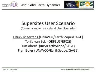
WP5 Solid Earth Dynamics. Supersites User Scenario ( formerly known as Iceland User Scenario) Chuck Meertens (UNAVCO/EarthScope/GAGE ) Torild van Eck (ORFEUS/EPOS) Tim Ahern (IRIS/EarthScope/SAGE) Fran Boler (UNAVCO/EarthScope/GAGE). 1. E POS & EarthScope.

E N D
WP5 Solid Earth Dynamics Supersites User Scenario (formerlyknown as Iceland User Scenario) Chuck Meertens (UNAVCO/EarthScope/GAGE) Torild van Eck (ORFEUS/EPOS) Tim Ahern (IRIS/EarthScope/SAGE) Fran Boler (UNAVCO/EarthScope/GAGE) 1 EPOS & EarthScope
The European Supersites (Iceland, Turkey, Italy)FUTUREVOLC An European volcanological supersite in Icelandprospective partner in a use case study of EarthCube/ENVRI/EPOS. Contact::Kristin Vögfjord (IMO)
WP5 Solid Earth Dynamics Building on the existing Infrastructure 3 EPOS & EarthScope
WP5 Solid Earth Dynamics Building on the existing Infrastructure SUPERSITES 4 EPOS & EarthScope
WP5 Solid Earth Dynamics GEO SuperSites/Natural Laboratories Integration SAR data from ASF, UNAVCO and space agencies (via SSARA API and federated query) Ground Geodetic Data from GSAC and federated “COOPEUS” archives Seismic API from federated “COOPEUS” archives
WP5 Solid Earth Dynamics GEO SuperSites/Natural Laboratories Integration SAR data from ASF, UNAVCO and space agencies (via SSARA API and federated query) SAR Data and products Ground Geodetic Data from GSAC and federated “COOPEUS” archives Seismic API from federated “COOPEUS” archives
WP5 Solid Earth Dynamics GEO SuperSites/Natural Laboratories Integration SAR data from ASF, UNAVCO and space agencies (via SSARA API and federated query) Geodetic Data and products Ground Geodetic Data from GSAC and federated “COOPEUS” archives Seismic API from federated “COOPEUS” archives
WP5 Solid Earth Dynamics GEO SuperSites/Natural Laboratories Integration SAR data from ASF, UNAVCO and space agencies (via SSARA API and federated query) Seismic Data and products Ground Geodetic Data from GSAC and federated “COOPEUS” archives Seismic API from federated “COOPEUS” archives
WP5 Solid Earth Dynamics GEO SuperSites/Natural Laboratories Integration SAR data from ASF, UNAVCO and space agencies (via SSARA API and federated query) Other Data and products Ground Geodetic Data from GSAC and federated “COOPEUS” archives Seismic API from federated “COOPEUS” archives
WP5 Solid Earth Dynamics GEO SuperSites/Natural Laboratories Integration SAR data from ASF, UNAVCO and space agencies (via SSARA API and federated query) GEOSS Portal Ground Geodetic Data from GSAC and federated “COOPEUS” archives Seismic API from federated “COOPEUS” archives
Draft Data Plan – Demonstrated Multidata Query Interface WP5 Solid Earth Dynamics Federated, Integrated query of GSAC, IRIS, and SSARA web services for Hawaii. The queries are on the fly to each archive/repository and aggregated for display and data access. A tool like this prototype will be developed for SSNL. Geodetic Data – Seismic Data – Satellite Radar Data: Federated Query and Aggregated Response http://54.235.157.42:8080/hawaii
Draft Data Plan – Demonstrated Multidata Query Interface WP5 Solid Earth Dynamics • What’s happening under our feet in Finland? • Glacial Isostatic Adjustment and uplift following the melting of the icecap ~8,000 years ago • Horizontal motions from plate tectonics
Draft Data Plan – Demonstrated Multidata Query Interface WP5 Solid Earth Dynamics • NASA-funded “Plug and Play GPS” • Steady long term horizontal motion from plate tectonics • Uplift with seasonal effects North East North East Vertical Vertical Station SG40 Helsinki