Download
1 / 16
160 likes | 332 Views
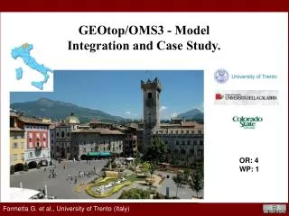
GEOtop /OMS3 - Model Integration and Case Study. OR: 4 WP: 1. Formetta G. et al., University of Trento (Italy). Outline. GEOtop. GOALS. OMS3. Application. Outline. GEOtop and Object Modelling System Goals of the integration. Application and Conclusion.

E N D
GEOtop/OMS3 - Model Integration and Case Study. OR: 4 WP: 1 Formetta G. et al., University of Trento (Italy)
Outline GEOtop GOALS OMS3 Application Outline • GEOtop and Object ModellingSystem • Goals of the integration • Application and Conclusion Formetta G., University of Trento (Italy) Formetta G., ARS-USDA-Fort Collins (CO)
GOALS • Component interoperability • Data interoperability • Language interoperability Outline GEOtop GOALS OMS3 Application What and Why OMS3? The Object Modeling System OMS is a modular modeling framework that, using an open source software approach, enables all members of the scientific community to address collaboratively the many complex issues associated with the design, development, and application of distributed hydrological and environmental models. G. Formetta, Trento 17 June 2011 Rome 09 March 2011 G. Formetta, Leipzig 05 July 2012 Formetta G., University of Trento (Italy)
Motivation Outline GEOtop Hydrological Components GOALS Basin Delineation OMS3 Conclusions Application What and Why OMS3? • PRMS • AgroEcoSystem-Watershed • NewAge Console for script execution uDig-Jgrass GIS integration • LUCA • Particle Swarm • DREAM G. Formetta, Trento 17 June 2011 Rome 09 March 2011 G. Formetta, Leipzig 05 July 2012 Formetta G., University of Trento (Italy)
Hydrological Components Informatic Structure Motivation Outline Motivation Outline Hydrological Component GEOtop Hydrological Components Calibration Issues Conclusions Data Assimilation GOALS Outline Basin Delineation OMS3 Conclusions Application GEOtop model • 3D physically based finite-difference model • spatially distributed • It models: • - subsurface saturated and unsaturated flows • - surface runoff • - turbulent fluxes across the soil-atmosphere interface. G. Formetta, Trento 17 June 2011 Rome 09 March 2011 G. Formetta, Leipzig 05 July 2012 Trento 14 June 2012 Trento 24 June 2011 Formetta G., University of Trento (Italy) Formetta G., ARS-USDA-Fort Collins (CO)
Hydrological Components Informatic Structure Motivation Outline Motivation Outline Hydrological Component GEOtop Hydrological Components Calibration Issues Conclusions Data Assimilation GOALS Outline Basin Delineation OMS3 Conclusions Application Model integration goals n.1: enjoy the GIS uDig-JGrass GEOtop OMS3 G. Formetta, Trento 17 June 2011 G. Formetta, Leipzig 05 July 2012 Trento 24 June 2011 Formetta G., University of Trento (Italy) Formetta G., ARS-USDA-Fort Collins (CO)
Hydrological Components Informatic Structure Motivation Outline Motivation Outline Hydrological Component GEOtop Hydrological Components Calibration Issues Conclusions Data Assimilation GOALS Outline Basin Delineation OMS3 Conclusions Application Model integration goals n.2: enjoy calibration algorithms Measured data GEOtop OMS3 G. Formetta, Trento 17 June 2011 G. Formetta, Leipzig 05 July 2012 Trento 24 June 2011 Formetta G., University of Trento (Italy) Formetta G., ARS-USDA-Fort Collins (CO)
Hydrological Components Informatic Structure Motivation Outline Motivation Outline Hydrological Component GEOtop Hydrological Components Calibration Issues Conclusions Data Assimilation GOALS Outline Basin Delineation OMS3 Conclusions Application Model Application: Tuostolo river basin, Italy Tuostolo river basin Measurement station Meteorological Input data: Rainfall Air temperature G. Formetta, Trento 17 June 2011 G. Formetta, Leipzig 05 July 2012 Trento 24 June 2011 Formetta G., University of Trento (Italy) Formetta G., ARS-USDA-Fort Collins (CO)
Hydrological Components Informatic Structure Motivation Outline Motivation Outline Hydrological Component GEOtop Hydrological Components Calibration Issues Conclusions Data Assimilation GOALS Outline Basin Delineation OMS3 Conclusions Application Model Application: Tuostolo river basin, Italy • Suction [KPa] simulation at 0.35 m depth • Simulation period: • 01-12-2007 to 01-05-2008 • Time step: hourly PBIAS=1.90 NSE=0.83 G. Formetta, Trento 17 June 2011 G. Formetta, Leipzig 05 July 2012 Trento 24 June 2011 Formetta G., University of Trento (Italy) Formetta G., ARS-USDA-Fort Collins (CO)
Hydrological Components Informatic Structure Motivation Outline Motivation Outline Hydrological Component GEOtop Hydrological Components Calibration Issues Conclusions Data Assimilation GOALS Outline Basin Delineation OMS3 Conclusions Application Model Application: Tuostolo river basin, Italy • Soil moisture simulation at 0.35 m depth • Simulation period: • 01-12-2007 to 01-05-2008 • Time step: hourly PBIAS=2.1 NSE=0.70 G. Formetta, Trento 17 June 2011 G. Formetta, Leipzig 05 July 2012 Trento 24 June 2011 Formetta G., University of Trento (Italy) Formetta G., ARS-USDA-Fort Collins (CO)
Hydrological Components Informatic Structure Motivation Outline Motivation Outline Hydrological Component GEOtop Hydrological Components Calibration Issues Conclusions Data Assimilation GOALS Outline Basin Delineation OMS3 Conclusions Application Model Application: Drake river basin, Co-USA C3 C1 Input data: Radiation Rainfall Air Temperature Relative Humidity Simulation time step: daily 1 year simulation: 10 min. # model runs: 800 G. Formetta, Trento 17 June 2011 G. Formetta, Leipzig 05 July 2012 Trento 24 June 2011 Formetta G., University of Trento (Italy) Formetta G., ARS-USDA-Fort Collins (CO)
Hydrological Components Informatic Structure Motivation Outline Motivation Outline Hydrological Component GEOtop Hydrological Components Calibration Issues Conclusions Data Assimilation GOALS Outline Basin Delineation OMS3 Conclusions Application Where the landslides are? Measurement data 3D-(Multi)Point simulations Model Setup I/O GIS integration Parameter estimation G. Formetta, Trento 17 June 2011 G. Formetta, Leipzig 05 July 2012 Trento 24 June 2011 Formetta G., University of Trento (Italy) Formetta G., ARS-USDA-Fort Collins (CO)
Hydrological Components Informatic Structure Motivation Outline Motivation Outline Hydrological Component GEOtop Hydrological Components Calibration Issues Conclusions Data Assimilation GOALS Outline Basin Delineation OMS3 Conclusions Application Where the landslides are? Measurement data 3D-(Multi)Point simulations MODEL OUTPUT: • Soil moisture maps for each layer (SM) • Suction maps for each layer (WP) Model Setup I/O GIS integration Parameter estimation Raster simulations SAFETY FACTOR MAP COMPUTATION: FS(WP, SM, C, φ, SLOPE, etc.) Model Setup I/O GIS integration GEOtop Model G. Formetta, Trento 17 June 2011 G. Formetta, Leipzig 05 July 2012 Trento 24 June 2011 Formetta G., University of Trento (Italy) Formetta G., ARS-USDA-Fort Collins (CO)
Thanks for your attention Formetta G., University of Trento (Italy) Formetta G., ARS-USDA-Fort Collins (CO)