Download
1 / 21
210 likes | 240 Views
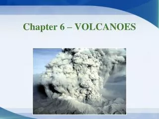
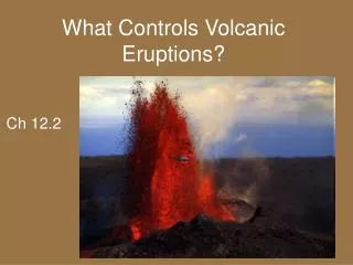
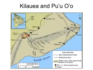
Engage in an interactive class exercise interpreting data from scientific stations monitoring Kilauea and Pu’u O’o volcanoes. Analyze GPS, tilt, and seismic data to identify trends and correlations, hypothesize volcanic events, and discuss potential outcomes. Utilize a variety of techniques to understand the volcanic activity before a potential eruption. Summarize findings as a group to deepen understanding of volcanic behavior.

E N D
GPS Stations Tilt Stations
In Class Exercise • Break up into groups of 4 • Choose one person to play the following roles: • GPS specialist – will analyze GPS data • Tilt specialist – will analyze Tilt data • Seismologist – will analyze RSAM data • Scientist in Charge of Hawaii Volcanoes Observatory – will read update on volcano over past weeks to months
In Class Exercise • I will hand out a packet of data for each group • Separate the packet and distribute accordingly • Take a few minutes to study your data. • Describe any trends or irregularities you might see. • DO NOT ATTEMPT TO INTERPRET THE DATA!
In Class Exercise • Report the data to the scientist in charge • Together, identify any trends or correlations between the data sets. • Hypothesize what may be happening
RSAM Data STC short period (EHZ) and Broadband (BHZ) data for July 2007.
RSAM Data STC short period (EHZ) and Broadband (BHZ) data for July 19-25, 2007.
All Data – Any Hypothesis? GPS Moving North GPS Moving Vertically Tilt Rapidly Increases Increased Seismic Amplitude Increased Seismic Amplitude
Other Techniques? • Are there any other techniques we can use to figure out what is going on at Pu’u O’o before the helicopter arrives to fly us out? Pu’u O’o
Morning of July 21st Afternoon of July 21st July 22nd July 20th Webcam
Hypothesis? • What signal would you expect from a lava lake draining? • How would the draining of a lava lake correspond to an inflation event? • Where might the lava be going? Pu’u O’o
Revisiting The Data… Summarize as a group GPS Moving North GPS Moving Vertically Tilt Rapidly Increases Increased Seismic Amplitude Increased Seismic Amplitude