Download
1 / 44
450 likes | 474 Views
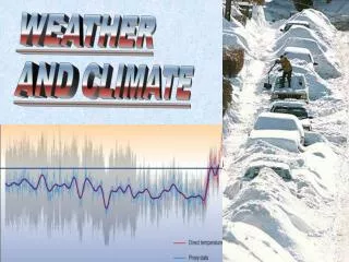
Explore the fascinating world of extreme weather events such as tornadoes, cyclones, and hurricanes. Learn about the formation and impact of these natural disasters, including the stages of development, unique characteristics, and destructive potentials. Dive into the science behind thunderstorms, snowstorms, and mid-latitude cyclones, and discover the intricate processes that trigger lightning, blizzards, and torrential rainfall. Gain insights into forecasting techniques, historical data, and how climate factors influence the frequency and intensity of severe weather occurrences. Prepare to be amazed by the forces of nature at play in these spectacular phenomena.

E N D
Weather Thunderstorms Snow / Rain storms Mid-latitude cyclones Tropical cyclones
Types of Severe Weather • Thunderstorms • Snow / Rain storms • Mid-latitude cyclones • Blizzards • Tornadoes • Tropical cyclones • Typhoons in the western Pacific • Cyclones in the Indian Ocean • Hurricanes in the U.S.
Thunderstorms • How Lightning Works
Lightning Varieties cloud-to-ground Cloud discharge Ball lightning Blue jets Red sprites Elves (NOVA: Science Now – Lightning http://www.pbs.org/wgbh/nova/sciencenow/3214/02.html)
Lightning Varieties Volcanic Lightning Nuclear Lightning Triggered Lightning (NOVA: Science Now – Lightning http://www.pbs.org/wgbh/nova/sciencenow/3214/02.html)
Severe weather types • Tornadoes • How a Tornado Forms • Moist air from Gulf of Mexico • Fast moving cold, dry air mass from Canada • Jet stream moving east at 150 mph • Sets up shearing conditions
Severe weather types • Tornadoes • How a Tornado Forms • Warm moist Gulf air releases latent heat, creates strong updraft • Updraft sheared by polar air, then twisted in a different direction by jet stream
Severe weather types • Tornadoes • Why do some thunderstorms spawn tornadoes while others do not? • Super Cell Thunderstorms
Severe weather types • Tornadoes • The Fujita-Pearson Scale • The size of a tornado is not necessarily an indication of its intensity!
Tornadoes • “Tornado Capitol of the World” • CNN’s “10 deadliest U.S. tornadoes” Source: cnn.com
Tornadoes • Why don’t tornadoes strike large cities? • Occur over large regions • Cities are relatively small targets • Oklahoma City Tornado (1999)
Mid-latitude Cyclones • Idealized weather • Middle-latitude cyclones move eastward across the United States • First signs of their approach are in the western sky • Require two to four days to pass over a region • Largest weather contrasts occur in the spring
Mid-latitude Cyclones • Blizzards • Form when a long cyclone brings • Cold 60 km/hr winds • Freezing temperatures • Lots of snow • Can travel very slowly • Storm itself usually doesn’t kill • Shoveling snow, auto accidents, etc.
Mid-latitude Cyclones • Ice Storms • Formation: • Falling snow and ice melt, change to rain, then freeze again as they reach the ground • Sleet • Freezing rain
Hurricanes • Only natural disaster that is given a human name • Actually large tropical cyclones • Convert heat in the ocean into winds • Exports excess heat from the tropics to the midlatitudes
Hurricanes • How a Hurricane Works • Tropical disturbance • Low pressure zone develops and draws in clusters of thunderstorms and winds
Hurricanes • How a Hurricane Works • Tropical disturbance • Tropical depression • Surface winds strengthen, move about the center of the storm • Central core funnels warm moist air up towards stratosphere • Air cools, vapor condenses, latent heat released • Fuels more updrafts, cycle repeats, storm grows
Hurricanes • How a Hurricane Works • Tropical disturbance • Tropical depression • Tropical Storm • Storm has sustained surface wind speeds of +39 mph
Hurricanes • How a Hurricane Works • Tropical disturbance • Tropical depression • Tropical Storm • Hurricane • Surface winds consistently over 74 mph
Hurricanes • How a Hurricane Works • Tropical disturbance • Tropical depression • Tropical Storm • Hurricane • The Eye • As wind speed increases, winds are spiraled upwards prior to reaching the center • A distinctive clear “eye” is formed • Strongest winds are located on the walls of the eye
Hurricane Origins • Form in the tropics ~ 5° and 20 ° latitude • Cannot form at the equator (Coriolis effect = 0)
Hurricanes • Hurricane Damages • Storm Surges • Large mound of water builds up beneath the eye • Reaches land as a surge of water
Hurricanes • Hurricane Damages • Storm Surges • Wind speed varies depending upon which side of the hurricane you’re on • Amount of damage on the coastline will vary accordingly
Hurricanes • Hurricane Damages • Heavy Rains • Mudflows and Debris Avalanches • Flooding
Hurricanes • Hurricane paths • Curves due to Coriolis affect • Storms must go around high • Strong and large – storms to Atlantic seaboard • Small and to the north – storms may miss the U.S.
Forecasting the Hurricane Season • Frequency of hurricanes in the North Atlantic is affected by climate • Wet Sahel region in Africa = more thunderstorms • Warm SST = more energy for tropical depressions • Low atmospheric pressure in Caribbean = more cyclones
Forecasting the Hurricane Season • The La Nina / El Nino Connection • La Nina present in Pacific = more winds to move storms • El Nino present in the Pacific = less winds, disrupts storms
Normal conditions in the tropical Pacific Ocean • Surface winds move from east to west • From high pressure in S. America to low pressure in Australia • Drags water westward • Warm water pools in the western Pacific
Every 3 – 8 years, system reverses • Called the Southern Oscillation • Trade winds weaken or reverse • Warm water migrates from Australia to S. America • Arrives in time for Christmas – Corriente del Niño
What is El Niño? • Basically, it's a giant puddle (or pod) of heated water that sloshes across the Pacific Ocean • Similar to an iceberg • Bulge on the surface • Most of “pod” beneath the surface • Due to difference in density • National Geographic’s Model
ENSO - El Niño-Southern Oscillation • Typically lasts 1 year • May last up to 3 • In multi-year events, first year not as affected • Affects both hemispheres
Recognizing an El Niño • Sea Surface Temperatures (SST) • Normal: 6-8° C warmer in the western tropical Pacific than in the eastern tropical Pacific • Check SST to see if in “normal” range
La Niña • Return to “normal” conditions from an El Niño strong • Produces: • Strong currents • Powerful upwelling • Chilly and stormy conditions along S. American coast • Eastern Pacific cools rapidly, Western Pacific warms rapidly • Renewed Trade Wind activity spreads the cooler eastern Pacific waters westward