Download
1 / 18
180 likes | 408 Views
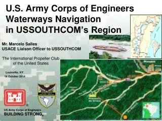
U.S. Army Corps of Engineers Waterways Navigation in USSOUTHCOM’s Region. Mr. Marcelo Salles USACE Liaison Officer to USSOUTHCOM. The International Propeller Club of the United States. Louisville, KY. 16 October 2014. BRAZIL: WATER USES. Navigation Sector. Waterways Extention (2013)

E N D
U.S. Army Corps of EngineersWaterways Navigationin USSOUTHCOM’s Region Mr. Marcelo Salles USACE Liaison Officer to USSOUTHCOM The International Propeller Club of the United States Louisville, KY 16 October 2014
BRAZIL: WATER USES Navigation Sector • Waterways Extention (2013) • Total: 20,956 km – 13,021 mi / US = 25,000 mi • 8,500 km – 5,282 mi (29.5%) uninterrupted all year long • Cargo shipment (2013) • Total: 80 million tons/year / US = 565 M tons/year • Ore Minerals: 28.8 million tons/year / US = 14.7 M • Fuels and mineral oils: 7.4 million tons/year / US = 162 M • Grains: 6.7 million tons/year • Containers: 6.4 million tons/year Water conflictbetweenhydroelectric sector andtransport sector relatedtolocks.
BRAZIL: WATER USES Hydropower • 70% of total energy generation • Installed capacity: 84,000 MW • Potential capacity: 270,000 MW Brazil World Source Petroleum Gas Mineral Coal Nuclear Hydraulic Biomass/Wind/Others
U.S. Army Corps of EngineersCODEVASF – USACE PartnershipSão Francisco River Navigation Program
Area of Interest/ Area of Operations Sao Francisco River The Sao Francisco river is approx 10 Hours by car from Brasilia or about 1 hour by plane. The project covers an area of over 450 km with 12 project sites along the river.
Partnership Purpose • Transfer of knowledge between Brazil and the United States • Project Purpose: Leverage USACE expertise to develop bank stabilization and navigation projects along the São Francisco River • Relationship building between Brazil and the United States São Francisco River at Barra, Bahia, Brazil
São Francisco River Basin • Basin Characteristics: • Northeastern Brazil • Largest basin located entirely in Brazil • 640,000 sq. km (size of Texas) • 2,750 km long (~1/2 the Mississippi River) • Navigation Channel: 1,371 km • Focus on 657 km in the Middle Sao Francisco Barra, Bahia (4 Projects in Year 1) Juazeiro Pirapora
Current Navigation Challenges • Navigation Channel between Pirapora and Petrolina/Juazeiro • 61 Identified Historical Critical Reaches • 149 individual shoals based on 2012 channel (less than 2.0 meters) • Estimated Dredging Volume = 7,750,000 m3 • Priority Reach between Ibotirama and Petrolina/Juazeiro • 21 Critical Reaches • Estimated Dredging Volume = 775,000 m3 (Between Ibotirama and Sobradinho Reservoir)
Recently Completed Projects • Sediment Transport Modeling of Navigation Channel • Develop conceptual designs for 61 critical sites using: • Self-scouring channels (dikes) • Dredging • Feasibility study and cost estimates for sustainable navigation
Path Forward • Knowledge transfer (2 directions) between countries • Building a teamofsubjectmatter experts in Brazil in theareasofnavigation, dredging, andriverengineering • Process of amending the US – Brazil agreement to include: • Training • Additionalprojects • Contractextenstionand future teamgrowth • Directsupport for dredgingandconstructionofengineeringprojects • Maintain the positive relationships between Brazil and US
Rio Paraguay Comprehensive Master PlanScope of Work30 June 2014
El río Paraguay • The Paraguay Riveris: • 1,629 mi (2,621 km) • 141,156 mi² (365,592 km²) • Borders: Paraguay, Brazil, • Argentina, Bolivia 7 ft 2.1 m Río Paraguay BOLIVIA Río Paranaiba BRAZIL Río Grande Bahia Negra (1250 km) Río Tietê PARAGUAY Río Apa São Paulo Río Parana North Zone Río Paranapanema 333 mi 535 km Río Pilcomayo Río Bermejo Río Iguaçu South Zone 242 mi 390 km Asuncion Rio Parana 11 ft 3.6 m Río Uruguay Río Salado TOTAL 575 mi Zones 3-4 925 km ARGENTINA URUGUAY Santa Fe 25 ft 7.6 m Rosario Río Negro • Makes up 42% of the La Plata Basin • Rises 300 m above sea level, (1,100 sq km) • Divided into 4 zones 34 ft 10.4 m Buenos Aires 12
Principales problemas de la navegación • Mostly operated by barge convoys. • Solid bulk cargo: Soybean (and by-products), wheat, iron ore and manganese, clinker, limestone materials, cement, liquid (petroleum and petroleum products, oils). • Traffic between ports in south western Brazil (Corumbá and Ladario), the Bolivian West (Terminal Aguirre) and Paraguay (Vallemí and other minor ports) ports of Argentina, Uruguay. • Sandy bottom: 37 places • Bedrock: 7 places • Tight bends: 11
UNCLASSIFIED Title Slide Sep Partnering Directorate (J9) Overview UNCLASSIFIED
Western Hemisphere Institute for Security Cooperation Army Marine Corps Navy Air Force The Perry Center Inter-American Defense College Commerce Homeland Security State Justice USAID Energy Treasury Intelligence Agencies Collaborative Environment IOM OAS Coast Guard United Nations Naval Postgraduate School HHS Defense Language Institute Foreign Language Center DLIFLC Interagency and Public-Private Partnerships “Whole of Society”
UNCLASSIFIED Organization Websites and POCs • Organization Web Sites and POCs: • PIANC – World Association for Waterbourne Transport Infrastructure • www.PIANC.org • PIANC-COPEDEC IX will take place in Rio de Janeiro, Brazil in October 2016 • 6th International PIANC-SMART Rivers Conference • US Chapter: http://pianc.us • POC: Kevin Knight, USACE IWR, Kevin.P.Knight@usace.army.mil; 703-428-7250 • Organization of American States – Inter-American Committee on Ports (CIP/OAS) • http://www.oas.org/CIP/english/ • 1st Hemispheric Seminar on Port Legislation, Uruguay, November 2014 • http://www.oas.org/cip/english/courses.html UNCLASSIFIED
THANK YOU!!Marcelo SallesUS Army Corps of Engineers (USACE)USACE Liaison Officer to USSOUTHCOMW: 305-437-1158, BB: 202-615-6367E-Mail: Marcelo.Z.Salles.civ@mail.milAny Questions?