Download
1 / 31
310 likes | 469 Views
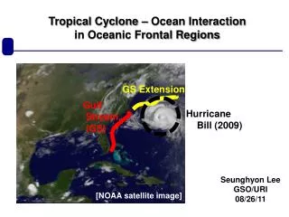
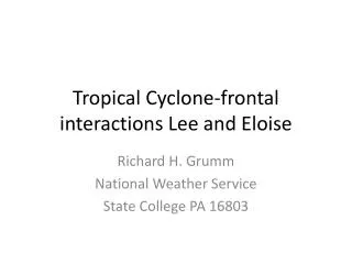
Tropical Cyclone-frontal interactions Lee and Eloise. Richard H. Grumm National Weather Service State College PA 16803. Motivation. Tropical cyclone Lee brought flooding to northeastern US Rain fell on heels of previous event Enduring event frontal to synoptic-like rainfall event

E N D
Tropical Cyclone-frontal interactions Lee and Eloise Richard H. Grumm National Weather Service State College PA 16803
Motivation • Tropical cyclone Lee brought flooding to northeastern US • Rain fell on heels of previous event • Enduring event frontal to synoptic-like rainfall event • Pattern & rainfall pattern relatively well predicted • Thus rainfall pattern evolution was well predicted • Pattern was similar to that associated with Eloise 1975 • We can learn from patterns and probabilities
The power of antecedent conditions • Irene rainfall 28-29 August 2011 • Then a frontal event ahead of Lee • Not a true PRE • Transitioned with remnants of Lee
Frontal rain to TC Lee PlumeProduces T-bone rainfall pattern (A1)
T-bone rainfall Eloise September 1975Frontal rains followed by southerly flow with remnant system
TC Lee vs Eloise Salient points • Similar large scale patterns • Atlantic ridge southern US trough • Similar general storm track • And resulting moisture surge • Similar transition frontal to more synoptic rain pattern • T-bone rain pattern due to transition • Both were significant flood events
Lee Forecast Issues • The pattern was “well predicted” • We will show one example • 12Z 6-8 September frontal synoptic • 6hrs from 0000 UTC 7 September • The rainfall was relatively well predicted • Or was it…. • The devil is always in the details…and that is a hell of a problem! • Controversial too
QPF Pattern Looked good details not so good • The GFS: • Over predicted the extent of heavy rainfall • And had position errors too far west • Saw this in Irene and the August NJ floods • NAM • Too much QPF and clear location errors • GEFS • See above so we likely have to over warn to protect those who might actually be affected
Decision to forecasts issues to ponder • Uncertainty is not a reason not to act • QPFs are not so good when verified over a small region details are wanting • For High Impact Weather we may have to accept that there are fewer wolves then we see, or are forced to see.
Summary • Tropical cyclone Lee brought flooding to NE US • The pattern was well predicted • The event spanned days and antecedent conditions likely played role in impacts/flooding • The QPFs looked good but verified not so good • The Pattern • was similar to that associated with Eloise 1975 • Similar rainfall T-bone • Similarly both were high impact events • We can learn from patterns and probabilities • But may have to accept we know a big event but • We may not know the exact areas to be affect (will we ever?)
High resolution satellite image historic snow and how it was predicted!
Historic October East Coast Winter Storm • 29-30 October record snows • Snow from Appalachians into New England • Well predicted and nearly ideal pattern • For January! • Though October has February sun angles
Great Pattern and Forecast • Forecasting record events • That deviate from climate • Climate is our base state • our reference anchor • We regress toward the mean • How we decide? • Rare events take confidence • Pattern and Probabilities ENSEMBLES • Allow us not to regress toward the mean • They provide the confidence we need.
Classic ECWS pattern and -3to -5CConfidence and probabilities good decisions
Thinking Fast and Slow • Kahneman, D.(2011) • Need good data and confidence to forecast rare events • Not easy to do intuition, experience and reliable data • Rare event snow: • Good pattern with supporting anomalies • Ensembles for probabilities and confidence • Result in relatively well forecast historic event!