Download

1 / 7
70 likes | 194 Views
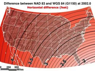
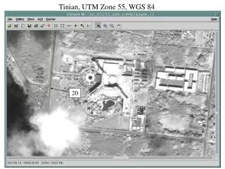
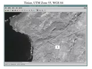
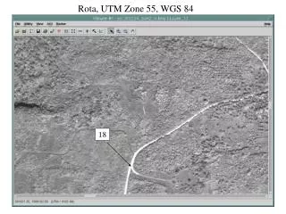
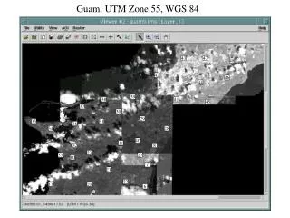
This resource provides detailed geographic information pertaining to Tinian Island using the Universal Transverse Mercator (UTM) and World Geodetic System (WGS) coordinate systems. It specifies UTM Zone 55 and includes several reference points within the WGS 84 system. The data can be useful for navigation, cartography, and geographical studies related to Tinian, including spatial analysis and mapping applications.

E N D