Download
1 / 62
750 likes | 1.53k Views
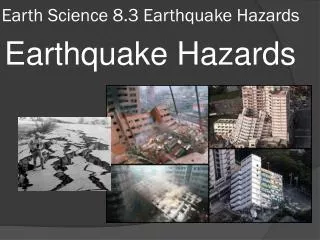
Key Concepts What is a fault? What is the cause of earthquakes? Vocabulary Earthquake, focus, epicenter, fault, elastic rebound hypothesis, aftershock, foreshock. 8.1 What is an Earthquake?. WORD PARTS. The prefix epi - is from the Greek word “ on ” or “ above ”…

E N D
Key Concepts What is a fault? What is the cause of earthquakes? Vocabulary Earthquake, focus, epicenter, fault, elastic rebound hypothesis, aftershock, foreshock 8.1 What is an Earthquake?
WORD PARTS • The prefix epi- is from the Greek word “on” or “above”… What do you think the word epicenter means? above the center
Earthquakes 8.1 What Is an Earthquake? An earthquake is the vibration of Earth produced by the rapid release of energy Focus and Epicenter • Focus is the point within Earth where the earthquake starts. • Epicenter is the location on the surface directly above the focus. Faults • Faults are fractures in Earth where movement has occurred.
Focus, Epicenter, and Fault The focus of each Earthquake is the place where the earthquake originated. The foci (plural of focus) are located along faults. The surface location directly above the focus is called the epicenter. Where do you think the damage from an Earthquake is usually greatest?
Slippage Along a Fault Figure 3 Slippage along a fault caused an offset in this orange grove east of Calexico, California. The white arrows show the direction of movement on either side of the fault.
Cause of Earthquakes 8.1 What Is an Earthquake? Elastic Rebound Hypothesis • Most earthquakes are produced by the rapid release of elastic energy stored in rock that has been subjected to great forces. • When the strength of the rock is exceeded, it suddenly breaks, causing the vibrations of an earthquake.
Elastic Rebound Hypothesis http://projects.crustal.ucsb.edu/understanding/downloads/ElasticReboundDemo.mov
NOTEBOOK ASSIGNMENT: • Using Figure 4 answer the following question. • What evidence of deformation is present in the fourth picture? • Explain how deformation can occur in rocks.
Cause of Earthquakes 8.1 What Is an Earthquake? Aftershocks and Foreshocks • An aftershock is a small earthquake that follows the main earthquake. • A foreshock is a small earthquake that often precedes a major earthquake.
NOTEBOOK ASSIGNMENT: Create a Venn diagram to compare and contrast aftershocks and foreshocks.
Complete the Guided Reading Study Worksheet on your own paper. 1-14 Classwork HOMEWORK: Create a diagram to show the difference between the focus and epicenter.
Using Figure 4 on page 220 answer the following questions. • What evidence of deformation is present in the fourth picture? • 2. Explain how deformation can occur in rocks. Illustrate the Elastic Rebound Hypothesis Draw a diagram to illustrate the focus and the epicenter. Create a Venn diagram to compare and contrast aftershocks and foreshocks.
8.2 Measuring Earthquakes Key Concepts -What are the types of seismic waves? -How is an earthquake epicenter located? -How is the size of an earthquake measured? Vocabulary Seismograph, seismogram, surface wave P wave, S wave, moment magnitude
Earthquake Waves 8.2 Measuring Earthquakes Seismographs are instruments that record earthquake waves. Seismograms aretraces of amplified, electronically recorded ground motion made by seismographs. Surface waves are seismic waves that travel along Earth’s outer layer.
Seismograph Figure 5 The seismograph (seismos = shake, graph = write) amplifies and records ground motion.
Seismogram Figure 6 Typical Seismogram The first wave to arrive is the P wave, followed later by S waves. The last waves recorded are the surface waves. Measuring What is the time interval in minutes between the start of the first P wave and the start of the first S wave?
Earthquake Waves 8.2 Measuring Earthquakes Body Waves • Identified as P waves or S waves • P waves - Are push-pull waves that push (compress) and pull (expand) in the direction that the waves travel - Travel through solids, liquids, and gases - Have the greatest velocity of all earthquake waves
Earthquake Waves 8.2 Measuring Earthquakes Body Waves • S waves • Seismic waves that travel along Earth’s outer layer - Shake particles at right angles to the direction that they travel - Travel only through solids - Slower velocity than P waves A seismogram shows all three types of seismic waves—surface waves, P waves, and S waves.
Seismic Waves Figure 7 Each type of seismic wave has characteristic motions.
Locating an Earthquake 8.2 Measuring Earthquakes Earthquake Distance • The epicenter is located using the difference in the arrival times between P and S wave recordings, which are related to distance. Earthquake Direction • Travel-time graphs from three or more seismographs can be used to find the exact location of an earthquake epicenter. Earthquake Zones • About 95 percent of the major earthquakes occur in a few narrow zones.
Locating an Earthquake Figure 8 Locating an Earthquake A A travel-time graph is used to determine the distance to the epicenter. The difference in arrival times of the first P wave and the first S wave in the graph is 5 minutes. So the epicenter is roughly 3800 kilometers away. B The epicenter is located using the distance obtained from three seismic stations. The place the circles intersect is the epicenter
Measuring Earthquakes 8.2 Measuring Earthquakes Historically, scientists have used two different types of measurements to describe the size of an earthquake—intensity and magnitude. Richter Scale • Based on the amplitude of the largest seismic wave • Each unit of Richter magnitude equates to roughly a 32-fold energy increase • Does not estimate adequately the size of very large earthquakes
Measuring Earthquakes 8.2 Measuring Earthquakes Momentum Magnitude • Derived from the amount of displacement that occurs along the fault zone • Moment magnitude is the most widely used measurement for earthquakes because it is the only magnitude scale that estimates the energy released by earthquakes. • Measures very large earthquakes
Notebook Assignment: • Use Figure 7 on page 224 to complete the chart to describe how the three types of waves are different.
Seismic Vibrations 8.3Destruction from Earthquakes The damage to buildings and other structures from earthquake waves depends on several factors. These factors include the intensity and duration of the vibrations, the nature of the material on which the structure is built, and the design of the structure.
Earthquake Damage Figure 10 Earthquake Damage This five-story building in Anchorage, Alaska, collapsed from the great earthquake of 1964. Very little structural damage was incurred by the steel-framed building to the left. Inferring Why do some buildings undergo little damage, while nearby buildings are nearly destroyed?
Seismic Vibrations 8.3Destruction from Earthquakes Building Design • Factors that determine structural damage - Intensity of the earthquake - Unreinforced stone or brick buildings are the most serious safety threats - Nature of the material upon which the structure rests - The design of the structure
Seismic Vibrations 8.3Destruction from Earthquakes Liquefaction • Saturated material turns fluid • Underground objects may float to surface
Effects of Subsidence Due to Liquefaction Figure 13 Effects of Subsidence Due to Liquefaction This tilted building rests on unconsolidated sediment that imitated quicksand during the 1985 earthquake in Mexico.
Tsunamis 8.3Destruction from Earthquakes Cause of Tsunamis • A tsunami triggered by an earthquake occurs where a slab of the ocean floor is displaced vertically along a fault. • A tsunami also can occur when the vibration of a quake sets an underwater landslide into motion. • Tsunami is the Japanese word for “seismic sea wave.”
Movement of a Tsunami Figure 11 Movement of a Tsunami A tsunami is generated by movement of the ocean floor. The speed of a wave moving across the ocean is related to the ocean depth. Waves moving in deep water travel more than 800 kilometers per hour. Speed gradually slows to 50 kilometers per hour at depths of 20 meters. As waves slow down in shallow water, they grow in height until they topple and hit shore with tremendous force.
Tsunamis 8.3Destruction from Earthquakes Tsunami Warning System • Large earthquakes are reported to Hawaii from Pacific seismic stations. • Although tsunamis travel quickly, there is sufficient time to evacuate all but the area closest to the epicenter.
Other Dangers 8.3 Destruction from Earthquakes Landslides • With many earthquakes, the greatest damage to structures is from landslides and ground subsidence, or the sinking of the ground triggered by vibrations. Fire • In the San Francisco earthquake of 1906, most of the destruction was caused by fires that started when gas and electrical lines were cut.
Landslide Damage Figure 12 This landslide caused by the 1964 Alaskan earthquake destroyed many homes. More than 200 acres of land slid toward the ocean. Interpreting Photos Assuming the land was originally horizontal, to what angle have the trees on the left side of the photo been tilted?
Predicting Earthquakes 8.3Destruction from Earthquakes Short-Range Predictions • So far, methods for short-range predictions of earthquakes have not been successful. Long-Range Forecasts • Scientists don’t yet understand enough about how and where earthquakes will occur to make accurate long-term predictions. • A seismic gap is an area along a fault where there has not been any earthquake activity for a long period of time.
Layers Defined by Composition 8.4 Earth’s Layered Structure Earth’s interior consists of three major zones defined by their chemical composition—the crust, mantle, and core. Crust • Thin, rocky outer layer • Varies in thickness - Roughly 7 km in oceanic regions - Continental crust averages 8–40 km - Exceeds 70 km in mountainous regions
Seismic Waves Paths Through the Earth Figure 14 The arrows show only a few of the many possible paths that seismic waves take through Earth. Inferring What causes the wave paths to change?