Download
1 / 51
520 likes | 723 Views
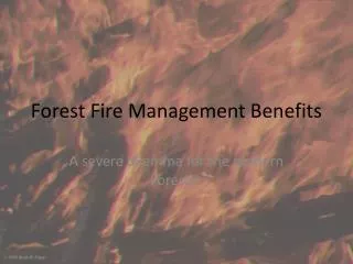
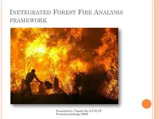
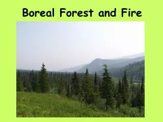
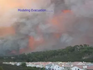
Forest Fire Picture. Modeling Evacuation……. Critical infrastructure issues in emergency evacuation of small areas . Richard L. Church Department of Geography University of California, Santa Barbara 93106-4060. The Problem. Evacuation can be defined in terms of:

E N D
Forest Fire Picture Modeling Evacuation……..
Critical infrastructure issues in emergency evacuation of small areas Richard L. Church Department of Geography University of California, Santa Barbara 93106-4060
The Problem • Evacuation can be defined in terms of: • The type of emergency: i.e.the threat • The size of area needed to be evacuated • The warning time, before the emergency is imminent 4
Potential risks that might trigger an evacuation • Urban-Wildland Interface Wildfires • Acts of terrorism • Hazardous materials spills • Hurricanes, violent storms • Floods • Volcanoes • Tsunamis…..
Traditional Evacuation Modeling focuses on: • 1) Transportation vehicles • Airplanes • Conduct tests of evacuation on planes for FAA certification • Simulate evacuation events • Describe on all flights, procedures for evacuation, exit doors • Ships • Conduct emergency drills on a regular basis • Simulate evacuation events • Provide enough seats on lifeboats
Traditional Evacuation Modeling focuses on: 2) Buildings: • Building egress models (deterministic network flow and stochastic simulation) • Building codes, design • standards, signage, & • room capacities • Fire drills
Traditional evacuation modeling focuses on: • 3)Nuclear power plants • Require approved evacuation plans for entire region surrounding plant • Conduct drills with associated public agencies • Plan, Plan, Plan • 4) Hurricane/Flood evacuation Zones • Develop weather prediction models and early warning systems • Model evacuation by large-scale computer simulation to identify bottlenecks • Develop emergency evacuation plans with specific roles for each agency involved • Conduct mock disaster drills with public agencies and service organizations like the Red Cross • Designate evacuation routes • Identify and designate safe zones or shelters • Purchase & Store emergency supplies • Educate people about what to do and what supplies to have • Provide clearing centers so that people can find each other • Develop backup power supply at gas stations, police stations and hospitals • Give information to radio and TV stations about what to tell people in getting information during the disaster, prepare for disaster, etc.
For large geographical areas: • Coastal zones • Cities • Nuclear power plants ==>Define an EPZ • Given an EPZ • simulate or model as a deterministic network flow • example: OREMS of ORNL • use model to craft an evacuation plan
Plans & Maps Typical products of advanced planning: • Routes • Shelters • Plans
Warning time is critical… • Hurricanes come with forecasts that extend days before an event • Wildfire, acts of terrorism, hazardous materials spills, cannot be forecasted like a hurricane… • If the warning time is limited, then orderly evacuation may not happen, without significant capabilities to assess the situation…..in a very short period of time
Timing of threat alters the process of planning • Threat must be detectable • Geographical data must be immediately available • Correct positioning of equipment and personnel could avert disaster
When warning time is limited…. Three major issues are especially critical: • Advanced planning to identify and map those areas at risk is critical • Advanced modeling of those areas considered at high risk • Real time capabilities are needed to track an event and deploy assets
Mapping such risks is not immediately obvious • An EPZ is easily drawn for a building or a city, but: • where should we plan for a wildfire evacuation or hazardous material spill, that is, just where is the EPZ? • where is the greatest risk in evacuation? “The major objective is to estimate clearing time for a specific type of action or plan”
Understanding the Oakland Hills fire disaster…. We can represent an area by the network and what it contains:
1 1 household exit EPZ household exit EPZ Defining flexible EPZs
We can define: The clearing time estimate in minutes • the population of neighborhood k, which may be estimated as the product of the number of houses times the number of people per household. people per vehicle during a sudden evacuation of neighborhood k. capacity of lanes leading out of neighborhood k in vehicles per minute
We can also define bulk lane demand as: • (Population in neighborhood)/(number of exit lanes) • (Vehicles that will be used in an evacuation) / (number of exit lanes) BLD and CTE represent gross measures of potential problems in evacuation
Defining areas that might have difficulty evacuating: “we want to identify those clusters of nodes and street segments that define contiguous neighborhoods that have high values of cte or bld”
We can do this with the following spatial optimization model: Maximize Z =
Subject to: 1) 2) 3) 4) 5) Contiguity constraint set. 6)
The objective is non-linear, but can be converted to a linear form as: Converted to where the objective is to maximize M.
Contiguity constraint set for node l. 1) 2) 3) 4) 5) Where:
Three main points here: • We have now defined an ILP that can be solved for each root node to find “critical clusters” • Such a model can be used sparingly, not all the time, so we developed a heuristic • We used the optimal model to test the efficacy of the heuristic process
Overlay evacuation risk map and map of fire risk ===> identify areas of greatest concern for evacuation planning
Results of simulation can be used to develop plans for traffic control, barrier placement, etc.
Recommendations from this research: • Advanced mapping of evacuation risk should be expanded beyond flood, hurricane/storm surge, and earthquake hazards to include smaller events like hazardous materials spills, wildfire, acts of terrorism….. • Evacuation simulation should be performed for those areas that indicate significant vulnerabilities exist • Evacuation plans should be developed for those areas that are considered at the highest risk and equipment, staffing, and positioning should be addressed within the context of the areas of highest risk. • Develop advanced remote sensing techniques for data collection in terms of vegetation change and housing placement.
We wish to acknowledge research support from NCRST-I, Caltrans, NASA, and Quadstone Corporation.
Last three elements should be based upon the development and use of an evacuation simulation model or network egress model. Virtually all other major evacuation problems are modeled on the computer in order to test plans, e.g. buildings, flood plains, hurricanes, etc.
I wish to acknowledge: • Tom Cova • Eva Lorai • Ryan Sexton • Dar Roberts, Chris Lee, and RESAC participants, NASA support • Caltrans and NCRST support
Evacuation of Los Alamos, NM (Cerro Grande Fire, April, 2000)
“Hotspot” Neighborhood Plans • Educate the neighborhood, just like FEMA does for inhabitants of flood plains • Collect appropriate neighborhood data: cars, roads, demographics, etc. • Identify the disabled, elderly, and latch-key children that need special services in time of an evacuation • Reduce need to evacuate: identify suitable in-place shelters • Implement an early warning system: sirens, phones, radio, etc. • Create a Neighborhood Disaster Management Plan: identify evacuation routes, traffic management plan, fire attack plan, etc. • Evaluate the need to ban on-street parking, make some streets one-way, add street connections, etc. • Traffic control plan: identify evacuation routes; how traffic flow will be managed; change personnel stations during extreme weather events, etc. These last 3 items can be guided by the use of an evacuation simulation model
Disasters sharpen awareness • Beverly Hills Supper Club, Southgate KY • Oakland Hills/Tunnel Fire • 25 deaths including a police officer and a fire fighter • Three-mile Island Nuclear Power Plant • Importance of having an evacuation plan and good information • Brown’s Ferry Nuclear Power Plant • Failure of good advanced planning and fire-fighting • training • Gas Release in Bhopal, India • Demonstrated problems with the lack of information on the part of the public • Bushfire in Adelaide Hills • Kills 18 people. • Events of 9/11